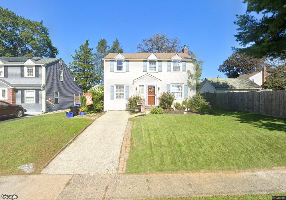
1510 Norman Rd Havertown, PA 19083
Estimated Value: $477,221 - $540,000
3
Beds
2
Baths
1,946
Sq Ft
$265/Sq Ft
Est. Value
About This Home
This home is located at 1510 Norman Rd, Havertown, PA 19083 and is currently estimated at $514,805, approximately $264 per square foot. 1510 Norman Rd is a home located in Delaware County with nearby schools including Manoa Elementary School, Haverford Middle School, and Haverford Senior High School.
Ownership History
Date
Name
Owned For
Owner Type
Purchase Details
Closed on
Jun 8, 2021
Sold by
Moffa Patricia D and Moffa John J
Bought by
Moffa Patricia D
Current Estimated Value
Home Financials for this Owner
Home Financials are based on the most recent Mortgage that was taken out on this home.
Original Mortgage
$163,000
Interest Rate
2.2%
Mortgage Type
New Conventional
Purchase Details
Closed on
Sep 21, 2006
Sold by
Novelli Patricia and Moffa Patricia D
Bought by
Moffa John J and Moffa Patricia D
Home Financials for this Owner
Home Financials are based on the most recent Mortgage that was taken out on this home.
Original Mortgage
$196,900
Interest Rate
6.52%
Mortgage Type
Stand Alone Refi Refinance Of Original Loan
Purchase Details
Closed on
Oct 24, 1998
Sold by
Novelli John J and Novelli Patricia D
Bought by
Novelli Patricia D
Create a Home Valuation Report for This Property
The Home Valuation Report is an in-depth analysis detailing your home's value as well as a comparison with similar homes in the area
Home Values in the Area
Average Home Value in this Area
Purchase History
| Date | Buyer | Sale Price | Title Company |
|---|---|---|---|
| Moffa Patricia D | -- | Haverford Abstract | |
| Moffa John J | -- | None Available | |
| Novelli Patricia D | -- | -- |
Source: Public Records
Mortgage History
| Date | Status | Borrower | Loan Amount |
|---|---|---|---|
| Closed | Moffa Patricia D | $163,000 | |
| Closed | Moffa John J | $196,900 |
Source: Public Records
Tax History Compared to Growth
Tax History
| Year | Tax Paid | Tax Assessment Tax Assessment Total Assessment is a certain percentage of the fair market value that is determined by local assessors to be the total taxable value of land and additions on the property. | Land | Improvement |
|---|---|---|---|---|
| 2025 | $7,403 | $287,920 | $88,160 | $199,760 |
| 2024 | $7,403 | $287,920 | $88,160 | $199,760 |
| 2023 | $7,193 | $287,920 | $88,160 | $199,760 |
| 2022 | $7,025 | $287,920 | $88,160 | $199,760 |
| 2021 | $11,444 | $287,920 | $88,160 | $199,760 |
| 2020 | $6,074 | $130,678 | $50,210 | $80,468 |
| 2019 | $5,962 | $130,678 | $50,210 | $80,468 |
| 2018 | $5,859 | $130,678 | $0 | $0 |
| 2017 | $5,735 | $130,678 | $0 | $0 |
| 2016 | $717 | $130,678 | $0 | $0 |
| 2015 | $717 | $130,678 | $0 | $0 |
| 2014 | $717 | $130,678 | $0 | $0 |
Source: Public Records
Map
Nearby Homes
- 104 Treaty Rd
- 181 Friendship Rd
- 505 Glendale Rd
- 2223 Steele Rd
- 5042 Sylvia Rd
- 635 Grand Ave
- 333 Sussex Blvd
- 42 Colonial Dr
- 5233 Arrowhead Ln
- 736 Timber Trail Ln
- 1042 Blythe Ave
- 601 S Eagle Rd
- 1223 Drexel Ave
- 220 Glendale Rd
- 921 Addingham Ave
- 1102 Childs Ave
- 6 N Lexington Ave
- 1029 Belfield Ave
- 1013 Bon Air Rd
- 162 S Eagle Rd
- 1500 Norman Rd
- 1436 Leedom Rd
- 1513 Norman Rd
- 1505 Norman Rd
- 1509 Norman Rd
- 1501 Norman Rd
- 1432 Leedom Rd
- 1432 Norman Rd
- 1514 Norman Rd
- 1441 Norman Rd
- 1517 Norman Rd
- 1428 Leedom Rd
- 1428 Norman Rd
- 1518 Norman Rd
- 1437 Norman Rd
- 1508 Burmont Rd
- 1516 Burmont Rd
- 1500 Burmont Rd
- 1521 Norman Rd
- 1472 Burmont Rd