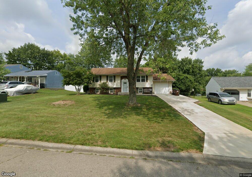
1510 Rolling Knoll Dr Loveland, OH 45140
Estimated Value: $251,000 - $294,000
3
Beds
2
Baths
1,956
Sq Ft
$137/Sq Ft
Est. Value
About This Home
This home is located at 1510 Rolling Knoll Dr, Loveland, OH 45140 and is currently estimated at $267,646, approximately $136 per square foot. 1510 Rolling Knoll Dr is a home located in Clermont County with nearby schools including Marr/Cook Elementary School, Spaulding Elementary School, and Goshen Middle School.
Ownership History
Date
Name
Owned For
Owner Type
Purchase Details
Closed on
Mar 29, 2018
Sold by
Cash Thomas C and Brownstead Gina
Bought by
Brownsted Michael and Brownsted Gina
Current Estimated Value
Home Financials for this Owner
Home Financials are based on the most recent Mortgage that was taken out on this home.
Original Mortgage
$117,114
Outstanding Balance
$99,640
Interest Rate
3.99%
Mortgage Type
FHA
Estimated Equity
$168,006
Purchase Details
Closed on
Oct 1, 1997
Sold by
Hatcher James E
Bought by
Cash Thomas C and Cash Gina E
Home Financials for this Owner
Home Financials are based on the most recent Mortgage that was taken out on this home.
Original Mortgage
$94,888
Interest Rate
7.54%
Mortgage Type
FHA
Purchase Details
Closed on
Apr 26, 1994
Create a Home Valuation Report for This Property
The Home Valuation Report is an in-depth analysis detailing your home's value as well as a comparison with similar homes in the area
Home Values in the Area
Average Home Value in this Area
Purchase History
| Date | Buyer | Sale Price | Title Company |
|---|---|---|---|
| Brownsted Michael | -- | None Available | |
| Cash Thomas C | $95,000 | -- | |
| -- | $80,500 | -- |
Source: Public Records
Mortgage History
| Date | Status | Borrower | Loan Amount |
|---|---|---|---|
| Open | Brownsted Michael | $117,114 | |
| Previous Owner | Cash Thomas C | $94,888 |
Source: Public Records
Tax History Compared to Growth
Tax History
| Year | Tax Paid | Tax Assessment Tax Assessment Total Assessment is a certain percentage of the fair market value that is determined by local assessors to be the total taxable value of land and additions on the property. | Land | Improvement |
|---|---|---|---|---|
| 2024 | $2,800 | $62,790 | $9,170 | $53,620 |
| 2023 | $2,714 | $62,790 | $9,170 | $53,620 |
| 2022 | $2,705 | $55,090 | $8,050 | $47,040 |
| 2021 | $2,721 | $55,090 | $8,050 | $47,040 |
| 2020 | $2,542 | $55,090 | $8,050 | $47,040 |
| 2019 | $2,268 | $47,150 | $11,270 | $35,880 |
| 2018 | $2,277 | $47,150 | $11,270 | $35,880 |
| 2017 | $2,279 | $47,150 | $11,270 | $35,880 |
| 2016 | $1,962 | $38,050 | $9,100 | $28,950 |
| 2015 | $1,770 | $38,050 | $9,100 | $28,950 |
| 2014 | $1,770 | $38,050 | $9,100 | $28,950 |
| 2013 | $1,756 | $39,410 | $9,800 | $29,610 |
Source: Public Records
Map
Nearby Homes
- 6716 Oakland Rd
- 6725 Oakland Rd
- Brookside Plan at Oakridge Estates - Signature Series
- Shaker Run Plan at Oakridge Estates - Signature Series
- Medinah Plan at Oakridge Estates - Signature Series
- Shadow Creek Plan at Oakridge Estates - Signature Series
- Oakmont Plan at Oakridge Estates - Signature Series
- Sonoma Plan at Oakridge Estates - Signature Series
- Piedmont Plan at Oakridge Estates - Signature Series
- Ferndale Plan at Oakridge Estates - Signature Series
- Equestrian Plan at Oakridge Estates - Signature Series
- Rubicon Plan at Oakridge Estates - Signature Series
- Meridian Plan at Oakridge Estates - Signature Series
- Peachtree Plan at Oakridge Estates - Signature Series
- Breckenridge Plan at Oakridge Estates - Signature Series
- Somerset Plan at Oakridge Estates - Signature Series
- Crooked Stick Plan at Oakridge Estates - Signature Series
- Heatherwood Plan at Oakridge Estates - Signature Series
- Cypress Pointe Plan at Oakridge Estates - Signature Series
- 1333 Cross Creek Dr
- 1508 Rolling Knoll Dr
- 1505 Woodland Dr
- 1506 Rolling Knoll Dr
- 1503 Woodland Dr
- 1514 Rolling Knoll Dr
- 1507 Woodland Dr
- 1511 Rolling Knoll Dr
- 1501 Woodland Dr
- 1515 Rolling Knoll Dr
- 1509 Woodland Dr
- 1509 Rolling Knoll Dr
- 1504 Rolling Knoll Dr
- 1521 W Meadowbrook Dr
- 1511 Woodland Dr
- 6688 Lynne Haven Ct
- 1499 Woodland Dr
- 1523 E Meadowbrook Dr
- 1500 Rolling Knoll Dr
- 1500 Rolling Knoll
- 1519 W Meadowbrook Dr