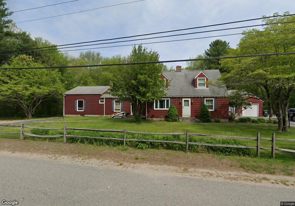
1510 Route 12 Gales Ferry, CT 06335
Estimated Value: $402,000 - $457,000
3
Beds
2
Baths
3,051
Sq Ft
$142/Sq Ft
Est. Value
About This Home
This home is located at 1510 Route 12, Gales Ferry, CT 06335 and is currently estimated at $432,325, approximately $141 per square foot. 1510 Route 12 is a home with nearby schools including Ledyard Middle School, Ledyard High School, and Academy Of St Therese.
Ownership History
Date
Name
Owned For
Owner Type
Purchase Details
Closed on
Nov 15, 2023
Sold by
Barnes Barbara H and Barnes Murray C
Bought by
Lopez Guido F
Current Estimated Value
Home Financials for this Owner
Home Financials are based on the most recent Mortgage that was taken out on this home.
Original Mortgage
$343,660
Outstanding Balance
$337,653
Interest Rate
7.49%
Mortgage Type
FHA
Estimated Equity
$94,672
Purchase Details
Closed on
Jun 7, 2010
Sold by
Rose Christopher S and Rose Rosemarie
Bought by
Saunders Lee and Saunders Tiffany
Purchase Details
Closed on
Mar 21, 1986
Bought by
Barnes Barbara H
Create a Home Valuation Report for This Property
The Home Valuation Report is an in-depth analysis detailing your home's value as well as a comparison with similar homes in the area
Home Values in the Area
Average Home Value in this Area
Purchase History
| Date | Buyer | Sale Price | Title Company |
|---|---|---|---|
| Lopez Guido F | $350,000 | None Available | |
| Saunders Lee | $160,000 | -- | |
| Barnes Barbara H | -- | -- |
Source: Public Records
Mortgage History
| Date | Status | Borrower | Loan Amount |
|---|---|---|---|
| Open | Lopez Guido F | $343,660 |
Source: Public Records
Tax History Compared to Growth
Tax History
| Year | Tax Paid | Tax Assessment Tax Assessment Total Assessment is a certain percentage of the fair market value that is determined by local assessors to be the total taxable value of land and additions on the property. | Land | Improvement |
|---|---|---|---|---|
| 2025 | $8,465 | $227,920 | $78,470 | $149,450 |
| 2024 | $7,411 | $210,490 | $78,470 | $132,020 |
| 2023 | $7,275 | $210,490 | $78,470 | $132,020 |
| 2022 | $7,119 | $210,490 | $78,470 | $132,020 |
| 2021 | $7,072 | $210,490 | $78,470 | $132,020 |
| 2020 | $6,888 | $196,980 | $82,880 | $114,100 |
| 2019 | $6,906 | $196,980 | $82,880 | $114,100 |
| 2018 | $6,754 | $196,980 | $82,880 | $114,100 |
| 2017 | $6,410 | $196,980 | $82,880 | $114,100 |
| 2016 | $6,284 | $196,980 | $82,880 | $114,100 |
| 2015 | $5,988 | $196,980 | $82,880 | $114,100 |
| 2014 | $6,248 | $208,950 | $87,220 | $121,730 |
Source: Public Records
Map
Nearby Homes
- 1513 Connecticut 12
- 1010 Long Cove Rd
- 17 Inchcliffe Dr
- 932 Long Cove Rd Unit TRLR 4
- 31 Richard Rd
- 14 Woodland Ln
- 1260 Connecticut 12
- 95 Murphys Dr Unit 95
- 7 Harvard Rd
- 47 Norman Dr
- 64 Scotch Cap Rd Unit 102
- 9 West Dr
- 16 Marty's Way
- 11 Marty's Way
- 205 Old Norwich Rd
- 25 Marty's Way
- 27 Marty's Way
- 176 Old Norwich Rd
- 621 Military Hwy
- 18 Marty's Way
- 1510 Connecticut 12
- 1506 Route 12
- 1500 Route 12
- 1504 Route 12
- 1 Inchcliffe Dr
- 990 Long Cove Rd
- 1005 Long Cove Rd
- 1010 Long Cove Rd
- 1010 Long Cove Rd
- 1010 Long Cove Rd Unit 24
- 1010 Long Cove Rd
- 1010 Long Cove Rd Unit 17
- 1010 Long Cove Rd Unit 33
- 1010 Long Cove Rd Unit 4
- 1010 Long Cove Rd Unit 1
- 1010 Long Cove Rd Unit 21
- 1010 Long Cove Rd Unit 36
- 1524 Route 12
- 993 Long Cove Rd
- 993 Long Cove Rd Unit R