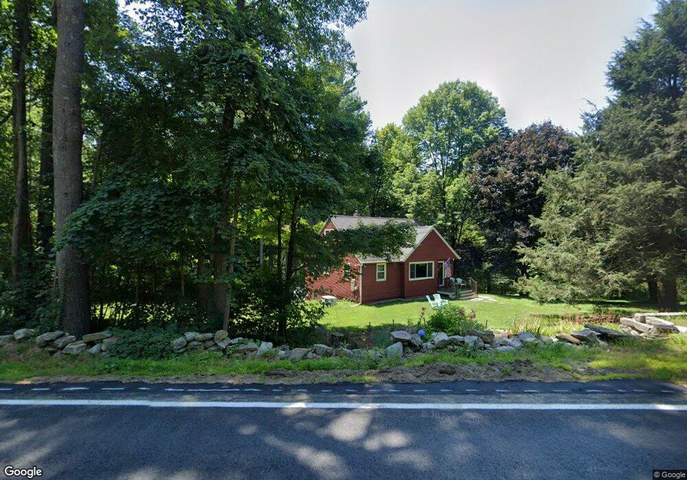
1510 Route 197 Woodstock, CT 06281
Estimated Value: $404,000
3
Beds
2
Baths
1,222
Sq Ft
$331/Sq Ft
Est. Value
About This Home
This home is located at 1510 Route 197, Woodstock, CT 06281 and is currently priced at $404,000, approximately $330 per square foot. 1510 Route 197 is a home located in Windham County with nearby schools including Woodstock Elementary School and Woodstock Middle School.
Ownership History
Date
Name
Owned For
Owner Type
Purchase Details
Closed on
Jul 9, 2009
Sold by
Froelich Paul W and Froelich Lisa A
Bought by
Duby 3Rd David W and Duby Kimberly A
Current Estimated Value
Home Financials for this Owner
Home Financials are based on the most recent Mortgage that was taken out on this home.
Original Mortgage
$209,100
Interest Rate
4.93%
Create a Home Valuation Report for This Property
The Home Valuation Report is an in-depth analysis detailing your home's value as well as a comparison with similar homes in the area
Home Values in the Area
Average Home Value in this Area
Purchase History
| Date | Buyer | Sale Price | Title Company |
|---|---|---|---|
| Duby 3Rd David W | $205,000 | -- |
Source: Public Records
Mortgage History
| Date | Status | Borrower | Loan Amount |
|---|---|---|---|
| Open | Duby 3Rd David W | $205,627 | |
| Closed | Duby 3Rd David W | $209,100 |
Source: Public Records
Tax History Compared to Growth
Tax History
| Year | Tax Paid | Tax Assessment Tax Assessment Total Assessment is a certain percentage of the fair market value that is determined by local assessors to be the total taxable value of land and additions on the property. | Land | Improvement |
|---|---|---|---|---|
| 2022 | $3,914 | $187,700 | $29,700 | $158,000 |
| 2021 | $3,861 | $151,400 | $29,700 | $121,700 |
| 2020 | $3,060 | $124,900 | $29,700 | $95,200 |
| 2019 | $3,060 | $124,900 | $29,700 | $95,200 |
| 2018 | $3,060 | $124,900 | $29,700 | $95,200 |
| 2017 | $3,035 | $124,900 | $29,700 | $95,200 |
| 2016 | $3,010 | $125,200 | $37,900 | $87,300 |
| 2015 | $2,925 | $125,200 | $37,900 | $87,300 |
| 2014 | $2,892 | $125,200 | $37,900 | $87,300 |
Source: Public Records
Map
Nearby Homes
- 381 Bungay Hill Rd
- 10 Laurel Hill Dr
- 0 Rr 197 Rd
- 56 Laurel Hill Dr
- 278 Child Rd
- 70 Laurel Hill Dr
- 1820 Route 197
- 19 Hiawatha Heights
- 80 Bungay Hill Rd
- 29 Crooked Trail Extension
- 0 Aplin Hill Ln
- 23 Little Bungee Hill Rd
- 0 Hemlock Dr
- 30 Lyon Rd
- 4 Perrin Rd
- 60 Indian Spring Rd
- 00 Route 171 Unit Lot 1
- 145 Perrin Rd
- 101 Center Rd
- 189 Center Rd
- 1510 Connecticut 197
- 1511 Route 197
- 1527 Route 197
- 41 Old Turnpike Rd
- 00 Old Turnpike Rd
- 106 Old Turnpike Rd
- 1540 Route 197
- 55 Old Turnpike Rd
- 1543 Route 197
- 1560 Route 197
- 67 Old Turnpike Rd
- 46 Pole Bridge Rd
- 1585 Route 197
- 1458 Route 197
- 1592 Route 197
- 76 Pole Bridge Rd
- 70 Pole Bridge Rd
- 1421 Route 197
- 02 Pole Bridge Rd
- 0X Pole Bridge Rd