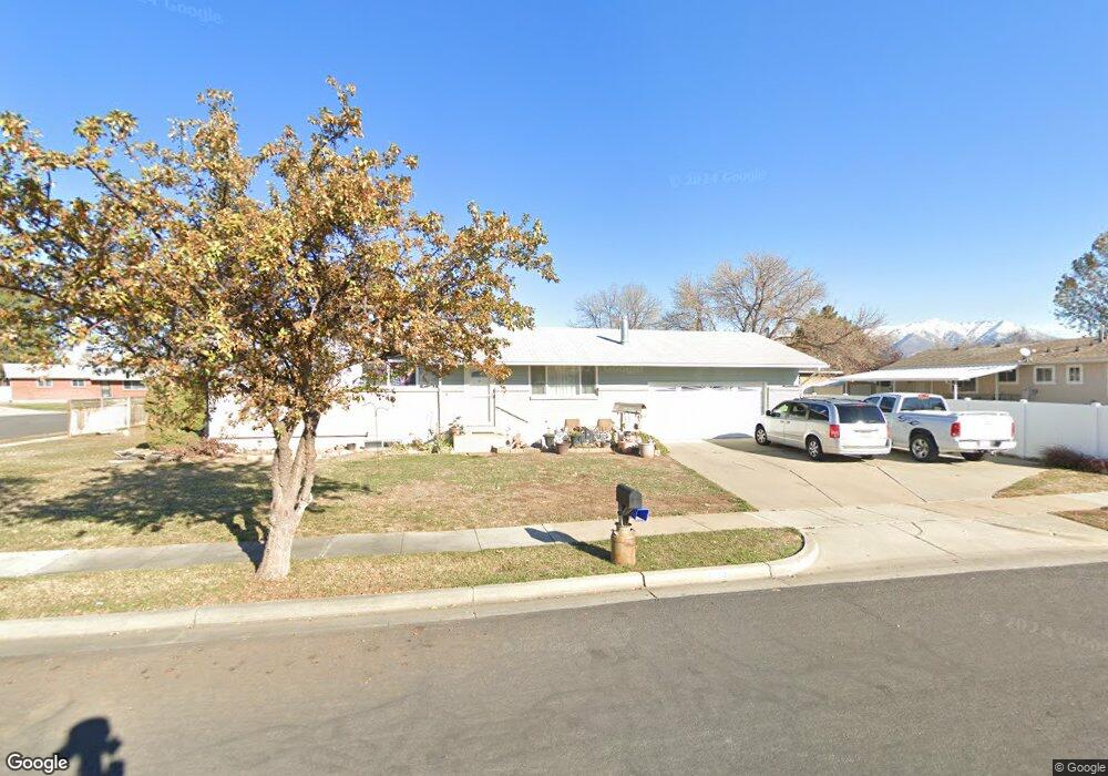
1510 W 1750 N Layton, UT 84041
Estimated Value: $431,000 - $478,000
4
Beds
3
Baths
1,125
Sq Ft
$401/Sq Ft
Est. Value
About This Home
This home is located at 1510 W 1750 N, Layton, UT 84041 and is currently estimated at $451,618, approximately $401 per square foot. 1510 W 1750 N is a home located in Davis County with nearby schools including Vae View Elementary School, North Layton Junior High School, and Northridge High School.
Ownership History
Date
Name
Owned For
Owner Type
Purchase Details
Closed on
Aug 24, 2023
Sold by
Ledin Ruth E
Bought by
Ruth E Ledin Revocable Supplemental Needs Tru and Ledin
Current Estimated Value
Purchase Details
Closed on
Jul 25, 1997
Sold by
Beck Marlowe G and Beck Susan R
Bought by
Ledin Randall C and Ledin Ruth E
Home Financials for this Owner
Home Financials are based on the most recent Mortgage that was taken out on this home.
Original Mortgage
$117,178
Interest Rate
7.7%
Mortgage Type
FHA
Create a Home Valuation Report for This Property
The Home Valuation Report is an in-depth analysis detailing your home's value as well as a comparison with similar homes in the area
Home Values in the Area
Average Home Value in this Area
Purchase History
| Date | Buyer | Sale Price | Title Company |
|---|---|---|---|
| Ruth E Ledin Revocable Supplemental Needs Tru | -- | None Listed On Document | |
| Ledin Randall C | -- | U S Title |
Source: Public Records
Mortgage History
| Date | Status | Borrower | Loan Amount |
|---|---|---|---|
| Previous Owner | Ledin Randall C | $117,178 |
Source: Public Records
Tax History Compared to Growth
Tax History
| Year | Tax Paid | Tax Assessment Tax Assessment Total Assessment is a certain percentage of the fair market value that is determined by local assessors to be the total taxable value of land and additions on the property. | Land | Improvement |
|---|---|---|---|---|
| 2025 | -- | $231,550 | $107,788 | $123,762 |
| 2024 | -- | $226,050 | $128,493 | $97,557 |
| 2023 | -- | $384,000 | $161,187 | $222,813 |
| 2022 | $1,447 | $228,250 | $77,064 | $151,186 |
| 2021 | $1,447 | $320,000 | $111,777 | $208,223 |
| 2020 | $1,447 | $263,000 | $83,489 | $179,511 |
| 2019 | $1,447 | $256,000 | $80,280 | $175,720 |
| 2018 | $0 | $225,000 | $74,334 | $150,666 |
| 2016 | $1,381 | $101,475 | $20,803 | $80,672 |
| 2015 | $1,314 | $91,630 | $20,803 | $70,827 |
| 2014 | $1,410 | $100,560 | $20,803 | $79,757 |
| 2013 | $1,296 | $87,477 | $18,770 | $68,707 |
Source: Public Records
Map
Nearby Homes
- 1748 N 1600 W
- 1740 N 1600 W Unit 116
- 1692 N 1600 W
- 1688 N 1600 W Unit 125
- 1682 N 1600 W
- 1678 N 1600 W
- 1668 N 1600 W
- 1664 N 1600 W
- Highbridge 3 Plan at Layton Towns on Main - Townhomes
- Highbridge 1 Plan at Layton Towns on Main - Townhomes
- Midtown Plan at Layton Towns on Main - Townhomes
- Cityline 1 Plan at Layton Towns on Main - Townhomes
- Cityline 2 Plan at Layton Towns on Main - Townhomes
- 1654 N 1600 W
- 1650 N Main St Unit 126
- 1652 N 1600 St W
- 1598 N Main St
- 1606 W 1960 N
- 1425 W 1650 N
- 1591 N Marilyn Dr