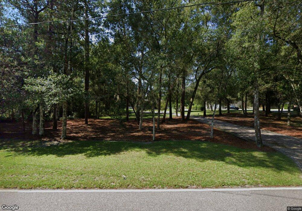
1510 W Beresford Rd Deland, FL 32720
Estimated Value: $399,000 - $511,000
3
Beds
2
Baths
1,753
Sq Ft
$267/Sq Ft
Est. Value
About This Home
This home is located at 1510 W Beresford Rd, Deland, FL 32720 and is currently estimated at $468,533, approximately $267 per square foot. 1510 W Beresford Rd is a home located in Volusia County with nearby schools including Woodward Avenue Elementary School, Deland High School, and Southwestern Middle School.
Ownership History
Date
Name
Owned For
Owner Type
Purchase Details
Closed on
Jun 24, 1998
Sold by
Steen Ralph and Steen George E
Bought by
Galasso Christopher R and Galasso Diane
Current Estimated Value
Home Financials for this Owner
Home Financials are based on the most recent Mortgage that was taken out on this home.
Original Mortgage
$26,000
Outstanding Balance
$5,274
Interest Rate
7.21%
Estimated Equity
$463,259
Purchase Details
Closed on
Apr 15, 1987
Bought by
Galasso Christopher R and Galasso Diane
Create a Home Valuation Report for This Property
The Home Valuation Report is an in-depth analysis detailing your home's value as well as a comparison with similar homes in the area
Home Values in the Area
Average Home Value in this Area
Purchase History
| Date | Buyer | Sale Price | Title Company |
|---|---|---|---|
| Galasso Christopher R | $29,000 | -- | |
| Galasso Christopher R | $100 | -- |
Source: Public Records
Mortgage History
| Date | Status | Borrower | Loan Amount |
|---|---|---|---|
| Open | Galasso Christopher R | $26,000 |
Source: Public Records
Tax History Compared to Growth
Tax History
| Year | Tax Paid | Tax Assessment Tax Assessment Total Assessment is a certain percentage of the fair market value that is determined by local assessors to be the total taxable value of land and additions on the property. | Land | Improvement |
|---|---|---|---|---|
| 2025 | $2,854 | $193,555 | -- | -- |
| 2024 | $2,854 | $188,101 | -- | -- |
| 2023 | $2,854 | $182,623 | $0 | $0 |
| 2022 | $2,791 | $177,304 | $0 | $0 |
| 2021 | $2,886 | $172,140 | $0 | $0 |
| 2020 | $2,843 | $169,763 | $0 | $0 |
| 2019 | $2,928 | $165,946 | $0 | $0 |
| 2018 | $2,917 | $162,852 | $0 | $0 |
| 2017 | $2,916 | $159,502 | $0 | $0 |
| 2016 | $2,784 | $156,221 | $0 | $0 |
| 2015 | $2,838 | $155,135 | $0 | $0 |
| 2014 | $2,810 | $153,904 | $0 | $0 |
Source: Public Records
Map
Nearby Homes
- 1387 Blue Ash Ln
- 1395 Blue Ash Ln
- 1383 Blue Ash Ln
- 1374 Blue Ash Ln
- 1373 Inkberry Cir
- 1301 Hammock Reserve Dr
- 1355 Blue Ash Ln
- 1362 Inkberry Cir
- 1351 Blue Ash Ln
- 1354 Inkberry Cir
- 0 W Beresford Rd Unit MFRV4941057
- 1386 Inkberry Cir
- 1299 Blue Ash Ln
- Eclipse Plan at Oak Hammock - Estate Key Collection
- Dawn Plan at Oak Hammock - Estate Key Collection
- Bloom Plan at Oak Hammock - Estate Key Collection
- Celeste Plan at Oak Hammock - Estate Key Collection
- Aura Plan at Oak Hammock - Estate Key Collection
- 1264 White Ash Loop
- 1262 Woodline Dr
- 1500 W Beresford Rd
- 1515 Deer Moss Ln
- 1530 W Beresford Rd
- 1559 Deer Moss Ln
- 1310 Jasper Ln
- 1525 Deer Moss Ln
- 1315 Jasper Ln
- 1550 W Beresford Rd
- 1399 Barrel Springs Trail
- 1520 Deer Moss Ln
- 1525 W Beresford Rd
- 1545 W Beresford Rd
- 1301 Jasper Ln
- 1371 Barrel Springs Trail
- 1535 Deer Moss Ln
- 1563 W Beresford Rd
- 1580 W Beresford Rd
- 1530 Deer Moss Ln
- 1399 Taylor Rd W
- 1581 W Beresford Rd
