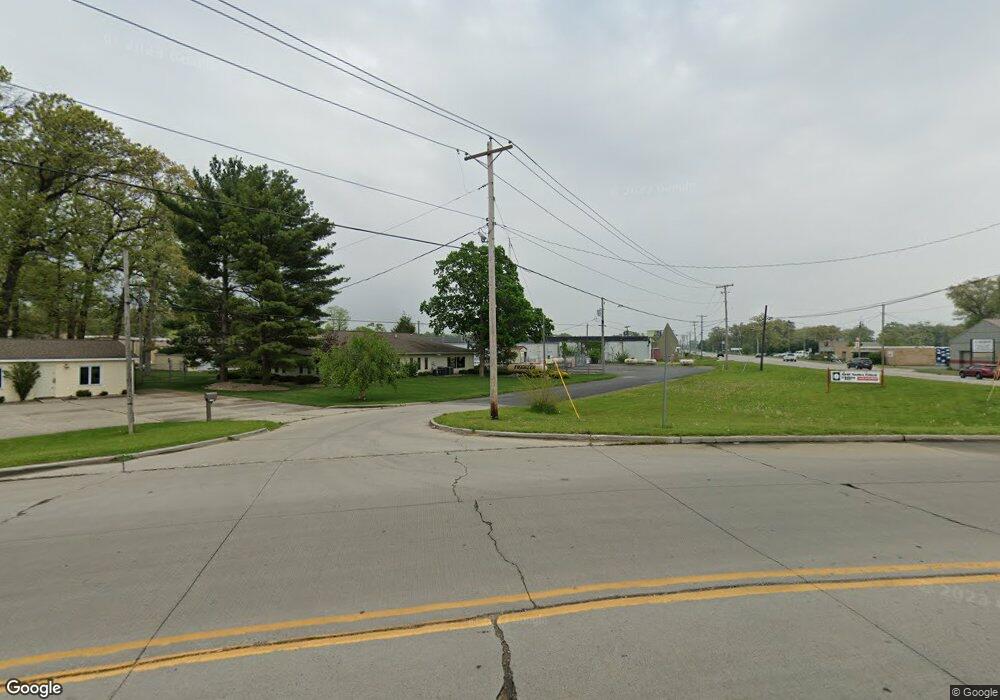
1510 W Bristol St Elkhart, IN 46514
--
Bed
--
Bath
25,000
Sq Ft
1.24
Acres
About This Home
This home is located at 1510 W Bristol St, Elkhart, IN 46514. 1510 W Bristol St is a home located in Elkhart County with nearby schools including Woodland Elementary School, West Side Middle School, and Elkhart High School.
Ownership History
Date
Name
Owned For
Owner Type
Purchase Details
Closed on
Sep 25, 2024
Sold by
Simba King Llc
Bought by
Rbs Properties Llc
Purchase Details
Closed on
Jul 24, 2012
Sold by
Real Estate Holding Llc
Bought by
Simba King Llc
Purchase Details
Closed on
Oct 23, 2003
Sold by
Kkr Properties Llc
Bought by
Real Estate Holdings Llc
Home Financials for this Owner
Home Financials are based on the most recent Mortgage that was taken out on this home.
Original Mortgage
$330,000
Interest Rate
6.01%
Mortgage Type
Commercial
Purchase Details
Closed on
Feb 27, 2001
Sold by
Burkholder Real Estate Holding Corp
Bought by
The Complex Ten Inc
Home Financials for this Owner
Home Financials are based on the most recent Mortgage that was taken out on this home.
Original Mortgage
$161,600
Interest Rate
6.68%
Mortgage Type
Commercial
Create a Home Valuation Report for This Property
The Home Valuation Report is an in-depth analysis detailing your home's value as well as a comparison with similar homes in the area
Home Values in the Area
Average Home Value in this Area
Purchase History
| Date | Buyer | Sale Price | Title Company |
|---|---|---|---|
| Rbs Properties Llc | -- | Meridian Title | |
| Simba King Llc | -- | Lawyers Title | |
| Real Estate Holdings Llc | -- | Century Title Services | |
| The Complex Ten Inc | -- | Meridian Title Corp |
Source: Public Records
Mortgage History
| Date | Status | Borrower | Loan Amount |
|---|---|---|---|
| Previous Owner | Real Estate Holdings Llc | $330,000 | |
| Previous Owner | The Complex Ten Inc | $161,600 |
Source: Public Records
Tax History Compared to Growth
Tax History
| Year | Tax Paid | Tax Assessment Tax Assessment Total Assessment is a certain percentage of the fair market value that is determined by local assessors to be the total taxable value of land and additions on the property. | Land | Improvement |
|---|---|---|---|---|
| 2024 | $2,077 | $130,000 | $39,200 | $90,800 |
| 2022 | $2,077 | $225,400 | $39,200 | $186,200 |
| 2021 | $3,589 | $204,100 | $39,200 | $164,900 |
| 2020 | $4,623 | $237,000 | $39,200 | $197,800 |
| 2019 | $4,108 | $394,900 | $39,200 | $355,700 |
| 2018 | $9,910 | $505,300 | $40,000 | $465,300 |
| 2017 | $5,247 | $252,800 | $40,000 | $212,800 |
| 2016 | $3,074 | $147,600 | $40,000 | $107,600 |
| 2014 | $2,786 | $135,800 | $40,000 | $95,800 |
| 2013 | $7,628 | $348,600 | $40,000 | $308,600 |
Source: Public Records
Map
Nearby Homes
- 54290 Northwood Dr
- 27911 Plainfield Dr
- 54039 County Road 5
- 0000 Mishawaka St
- 1214 Locust St
- 1318 Maple Row
- 1117 Edwardsburg Ave
- 1111 Edwardsburg Ave
- 1105 Edwardsburg Ave
- 54270 Silver St
- 1118 Cedar St
- 1113 Cedar St
- 507 Prospect St
- 509 Prospect St
- 1701 Kilbourn St
- 134 E Emerald St
- 626 Bower St
- 216 Floyd St
- 1106 Strong Ave
- 1021 Strong Ave
- 1500 W Bristol St
- 27773 County Road 10
- 27792 Westwood Dr
- 27798 Westwood Dr
- 27807 County Road 10
- 27812 Westwood Dr
- 27826 Westwood Dr
- 27840 Westwood Dr
- 1620 W Bristol St
- 27797 Westwood Dr
- 27811 Westwood Dr
- 27852 Westwood Dr
- 27726 A Ct
- 27740 A Ct
- 27752 A Ct
- 27866 Westwood Dr
- 27825 Westwood Dr
- 27772 A Ct
- 27841 Westwood Dr
- 54293 Southwood Dr
