
Seller's Agent in 2024
Jennifer M Sims
Lindsey & Associates Inc
(479) 841-5636
125 Total Sales
Estimated Value: $125,710
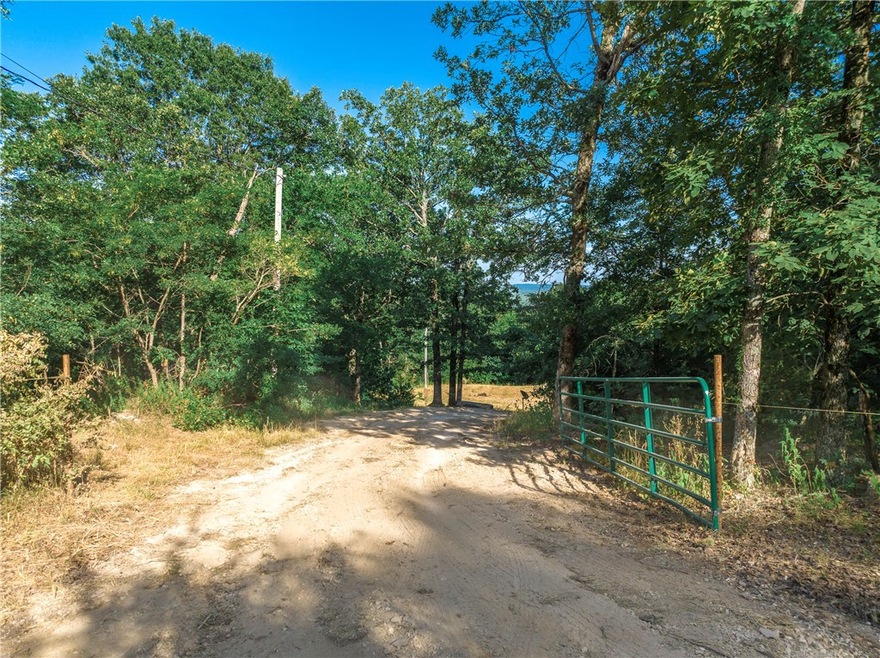
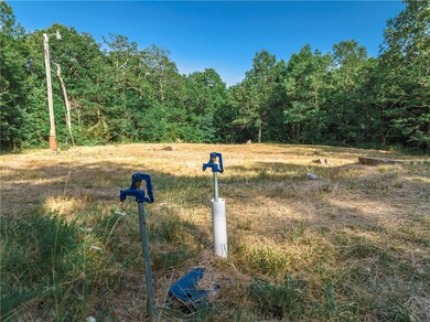
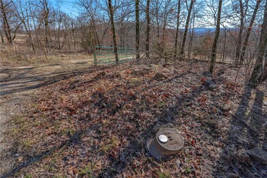
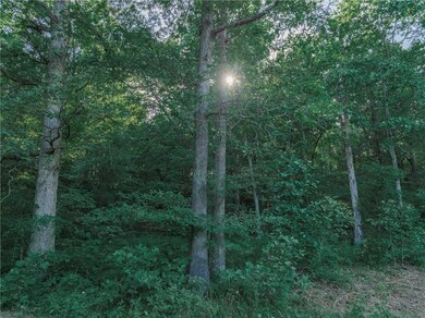
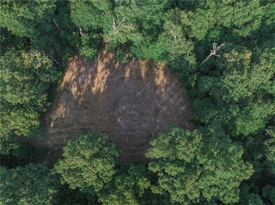
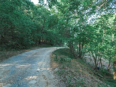
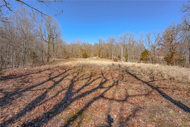
The best of the Ozarks. Neary 10 acres with amazing view potential at 1715 ft. elevation. Feels remote yet only 20 mins to Fayetteville. Save thousands in infrastructure costs with all utilities installed on site – Mt. Olive Water, Ozarks Electric and Ozarks Go. Ready for your RV or build site. Private location with woods, clearings, rock outcroppings, wet-weather creeks and abundant wildlife. Property sits on both sides of the road for increased flexibility. Survey and positive soil test available. No deed restrictions.
Last Agent to Sell the Property
Lindsey & Associates Inc Brokerage Phone: 479-521-6611 License #EB00081886 Listed on: 07/08/2022
Last Buyer's Agent
Lindsey & Associates Inc Brokerage Phone: 479-521-6611 License #EB00081886 Listed on: 07/08/2022
| Date | Buyer | Sale Price | Title Company |
|---|---|---|---|
| Wintrode Thomas D | -- | -- | |
| Wintrode Thomas D | $15,000 | None Available | |
| Price Richard | $35,000 | -- | |
| Cook, George R Trust | -- | -- | |
| Cook George R | -- | -- |
| Date | Event | Price | List to Sale | Price per Sq Ft |
|---|---|---|---|---|
| 06/25/2024 06/25/24 | Sold | $120,000 | -17.2% | -- |
| 06/12/2024 06/12/24 | Pending | -- | -- | -- |
| 06/01/2024 06/01/24 | For Sale | $145,000 | 0.0% | -- |
| 04/17/2024 04/17/24 | Pending | -- | -- | -- |
| 03/01/2024 03/01/24 | Price Changed | $145,000 | -6.5% | -- |
| 01/08/2024 01/08/24 | Price Changed | $155,000 | 0.0% | -- |
| 01/08/2024 01/08/24 | For Sale | $155,000 | +29.2% | -- |
| 01/07/2024 01/07/24 | Off Market | $120,000 | -- | -- |
| 09/18/2023 09/18/23 | Price Changed | $170,000 | -12.8% | -- |
| 05/12/2023 05/12/23 | Price Changed | $195,000 | -9.3% | -- |
| 03/03/2023 03/03/23 | Price Changed | $215,000 | -4.4% | -- |
| 09/22/2022 09/22/22 | Price Changed | $225,000 | -10.0% | -- |
| 07/08/2022 07/08/22 | For Sale | $250,000 | -- | -- |
| Year | Tax Paid | Tax Assessment Tax Assessment Total Assessment is a certain percentage of the fair market value that is determined by local assessors to be the total taxable value of land and additions on the property. | Land | Improvement |
|---|---|---|---|---|
| 2025 | $10 | $210 | $210 | $0 |
| 2024 | $10 | $210 | $210 | $0 |
| 2023 | $10 | $210 | $210 | $0 |
| 2022 | $11 | $210 | $210 | $0 |
| 2021 | $11 | $210 | $210 | $0 |
| 2020 | $11 | $210 | $210 | $0 |
| 2019 | $22 | $480 | $480 | $0 |
| 2018 | $22 | $480 | $480 | $0 |
| 2017 | $22 | $480 | $480 | $0 |
| 2016 | $22 | $480 | $480 | $0 |
| 2015 | $22 | $480 | $480 | $0 |
| 2014 | $24 | $520 | $520 | $0 |
Seller's Agent in 2024
Jennifer M Sims
Lindsey & Associates Inc
(479) 841-5636
125 Total Sales
Source: Northwest Arkansas Board of REALTORS®
MLS Number: 1223754
APN: 001-06365-000
Disclaimer: Certain information contained herein is derived from information provided by parties other than Homes.com. All information provided is deemed reliable, but is not guaranteed to be accurate and should be independently verified.
![]() IDX information is provided exclusively for personal, non-commercial use, and may not be used for any purpose other than to identify prospective properties consumers may be interested in purchasing. Information is deemed reliable but not guaranteed.
IDX information is provided exclusively for personal, non-commercial use, and may not be used for any purpose other than to identify prospective properties consumers may be interested in purchasing. Information is deemed reliable but not guaranteed.