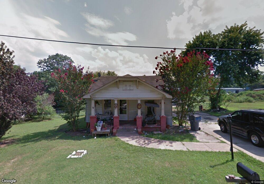
1511 Buffalo St Kannapolis, NC 28081
Estimated Value: $117,000 - $246,000
--
Bed
1
Bath
1,148
Sq Ft
$167/Sq Ft
Est. Value
About This Home
This home is located at 1511 Buffalo St, Kannapolis, NC 28081 and is currently estimated at $191,447, approximately $166 per square foot. 1511 Buffalo St is a home located in Cabarrus County with nearby schools including Landis Elementary School, Corriher Lipe Middle School, and South Rowan High School.
Ownership History
Date
Name
Owned For
Owner Type
Purchase Details
Closed on
Dec 8, 2022
Sold by
Sexton Jamie Shawn and Sexton Barbara Gilliam
Bought by
Sexton Jamie Shaw and Sexton Barbara Gilliam
Current Estimated Value
Home Financials for this Owner
Home Financials are based on the most recent Mortgage that was taken out on this home.
Original Mortgage
$149,400
Outstanding Balance
$143,789
Interest Rate
5.7%
Mortgage Type
New Conventional
Estimated Equity
$47,658
Purchase Details
Closed on
Mar 29, 2016
Sold by
Bare William James and Bare Patricia
Bought by
Sexton Jamie Shaw
Purchase Details
Closed on
Jun 26, 2009
Sold by
Bare Paul Eugene and Bare Linda
Bought by
Bare William James
Create a Home Valuation Report for This Property
The Home Valuation Report is an in-depth analysis detailing your home's value as well as a comparison with similar homes in the area
Home Values in the Area
Average Home Value in this Area
Purchase History
| Date | Buyer | Sale Price | Title Company |
|---|---|---|---|
| Sexton Jamie Shaw | -- | -- | |
| Sexton Jamie Shaw | -- | None Listed On Document | |
| Sexton Jamie Shaw | $20,000 | None Available | |
| Bare William James | -- | None Available |
Source: Public Records
Mortgage History
| Date | Status | Borrower | Loan Amount |
|---|---|---|---|
| Open | Sexton Jamie Shaw | $149,400 | |
| Closed | Sexton Jamie Shaw | $149,400 |
Source: Public Records
Tax History Compared to Growth
Tax History
| Year | Tax Paid | Tax Assessment Tax Assessment Total Assessment is a certain percentage of the fair market value that is determined by local assessors to be the total taxable value of land and additions on the property. | Land | Improvement |
|---|---|---|---|---|
| 2025 | $751 | $113,732 | $33,600 | $80,132 |
| 2024 | $751 | $113,732 | $33,600 | $80,132 |
| 2023 | $751 | $113,732 | $33,600 | $80,132 |
| 2022 | $549 | $74,458 | $23,520 | $50,938 |
| 2021 | $549 | $74,458 | $23,520 | $50,938 |
| 2020 | $549 | $74,458 | $23,520 | $50,938 |
| 2019 | $549 | $74,458 | $23,520 | $50,938 |
| 2018 | $482 | $65,897 | $23,520 | $42,377 |
| 2017 | $482 | $65,897 | $23,520 | $42,377 |
| 2016 | $475 | $65,897 | $23,520 | $42,377 |
| 2015 | $483 | $65,897 | $23,520 | $42,377 |
| 2014 | $459 | $63,782 | $19,600 | $44,182 |
Source: Public Records
Map
Nearby Homes
- 1530 Buffalo St
- 122 Andrew St
- 0 W C St Unit 2 CAR4255761
- 0 W C St Unit CAR4255556
- 1895 Normandy Rd
- 4648 Nob Hill Dr
- 150 Westover Ave
- 1734 Shadowbrook Dr
- 1408 Westwinds Ct
- 202 Glenn Ave
- 113 Hilton Ave
- 1006 Orangewood St
- 1022 W C St
- 1017 W C St
- 1302 S Juniper St
- 1001 Hoke St
- 0 Pump Station Rd
- 1116 S Juniper St
- 110 White Ave
- 1402 Birch St
- 1509 Buffalo St
- 1515 Buffalo St
- 1507 Buffalo St
- 1517 Buffalo St
- 1512 Buffalo St
- 1510 Buffalo St
- 1508 Buffalo St
- 1524 Buffalo St
- 1521 Buffalo St
- 1525 Buffalo St
- 1526 Buffalo St
- 1528 Buffalo St
- 1527 Buffalo St
- 113 Newell Ave
- 111 Newell Ave
- 118 Newell Ave
- 116 Newell Ave
- 114 Newell Ave
- 120 Newell Ave
- 112 Newell Ave