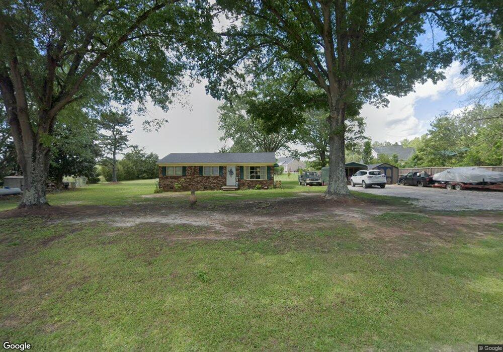
1511 Carroll Falls Rd Clover, SC 29710
Estimated Value: $162,010 - $241,000
--
Bed
--
Bath
1,107
Sq Ft
$196/Sq Ft
Est. Value
About This Home
This home is located at 1511 Carroll Falls Rd, Clover, SC 29710 and is currently estimated at $216,503, approximately $195 per square foot. 1511 Carroll Falls Rd is a home located in York County with nearby schools including Bethany Elementary School, Clover Middle School, and Clover High School.
Ownership History
Date
Name
Owned For
Owner Type
Purchase Details
Closed on
May 9, 2018
Sold by
Falls Frank C and Falls Duane Larry
Bought by
Auten Sarah Elizabeth
Current Estimated Value
Home Financials for this Owner
Home Financials are based on the most recent Mortgage that was taken out on this home.
Original Mortgage
$119,191
Outstanding Balance
$102,282
Interest Rate
4.44%
Mortgage Type
New Conventional
Estimated Equity
$114,221
Purchase Details
Closed on
Mar 23, 2018
Sold by
Falls Thomas N
Bought by
Falls Frank C and Falls Duane Larry
Home Financials for this Owner
Home Financials are based on the most recent Mortgage that was taken out on this home.
Original Mortgage
$119,191
Outstanding Balance
$102,282
Interest Rate
4.44%
Mortgage Type
New Conventional
Estimated Equity
$114,221
Create a Home Valuation Report for This Property
The Home Valuation Report is an in-depth analysis detailing your home's value as well as a comparison with similar homes in the area
Home Values in the Area
Average Home Value in this Area
Purchase History
| Date | Buyer | Sale Price | Title Company |
|---|---|---|---|
| Auten Sarah Elizabeth | $118,000 | Oig Title & Escrow Llc | |
| Falls Frank C | -- | None Available | |
| Falls Frank C | -- | None Available |
Source: Public Records
Mortgage History
| Date | Status | Borrower | Loan Amount |
|---|---|---|---|
| Open | Auten Sarah Elizabeth | $119,191 |
Source: Public Records
Tax History Compared to Growth
Tax History
| Year | Tax Paid | Tax Assessment Tax Assessment Total Assessment is a certain percentage of the fair market value that is determined by local assessors to be the total taxable value of land and additions on the property. | Land | Improvement |
|---|---|---|---|---|
| 2025 | $689 | $5,488 | $1,909 | $3,579 |
| 2024 | $618 | $4,772 | $1,344 | $3,428 |
| 2023 | $634 | $4,760 | $1,344 | $3,416 |
| 2022 | $512 | $4,760 | $1,344 | $3,416 |
| 2021 | -- | $4,760 | $1,344 | $3,416 |
| 2020 | $504 | $4,760 | $0 | $0 |
| 2019 | $532 | $4,580 | $0 | $0 |
| 2018 | $349 | $4,580 | $0 | $0 |
| 2017 | $1,472 | $4,470 | $0 | $0 |
| 2016 | $1,436 | $4,470 | $0 | $0 |
| 2014 | $1,390 | $4,470 | $1,320 | $3,150 |
| 2013 | $1,390 | $4,650 | $1,320 | $3,330 |
Source: Public Records
Map
Nearby Homes
- 00 Tart Rd
- 1240 Beamguard Rd
- 966 Laurelwood Dr
- 2944 Ranger Rd
- 8.128 Acres Ranger Rd
- 946 Laurelwood Dr
- TBD Crossland Rd Unit 2
- 0000 Davis Cir
- 218 Muldoon Ln
- 290 S Grandview Rd
- 531 Highway 161 N
- 00 State Road S-46-883
- Crossland Road Unit: 2
- 1698 Highway 161 S
- 1975 Kehl Rd
- 1312 Sage Pine Cir Unit 19
- Lot 1 Rhyne Rd
- 253 Highway 161 None N
- 13546 State Highway 55
- Princeton Plan at Shepherd's Trace - Shepherds Trace
- 447 Maynard Grayson Rd
- 465 Maynard Grayson Rd
- 455 Maynard Grayson Rd
- 443 Maynard Grayson Rd
- 2961 Highway 55 W
- 2963 Highway 55 W
- 2945 Highway 55 W
- 3003 Highway 55 W
- 2931 Highway 55 W
- 476 Maynard Grayson Rd
- 444 Maynard Grayson Rd
- 2991 Highway 55 W
- Lot A Maynard Grayson Rd
- 479 Maynard Grayson Rd
- 395 Maynard Grayson Rd
- Tract #A Maynard Grayson Rd
- 2995 Highway 55 W
- 13 +/- AC Maynard Grayson Rd
- 3029 Highway 55 W
- 6.5 ac Hwy 55 Hwy