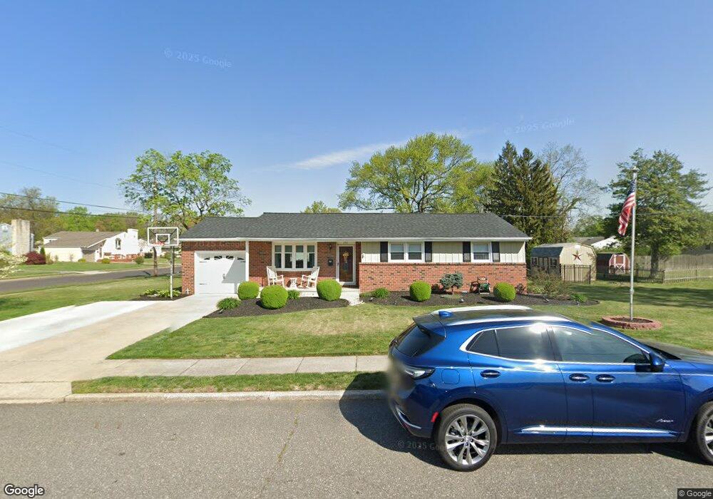
1511 Memorial Ave Gibbstown, NJ 08027
Greenwich Township NeighborhoodEstimated Value: $276,000 - $312,000
--
Bed
--
Bath
1,160
Sq Ft
$252/Sq Ft
Est. Value
About This Home
This home is located at 1511 Memorial Ave, Gibbstown, NJ 08027 and is currently estimated at $292,708, approximately $252 per square foot. 1511 Memorial Ave is a home located in Gloucester County with nearby schools including Nehaunsey Middle School and Guardian Angels Regional School.
Ownership History
Date
Name
Owned For
Owner Type
Purchase Details
Closed on
Sep 11, 2014
Sold by
Morgey Wendy and Banscher Wendy S
Bought by
Banscher Wendy S and Banscher John J
Current Estimated Value
Purchase Details
Closed on
Jan 11, 2008
Sold by
Robertson Mary L and Estate Of Anne Colanero
Bought by
Morgey Wendy S
Home Financials for this Owner
Home Financials are based on the most recent Mortgage that was taken out on this home.
Original Mortgage
$168,667
Outstanding Balance
$106,521
Interest Rate
6.17%
Mortgage Type
FHA
Estimated Equity
$186,187
Create a Home Valuation Report for This Property
The Home Valuation Report is an in-depth analysis detailing your home's value as well as a comparison with similar homes in the area
Home Values in the Area
Average Home Value in this Area
Purchase History
| Date | Buyer | Sale Price | Title Company |
|---|---|---|---|
| Banscher Wendy S | -- | Attorney | |
| Morgey Wendy S | $170,000 | Cumberland Title A |
Source: Public Records
Mortgage History
| Date | Status | Borrower | Loan Amount |
|---|---|---|---|
| Open | Morgey Wendy S | $168,667 |
Source: Public Records
Tax History Compared to Growth
Tax History
| Year | Tax Paid | Tax Assessment Tax Assessment Total Assessment is a certain percentage of the fair market value that is determined by local assessors to be the total taxable value of land and additions on the property. | Land | Improvement |
|---|---|---|---|---|
| 2025 | $4,393 | $127,600 | $34,900 | $92,700 |
| 2024 | $4,162 | $127,600 | $34,900 | $92,700 |
| 2023 | $4,162 | $127,600 | $34,900 | $92,700 |
| 2022 | $4,165 | $127,600 | $34,900 | $92,700 |
| 2021 | $4,121 | $127,600 | $34,900 | $92,700 |
| 2020 | $4,179 | $127,600 | $34,900 | $92,700 |
| 2019 | $4,181 | $127,600 | $34,900 | $92,700 |
| 2018 | $4,063 | $127,600 | $34,900 | $92,700 |
| 2017 | $3,965 | $127,600 | $34,900 | $92,700 |
| 2016 | $3,921 | $127,600 | $34,900 | $92,700 |
| 2015 | $3,795 | $127,600 | $34,900 | $92,700 |
| 2014 | $3,632 | $127,600 | $34,900 | $92,700 |
Source: Public Records
Map
Nearby Homes
- 836 E Broad St
- 330 Croce Ave
- 219 Vanneman Blvd
- 0 S Democrat Rd Unit NJGL2065008
- 0 Swedesboro Ave Unit NJGL2061592
- 344 W Washington St
- 335 W Buck St
- 255 Elizabeth Ave
- L18 20 W Broad St
- 269 W Broad St
- 1224 Heddon Ave
- 1214 Walter Ave
- 1043 Penn Line Rd
- 227 W Buck St
- 100 Giammarino Ave
- 342 Democrat Rd
- 1534 Pine St
- 140 142 W Jefferson St
- 122 W Washington St
- 1519 Pine St
- 312 Carson Ave
- 1515 Memorial Ave
- 1500 Memorial Ave
- 318 Carson Ave
- 93 Harmony Rd
- 1497 Memorial Ave
- 143 Harmony Rd
- 311 Carson Ave
- 264 Carson Ave
- 85 Harmony Rd
- 261 Carson Ave
- 324 Carson Ave
- 317 Carson Ave
- 149 Harmony Rd
- 77 Harmony Rd
- 256 Carson Ave
- 1492 Memorial Ave
- 323 Carson Ave
- 330 Carson Ave
- 465 Rosenthal Ave