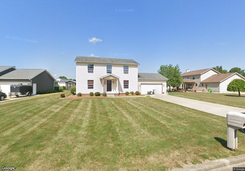
1511 Northwood Ave Alliance, OH 44601
Estimated Value: $236,000 - $304,000
3
Beds
3
Baths
1,728
Sq Ft
$160/Sq Ft
Est. Value
About This Home
This home is located at 1511 Northwood Ave, Alliance, OH 44601 and is currently estimated at $275,848, approximately $159 per square foot. 1511 Northwood Ave is a home located in Stark County with nearby schools including Marlington High School and Regina Coeli/St Joseph School.
Ownership History
Date
Name
Owned For
Owner Type
Purchase Details
Closed on
Jan 30, 2014
Sold by
Stout James G and Stout Mary Katherine
Bought by
Stout Jeffrey A and Stout Dawn R
Current Estimated Value
Home Financials for this Owner
Home Financials are based on the most recent Mortgage that was taken out on this home.
Original Mortgage
$67,000
Outstanding Balance
$19,445
Interest Rate
4.5%
Mortgage Type
New Conventional
Estimated Equity
$256,403
Purchase Details
Closed on
Feb 11, 2005
Sold by
Cendant Mobility Financial Corp
Bought by
Stout James G and Stout Mary Katherine
Purchase Details
Closed on
Jul 23, 2004
Sold by
Rackley James L and Rackley Anne E
Bought by
Cendant Mobility Financial Corp
Purchase Details
Closed on
Apr 25, 2000
Sold by
Alliance Citizens Health Associatio
Bought by
Rackley James L and Rackley Anne E
Home Financials for this Owner
Home Financials are based on the most recent Mortgage that was taken out on this home.
Original Mortgage
$120,700
Interest Rate
6.25%
Mortgage Type
Purchase Money Mortgage
Purchase Details
Closed on
Apr 3, 1998
Sold by
Stilwell Warren
Bought by
Alliance Citizens Health Assn
Purchase Details
Closed on
Nov 5, 1997
Sold by
Westwood Properties
Bought by
Stilwell Warren
Home Financials for this Owner
Home Financials are based on the most recent Mortgage that was taken out on this home.
Original Mortgage
$72,000
Interest Rate
7.42%
Mortgage Type
New Conventional
Create a Home Valuation Report for This Property
The Home Valuation Report is an in-depth analysis detailing your home's value as well as a comparison with similar homes in the area
Home Values in the Area
Average Home Value in this Area
Purchase History
| Date | Buyer | Sale Price | Title Company |
|---|---|---|---|
| Stout Jeffrey A | -- | Source One Title | |
| Stout James G | $150,000 | -- | |
| Cendant Mobility Financial Corp | $150,000 | -- | |
| Rackley James L | $142,000 | -- | |
| Alliance Citizens Health Assn | $128,240 | -- | |
| Stilwell Warren | $144,000 | -- |
Source: Public Records
Mortgage History
| Date | Status | Borrower | Loan Amount |
|---|---|---|---|
| Open | Stout Jeffrey A | $67,000 | |
| Previous Owner | Rackley James L | $120,700 | |
| Previous Owner | Stilwell Warren | $72,000 | |
| Closed | Rackley James L | $21,100 |
Source: Public Records
Tax History Compared to Growth
Tax History
| Year | Tax Paid | Tax Assessment Tax Assessment Total Assessment is a certain percentage of the fair market value that is determined by local assessors to be the total taxable value of land and additions on the property. | Land | Improvement |
|---|---|---|---|---|
| 2025 | -- | $66,610 | $20,130 | $46,480 |
| 2024 | -- | $66,610 | $20,130 | $46,480 |
| 2023 | $1,795 | $58,000 | $15,330 | $42,670 |
| 2022 | $1,801 | $58,000 | $15,330 | $42,670 |
| 2021 | $1,807 | $58,000 | $15,330 | $42,670 |
| 2020 | $1,778 | $51,000 | $13,340 | $37,660 |
| 2019 | $1,763 | $51,000 | $13,340 | $37,660 |
| 2018 | $1,765 | $51,000 | $13,340 | $37,660 |
| 2017 | $1,533 | $44,630 | $10,680 | $33,950 |
| 2016 | $1,598 | $46,490 | $10,680 | $35,810 |
| 2015 | $1,601 | $46,490 | $10,680 | $35,810 |
| 2014 | $1,722 | $44,520 | $10,220 | $34,300 |
| 2013 | $862 | $44,520 | $10,220 | $34,300 |
Source: Public Records
Map
Nearby Homes
- 2081 Marwood Cir
- 1430 Westwood Ave
- 0 S Sawburg Ave Unit 5113457
- 2371 Ansley St Unit 2371
- 2377 Ansley St Unit 2377
- 8630 Schubert Ave NE
- 2050 Federal Ave
- 1201 Overlook Dr
- 0 W Main St Unit 5090123
- 2220 Western Ave
- 2112 Blenheim Ave
- 0 Easton St NE
- 970 Kingsway St
- 2851 Patriots Path Unit 3D
- 1321 Parkway Blvd
- 2435 Queensbury Rd
- 884 W College Rd
- 896 Parkway Blvd
- 1515 S Rockhill Ave
- 738 Kingsway St
- 1521 Northwood Ave
- 2040 Crestwood St
- 2050 Crestwood St
- 1531 Northwood Ave
- 2051 Marwood Cir
- 1510 Northwood Ave
- 2030 Crestwood St
- 2060 Crestwood St
- 2061 Marwood Cir
- 1520 Northwood Ave
- 1530 Northwood Ave
- 2041 Crestwood St
- 2031 Crestwood St
- 2051 Crestwood St
- 2071 Marwood Cir
- 1540 Northwood Ave
- 2021 Crestwood St
- 2020 Crestwood St
- 2061 Crestwood St
- 2050 Marwood Cir