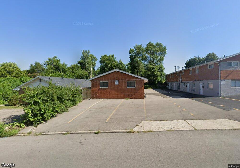
1511 Radio Rd Unit A & B Dayton, OH 45403
Wright View NeighborhoodEstimated Value: $110,000 - $166,000
4
Beds
2
Baths
1,716
Sq Ft
$77/Sq Ft
Est. Value
About This Home
This home is located at 1511 Radio Rd Unit A & B, Dayton, OH 45403 and is currently estimated at $132,112, approximately $76 per square foot. 1511 Radio Rd Unit A & B is a home located in Montgomery County with nearby schools including Kiser Elementary, Ruskin Elementary School, and Horizon Science Academy Dayton Downtown.
Ownership History
Date
Name
Owned For
Owner Type
Purchase Details
Closed on
May 27, 2022
Sold by
Montgomery County
Bought by
Salmon Sedray
Current Estimated Value
Purchase Details
Closed on
Feb 3, 2011
Sold by
Hall Merlin
Bought by
Apostolakis George
Purchase Details
Closed on
Sep 29, 2000
Sold by
Hall Leota
Bought by
Hall Merlin
Purchase Details
Closed on
Sep 4, 1997
Sold by
Webber Jonnie P and Webber Johnnie P
Bought by
Hall Merlin and Hall Leota
Create a Home Valuation Report for This Property
The Home Valuation Report is an in-depth analysis detailing your home's value as well as a comparison with similar homes in the area
Home Values in the Area
Average Home Value in this Area
Purchase History
| Date | Buyer | Sale Price | Title Company |
|---|---|---|---|
| Salmon Sedray | $40,000 | Peterson Nathaniel S | |
| Apostolakis George | $18,000 | Attorney | |
| Hall Merlin | -- | -- | |
| Hall Merlin | $55,500 | Landmark Title |
Source: Public Records
Tax History Compared to Growth
Tax History
| Year | Tax Paid | Tax Assessment Tax Assessment Total Assessment is a certain percentage of the fair market value that is determined by local assessors to be the total taxable value of land and additions on the property. | Land | Improvement |
|---|---|---|---|---|
| 2024 | $1,135 | $19,140 | $3,940 | $15,200 |
| 2023 | $1,135 | $19,140 | $3,940 | $15,200 |
| 2022 | $1,767 | $15,350 | $3,160 | $12,190 |
| 2021 | $1,671 | $15,350 | $3,160 | $12,190 |
| 2020 | $1,683 | $15,350 | $3,160 | $12,190 |
| 2019 | $2,287 | $21,150 | $4,140 | $17,010 |
| 2018 | $3,853 | $21,150 | $4,140 | $17,010 |
| 2017 | $1,894 | $21,150 | $4,140 | $17,010 |
| 2016 | $1,966 | $22,540 | $4,490 | $18,050 |
| 2015 | $1,862 | $22,540 | $4,490 | $18,050 |
| 2014 | $1,862 | $22,540 | $4,490 | $18,050 |
| 2012 | -- | $29,440 | $6,310 | $23,130 |
Source: Public Records
Map
Nearby Homes
- 400 N Cherrywood Ave
- 410 N Cherrywood Ave
- 321 N Cherrywood Ave
- 1718 Radio Rd
- 423 Briarwood Ave
- 446 N Garland Ave
- 1708 Rangeley Ave
- 251 N Smithville Rd
- 254 N Wright Ave
- 238 N Cherrywood Ave
- 241 N Smithville Rd
- 1622 Woodley Rd
- 144 N Quentin Ave
- 213 N Delmar Ave
- 13 Murray Hill Dr
- 4129 E 3rd St Unit 4127
- 133 Bircher Ave
- 4856 Airway Rd
- 4516 Glen Martin Dr
- 124 N Harbine Ave
- 1511 Radio Rd
- 403 N Cherrywood Ave Unit 8
- 403 N Cherrywood Ave
- 1501 Radio Rd
- 412 N Wright Ave
- 1407 Radio Rd
- 341 N Cherrywood Ave
- 1504 Radio Rd
- 416 N Wright Ave
- 410 N Cherrywood Ave Unit 6
- 410 N Cherrywood Ave Unit 7
- 410 N Cherrywood Ave Unit 8
- 410 N Cherrywood Ave Unit 5
- 410 N Cherrywood Ave Unit 2
- 420 N Wright Ave
- 334 N Cherrywood Ave
- 420 N Cherrywood Ave Unit 12
- 420 N Cherrywood Ave Unit 3
- 420 N Cherrywood Ave Unit 8
- 420 N Cherrywood Ave