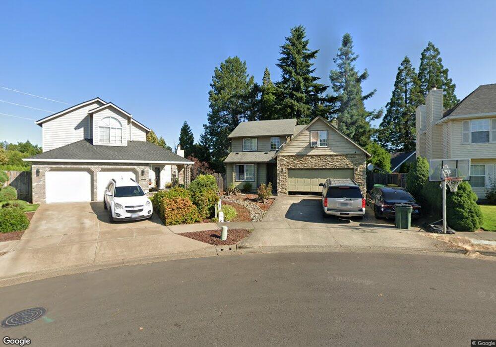
1511 Rodlun Ct Forest Grove, OR 97116
Estimated Value: $488,000 - $592,000
4
Beds
3
Baths
2,122
Sq Ft
$251/Sq Ft
Est. Value
About This Home
This home is located at 1511 Rodlun Ct, Forest Grove, OR 97116 and is currently estimated at $533,449, approximately $251 per square foot. 1511 Rodlun Ct is a home located in Washington County with nearby schools including Harvey Clarke Elementary School, Tom McCall Upper Elementary School, and Neil Armstrong Middle School.
Ownership History
Date
Name
Owned For
Owner Type
Purchase Details
Closed on
Oct 4, 2008
Sold by
Deutsche Bank National Trust Company
Bought by
Gilbert David P and Gilbert Juanita E
Current Estimated Value
Home Financials for this Owner
Home Financials are based on the most recent Mortgage that was taken out on this home.
Original Mortgage
$162,000
Interest Rate
5.9%
Mortgage Type
Purchase Money Mortgage
Purchase Details
Closed on
May 22, 2008
Sold by
Vilhauer Shawn and Vilhauer Donna
Bought by
Deutsche Bank National Trust Co and Registered Holders Of Cdc Mortgage Capit
Purchase Details
Closed on
Feb 27, 2003
Sold by
Davis Claud and Davis Virginia
Bought by
Vilhauer Shawn and Vilahuer Donna
Home Financials for this Owner
Home Financials are based on the most recent Mortgage that was taken out on this home.
Original Mortgage
$182,750
Interest Rate
8.25%
Mortgage Type
Purchase Money Mortgage
Create a Home Valuation Report for This Property
The Home Valuation Report is an in-depth analysis detailing your home's value as well as a comparison with similar homes in the area
Home Values in the Area
Average Home Value in this Area
Purchase History
| Date | Buyer | Sale Price | Title Company |
|---|---|---|---|
| Gilbert David P | $208,000 | Fidelity Natl Title Co Of Or | |
| Deutsche Bank National Trust Co | $264,759 | Fidelity National Title Co | |
| Vilhauer Shawn | -- | Fidelity National Title Co |
Source: Public Records
Mortgage History
| Date | Status | Borrower | Loan Amount |
|---|---|---|---|
| Previous Owner | Gilbert David P | $162,000 | |
| Previous Owner | Vilhauer Shawn | $182,750 |
Source: Public Records
Tax History Compared to Growth
Tax History
| Year | Tax Paid | Tax Assessment Tax Assessment Total Assessment is a certain percentage of the fair market value that is determined by local assessors to be the total taxable value of land and additions on the property. | Land | Improvement |
|---|---|---|---|---|
| 2026 | $4,846 | $272,120 | -- | -- |
| 2025 | $4,846 | $264,200 | -- | -- |
| 2024 | $4,675 | $256,510 | -- | -- |
| 2023 | $4,675 | $249,040 | $0 | $0 |
| 2022 | $4,088 | $249,040 | $0 | $0 |
| 2021 | $4,035 | $234,750 | $0 | $0 |
| 2020 | $4,013 | $227,920 | $0 | $0 |
| 2019 | $3,924 | $221,290 | $0 | $0 |
| 2018 | $3,803 | $214,850 | $0 | $0 |
| 2017 | $3,686 | $208,600 | $0 | $0 |
| 2016 | $3,582 | $202,530 | $0 | $0 |
| 2015 | $3,445 | $196,640 | $0 | $0 |
| 2014 | $3,428 | $190,920 | $0 | $0 |
Source: Public Records
Map
Nearby Homes
- 1609 Camino Dr
- 1611 Camino Dr
- 2235 D St
- 2341 Turnbull Ct
- 2327 Turnbull Ct
- 1315 Begonia Ave
- 1718 23rd Ave
- 2108 D St
- 1222 Brookside Ave
- 2119 B St
- 1425 Willamina Ave
- 0 C St Unit Lot 1
- 0 C St Unit 24232816
- 1078 Vista Oaks Dr
- 1931 D St
- 2517 Sweetwood Ct
- 1104 Magnolia Way
- 1316 19th Place
- 1569 19th Ave
- 1419 19th Ave