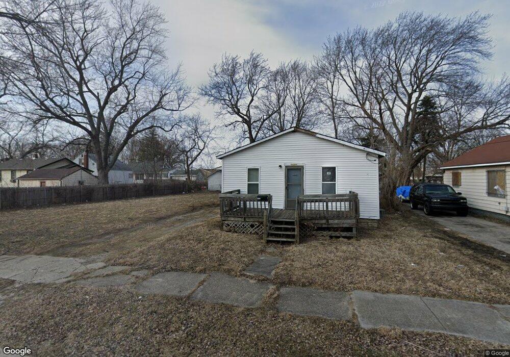
1511 Wayne St Flint, MI 48503
South Parks NeighborhoodEstimated Value: $39,000 - $165,000
4
Beds
1
Bath
878
Sq Ft
$105/Sq Ft
Est. Value
About This Home
This home is located at 1511 Wayne St, Flint, MI 48503 and is currently estimated at $91,957, approximately $104 per square foot. 1511 Wayne St is a home located in Genesee County with nearby schools including Freeman Elementary School, Flint Southwestern Classical Academy, and International Academy of Flint (K-12).
Ownership History
Date
Name
Owned For
Owner Type
Purchase Details
Closed on
Dec 20, 2016
Sold by
Cherry Deborah L
Bought by
Genesee County Land Bank
Current Estimated Value
Purchase Details
Closed on
Feb 22, 2011
Sold by
Payne Investments Llc
Bought by
Teed Harold G
Purchase Details
Closed on
Nov 24, 2010
Sold by
Cherry Deborah L
Bought by
Payne Investments Llc
Purchase Details
Closed on
Nov 30, 2006
Sold by
H & H Residential Llc
Bought by
Shepherd Tony
Purchase Details
Closed on
Jul 10, 2006
Sold by
Perry Melvin T and Perry Edna E
Bought by
H & H Residential Services Llc
Create a Home Valuation Report for This Property
The Home Valuation Report is an in-depth analysis detailing your home's value as well as a comparison with similar homes in the area
Home Values in the Area
Average Home Value in this Area
Purchase History
| Date | Buyer | Sale Price | Title Company |
|---|---|---|---|
| Genesee County Land Bank | -- | None Available | |
| Teed Harold G | $1,600 | None Available | |
| Payne Investments Llc | $400 | None Available | |
| Shepherd Tony | $60,000 | First American Title Ins Co | |
| H & H Residential Services Llc | $8,000 | 1St American |
Source: Public Records
Tax History
| Year | Tax Paid | Tax Assessment Tax Assessment Total Assessment is a certain percentage of the fair market value that is determined by local assessors to be the total taxable value of land and additions on the property. | Land | Improvement |
|---|---|---|---|---|
| 2025 | -- | $0 | $0 | $0 |
| 2024 | -- | $0 | $0 | $0 |
| 2023 | -- | $0 | $0 | $0 |
| 2022 | $0 | $0 | $0 | $0 |
| 2021 | $0 | $0 | $0 | $0 |
| 2020 | $0 | $0 | $0 | $0 |
| 2019 | $509 | $0 | $0 | $0 |
| 2018 | $221 | $0 | $0 | $0 |
| 2017 | $433 | $0 | $0 | $0 |
| 2016 | $509 | $0 | $0 | $0 |
| 2015 | $0 | $0 | $0 | $0 |
| 2014 | -- | $0 | $0 | $0 |
| 2012 | -- | $5,700 | $0 | $0 |
Source: Public Records
Map
Nearby Homes
- 1851 Seymour Ave
- 2033 Seymour Ave
- 2029 Winans Ave
- 1840 Mcphail St
- 1814 Mcphail St
- 1930 Owen St
- 9211 Owen St
- 2010 Crocker Ave
- 1510 S Franklin Ave
- 2221 Howard Ave
- 2224 Crocker Ave
- 2050 Ferris Ave
- 420 Pingree Ave
- 1210 Blanchard Ave
- 1114 W Vernon Dr
- 1720 Park St
- 1701 Park St
- 1925 Gilmartin St
- 2013 E Court St
- 915 E 8th St
Your Personal Tour Guide
Ask me questions while you tour the home.