Estimated Value: $182,799 - $214,000
3
Beds
2
Baths
1,512
Sq Ft
$131/Sq Ft
Est. Value
About This Home
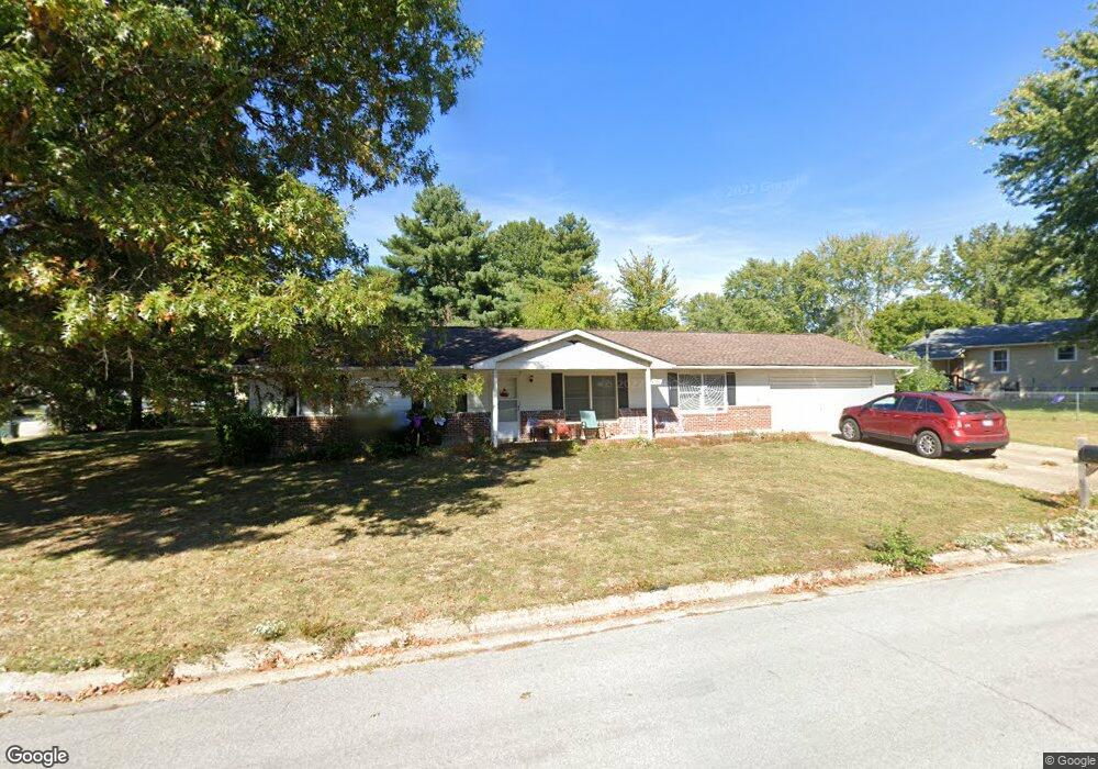
This home is located at 1511 Whitehall Rd, Rolla, MO 65401 and is currently estimated at $197,600, approximately $130 per square foot. 1511 Whitehall Rd is a home located in Phelps County with nearby schools including Rolla Junior High School, Rolla Senior High School, and Rolla Seventh-Day Adventist School.
Ownership History
Date
Name
Owned For
Owner Type
Purchase Details
Closed on
Jan 2, 2024
Sold by
Stella Maris Holdings Llc
Bought by
Ysjr Investments Llc
Current Estimated Value
Home Financials for this Owner
Home Financials are based on the most recent Mortgage that was taken out on this home.
Original Mortgage
$85,500
Outstanding Balance
$84,137
Interest Rate
7.44%
Mortgage Type
Construction
Estimated Equity
$113,463
Purchase Details
Closed on
Mar 14, 2013
Purchase Details
Closed on
Jul 21, 2011
Create a Home Valuation Report for This Property
The Home Valuation Report is an in-depth analysis detailing your home's value as well as a comparison with similar homes in the area
Home Values in the Area
Average Home Value in this Area
Purchase History
| Date | Buyer | Sale Price | Title Company |
|---|---|---|---|
| Ysjr Investments Llc | $106,875 | -- | |
| -- | $70,000 | -- | |
| -- | $75,000 | -- |
Source: Public Records
Mortgage History
| Date | Status | Borrower | Loan Amount |
|---|---|---|---|
| Open | Ysjr Investments Llc | $85,500 |
Source: Public Records
Tax History
| Year | Tax Paid | Tax Assessment Tax Assessment Total Assessment is a certain percentage of the fair market value that is determined by local assessors to be the total taxable value of land and additions on the property. | Land | Improvement |
|---|---|---|---|---|
| 2025 | $1,040 | $19,930 | $3,330 | $16,600 |
| 2024 | $975 | $18,130 | $3,040 | $15,090 |
| 2023 | $981 | $18,130 | $3,040 | $15,090 |
| 2022 | $833 | $18,130 | $3,040 | $15,090 |
| 2021 | $839 | $18,130 | $3,040 | $15,090 |
| 2020 | $860 | $18,130 | $3,040 | $15,090 |
| 2019 | $855 | $18,130 | $3,040 | $15,090 |
| 2018 | $847 | $18,130 | $3,040 | $15,090 |
| 2017 | $846 | $18,130 | $3,040 | $15,090 |
| 2016 | $818 | $18,130 | $3,040 | $15,090 |
| 2015 | -- | $18,130 | $3,040 | $15,090 |
| 2014 | -- | $18,130 | $3,040 | $15,090 |
| 2013 | -- | $18,130 | $0 | $0 |
Source: Public Records
Map
Nearby Homes
- 101 Steeplechase Rd
- 404 Fox Creek Rd
- 1506 Whitney Ln
- 603 Wakefield Dr
- 0 Redbud Ln
- 0 Sherwood Unit MIS25076064
- 803 Lovers Ln
- 24 Richard Dr
- 0 McCutchen Unit MIS25079909
- 60 Richard Dr
- Lot 38 Scottsvale Dr
- 622 Scottsvale Dr
- 1207 Elliott Dr
- 38 Johnson Dr
- 1408 Scenic Dr
- 1500 Independence Rd
- 0 Hillview Unit MIS25080072
- 10335 Stoltz Dr
- 1603 Independence Rd
- 654 Holmes Ln
- 202 Old English Rd
- 201 Fox Creek Rd
- 203 Fox Creek Rd
- 201 Old English Rd
- 1510 Whitehall Rd
- 204 Old English Rd
- 109 Fox Creek Rd
- 205 Fox Creek Rd
- 1508 Whitehall Rd
- 203 Old English Rd
- 112 Fox Creek Rd
- 206 Old English Rd
- 110 Fox Creek Rd
- 207 Fox Creek Rd
- 204 Fox Creek Rd
- 200 Fox Creek Rd
- 202 Fox Creek Rd
- 205 Old English Rd
- 200 Greentree Rd
- 300 Old English Rd
Your Personal Tour Guide
Ask me questions while you tour the home.