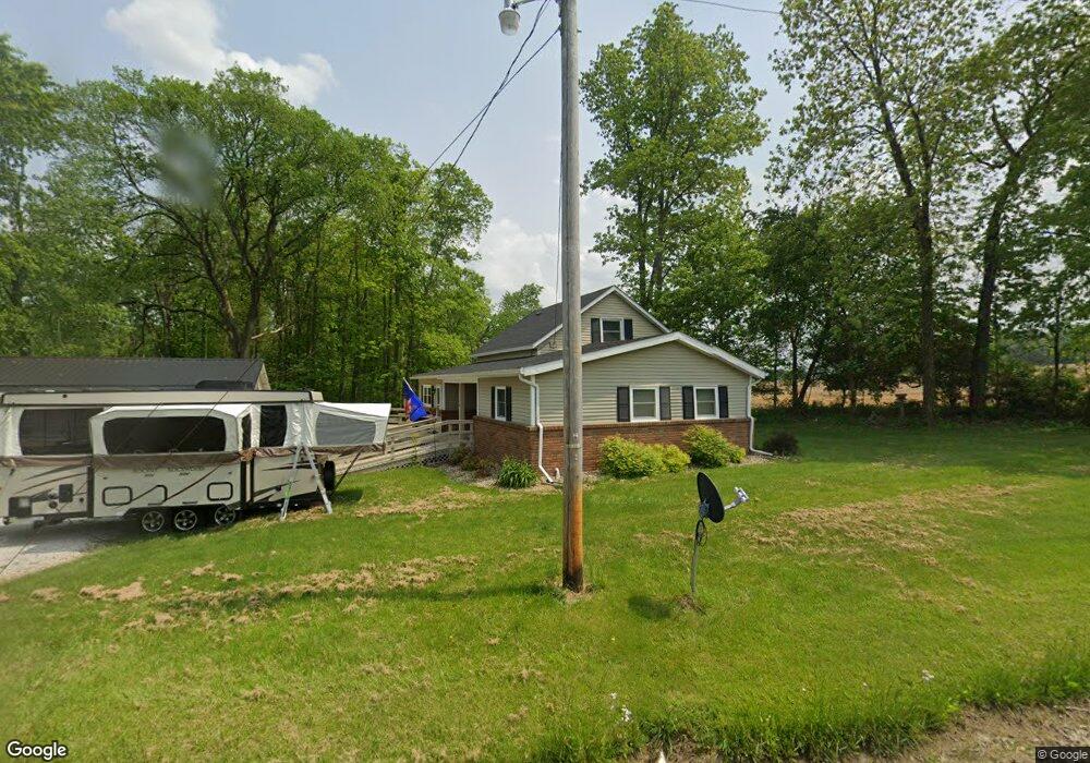
15114 North Liberty Rd Mount Vernon, OH 43050
Estimated Value: $239,000 - $304,000
2
Beds
1
Bath
1,303
Sq Ft
$198/Sq Ft
Est. Value
About This Home
This home is located at 15114 North Liberty Rd, Mount Vernon, OH 43050 and is currently estimated at $257,599, approximately $197 per square foot. 15114 North Liberty Rd is a home located in Knox County with nearby schools including Mount Vernon High School.
Ownership History
Date
Name
Owned For
Owner Type
Purchase Details
Closed on
Aug 28, 2020
Sold by
Poland Gwendolyn S
Bought by
Schonauer William E and Schonauer Kathryn E
Current Estimated Value
Home Financials for this Owner
Home Financials are based on the most recent Mortgage that was taken out on this home.
Original Mortgage
$83,200
Outstanding Balance
$75,130
Interest Rate
3.9%
Mortgage Type
New Conventional
Estimated Equity
$182,469
Purchase Details
Closed on
Jan 1, 1987
Bought by
Poland James and Poland Gwendolyn
Create a Home Valuation Report for This Property
The Home Valuation Report is an in-depth analysis detailing your home's value as well as a comparison with similar homes in the area
Home Values in the Area
Average Home Value in this Area
Purchase History
| Date | Buyer | Sale Price | Title Company |
|---|---|---|---|
| Schonauer William E | $104,000 | None Available | |
| Poland James | -- | -- |
Source: Public Records
Mortgage History
| Date | Status | Borrower | Loan Amount |
|---|---|---|---|
| Open | Schonauer William E | $83,200 |
Source: Public Records
Tax History Compared to Growth
Tax History
| Year | Tax Paid | Tax Assessment Tax Assessment Total Assessment is a certain percentage of the fair market value that is determined by local assessors to be the total taxable value of land and additions on the property. | Land | Improvement |
|---|---|---|---|---|
| 2024 | $2,250 | $52,670 | $8,950 | $43,720 |
| 2023 | $2,250 | $52,670 | $8,950 | $43,720 |
| 2022 | $1,714 | $36,320 | $6,170 | $30,150 |
| 2021 | $1,714 | $36,320 | $6,170 | $30,150 |
| 2020 | $1,296 | $28,760 | $6,170 | $22,590 |
| 2019 | $1,658 | $34,170 | $8,730 | $25,440 |
| 2018 | $1,659 | $34,170 | $8,730 | $25,440 |
| 2017 | $1,632 | $34,170 | $8,730 | $25,440 |
| 2016 | $1,521 | $31,650 | $8,090 | $23,560 |
| 2015 | $1,527 | $31,650 | $8,090 | $23,560 |
| 2014 | $1,534 | $31,650 | $8,090 | $23,560 |
| 2013 | $1,457 | $29,130 | $7,600 | $21,530 |
Source: Public Records
Map
Nearby Homes
- 14914 N Liberty Rd
- 0 N Liberty Rd
- 14499 Wooster Rd
- 14702 Wooster Rd
- 13999 Wooster Rd
- 15745 Lower Fredericktown Amity Rd
- 0 Crooked St
- 14021 Old Mansfield Rd
- 0
- 0 Crooked Street Land Split 2
- 17970 Scott Rd
- 1737 Vernonview Dr
- 14133 Beckley Rd
- 14835 Indian Hills Rd
- 0 Indian Hills Rd
- 13219 Old Mansfield Rd
- 14021 Gilchrist Rd
- 12627 Upper Gilchrist Rd
- 15114 N Liberty Rd
- 15071 North Liberty Rd
- 16640 Proper Rd
- 15081 North Liberty Rd
- 15075 North Liberty Rd
- 16648 Proper Rd
- 16684 Proper Rd
- 9 N Liberty Rd
- 15337 North Liberty Rd
- 14953 North Liberty Rd
- 14953 North Liberty Rd
- 16783 Proper Rd
- 16803 Proper Rd
- 16761 Proper Rd
- 16796 Proper Rd
- 14914 North Liberty Rd
- 16840 Proper Rd
- 14910 North Liberty Rd
- 14856 North Liberty Rd
- 15571 North Liberty Rd