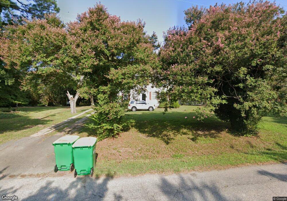
1512 Greate Rd Gloucester Point, VA 23062
Estimated Value: $409,000 - $460,000
4
Beds
2
Baths
2,302
Sq Ft
$187/Sq Ft
Est. Value
About This Home
This home is located at 1512 Greate Rd, Gloucester Point, VA 23062 and is currently estimated at $431,333, approximately $187 per square foot. 1512 Greate Rd is a home with nearby schools including Achilles Elementary School, Page Middle School, and Gloucester High School.
Ownership History
Date
Name
Owned For
Owner Type
Purchase Details
Closed on
Jul 10, 2018
Sold by
Economic Development Authority Of Glouce
Bought by
Carrillo And Sons Llc
Current Estimated Value
Home Financials for this Owner
Home Financials are based on the most recent Mortgage that was taken out on this home.
Original Mortgage
$188,000
Outstanding Balance
$162,589
Interest Rate
4.5%
Mortgage Type
Credit Line Revolving
Estimated Equity
$268,745
Purchase Details
Closed on
Aug 14, 2008
Sold by
Croft Sherril M and Croft Glen S
Bought by
Econmic Development Authority Of Glouces
Create a Home Valuation Report for This Property
The Home Valuation Report is an in-depth analysis detailing your home's value as well as a comparison with similar homes in the area
Home Values in the Area
Average Home Value in this Area
Purchase History
| Date | Buyer | Sale Price | Title Company |
|---|---|---|---|
| Carrillo And Sons Llc | $30,485,000 | Attorney | |
| Econmic Development Authority Of Glouces | $310,000 | None Available |
Source: Public Records
Mortgage History
| Date | Status | Borrower | Loan Amount |
|---|---|---|---|
| Open | Carrillo And Sons Llc | $188,000 |
Source: Public Records
Tax History
| Year | Tax Paid | Tax Assessment Tax Assessment Total Assessment is a certain percentage of the fair market value that is determined by local assessors to be the total taxable value of land and additions on the property. | Land | Improvement |
|---|---|---|---|---|
| 2025 | $3,131 | $323,290 | $61,970 | $261,320 |
| 2024 | $3,131 | $323,290 | $61,970 | $261,320 |
| 2023 | $1,885 | $323,290 | $61,970 | $261,320 |
| 2022 | $1,809 | $249,580 | $78,150 | $171,430 |
| 2021 | $1,735 | $249,580 | $78,150 | $171,430 |
| 2020 | $1,735 | $249,580 | $78,150 | $171,430 |
| 2019 | $1,930 | $277,740 | $118,280 | $159,460 |
| 2017 | $0 | $277,740 | $118,280 | $159,460 |
| 2016 | $0 | $291,830 | $118,280 | $173,550 |
| 2015 | -- | $349,200 | $205,000 | $144,200 |
| 2014 | -- | $349,200 | $205,000 | $144,200 |
Source: Public Records
Map
Nearby Homes
- 1399 Mercer Rd
- 7699 the Points Place Unit 1002
- 8157 O Carra Dr
- 7547 Villa Ct
- 7746 Farmwood Rd
- 7763 Jordan Rd
- Lot 2 Marshall Ln
- 8003 Sunset Dr Unit 1E
- 7971 Laura Ann Ln
- 7900 George Washington Memorial Hwy
- 8155 Billings Ct
- 230 Nelson St
- 7848 Guinea Rd
- Par A Hayes Rd
- 8335 Little England Rd
- 0000 Cove Rd
- .26+AC Cove Rd
- .51ac George Washington Memorial Hwy
- 000 George Washington Memorial Hwy
- 17 George Washington Memorial Hwy
- 0000 Ashe St
- 1530 Greate Rd
- 1509 Greate Rd
- 1517 Greate Rd
- 1501 Greate Rd
- 1467 George Washington Memorial Hwy
- 1527 Greate Rd
- 1491 Greate Rd
- 1505 George Washington Memorial Hwy
- 1540 Greate Rd
- 1535 Greate Rd
- 1546 Greate Rd
- 1453 George Washington Memorial Hwy
- 7586 Ashe St
- 1476 Greate Rd
- 1545 Greate Rd
- 1461 Tarleton Rd
- 1470 Greate Rd
- 1478 George Washington Memorial Hwy
- 1445 George Washington Memorial Hwy
Your Personal Tour Guide
Ask me questions while you tour the home.