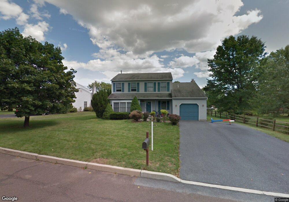
1512 Laurel Way Pottstown, PA 19464
Estimated Value: $402,000 - $495,000
3
Beds
3
Baths
2,495
Sq Ft
$184/Sq Ft
Est. Value
About This Home
This home is located at 1512 Laurel Way, Pottstown, PA 19464 and is currently estimated at $459,530, approximately $184 per square foot. 1512 Laurel Way is a home located in Montgomery County with nearby schools including Lower Pottsgrove Elementary School, Pottsgrove Middle School, and Pottsgrove Senior High School.
Ownership History
Date
Name
Owned For
Owner Type
Purchase Details
Closed on
Jul 2, 2021
Sold by
Skarbek Amy Marie and Skarbek Mark J
Bought by
Duncan Samantha Marie and Duncan Adam Taylor
Current Estimated Value
Home Financials for this Owner
Home Financials are based on the most recent Mortgage that was taken out on this home.
Original Mortgage
$236,000
Interest Rate
2.9%
Mortgage Type
New Conventional
Purchase Details
Closed on
Mar 18, 2004
Sold by
Bamer Ronald H
Bought by
Skarbeck Mark J and Skarbeck Amy M
Home Financials for this Owner
Home Financials are based on the most recent Mortgage that was taken out on this home.
Original Mortgage
$169,600
Interest Rate
5.56%
Purchase Details
Closed on
Aug 16, 1999
Sold by
Winters Craig A and Winters Cynthia C
Bought by
Bamer Ronald H
Create a Home Valuation Report for This Property
The Home Valuation Report is an in-depth analysis detailing your home's value as well as a comparison with similar homes in the area
Home Values in the Area
Average Home Value in this Area
Purchase History
| Date | Buyer | Sale Price | Title Company |
|---|---|---|---|
| Duncan Samantha Marie | $295,000 | None Available | |
| Skarbeck Mark J | $212,000 | -- | |
| Bamer Ronald H | $144,900 | -- |
Source: Public Records
Mortgage History
| Date | Status | Borrower | Loan Amount |
|---|---|---|---|
| Previous Owner | Duncan Samantha Marie | $236,000 | |
| Previous Owner | Skarbeck Mark J | $169,600 |
Source: Public Records
Tax History Compared to Growth
Tax History
| Year | Tax Paid | Tax Assessment Tax Assessment Total Assessment is a certain percentage of the fair market value that is determined by local assessors to be the total taxable value of land and additions on the property. | Land | Improvement |
|---|---|---|---|---|
| 2025 | $6,317 | $128,530 | $35,060 | $93,470 |
| 2024 | $6,317 | $128,530 | $35,060 | $93,470 |
| 2023 | $6,122 | $128,530 | $35,060 | $93,470 |
| 2022 | $6,030 | $128,530 | $35,060 | $93,470 |
| 2021 | $5,911 | $128,530 | $35,060 | $93,470 |
| 2020 | $5,857 | $128,530 | $35,060 | $93,470 |
| 2019 | $5,826 | $128,530 | $35,060 | $93,470 |
| 2018 | $5,827 | $128,530 | $35,060 | $93,470 |
| 2017 | $5,775 | $128,530 | $35,060 | $93,470 |
| 2016 | $5,726 | $128,530 | $35,060 | $93,470 |
| 2015 | $5,595 | $128,530 | $35,060 | $93,470 |
| 2014 | $5,595 | $128,530 | $35,060 | $93,470 |
Source: Public Records
Map
Nearby Homes
- 2126 Deer Ridge Dr
- 3204 Walnut Ridge Estate
- 3603 Walnut Ridge Estate
- 3605 Walnut Ridge Dr
- 1103 Walnut Ridge Dr
- 1769 Clearview Rd
- 1876 Glen Eagles Dr
- 1330 N Sanatoga Rd
- 1532 Briarwood Ln
- 1527 Cedar Hill Rd
- 277 N Pleasantview Rd
- 260 Hause Ave
- 1240 Wooded Way
- 2600 Allison Dr Unit 5
- 17 Doe Run Ln
- 1871 Linda Ln
- 2917 E High St Unit 47
- 233 Creekside Dr
- 1814 N Keim St
- 735 Oaktree Ct
- 1532 Laurel Way
- 2121 Buchert Rd
- 1560 Laurel Way
- 1947 Deer Ridge Dr
- 1535 Laurel Way
- 2129 Buchert Rd
- 2107 Buchert Rd
- 2144 Foxtail Dr
- 2146 Foxtail Dr
- 1584 Laurel Way
- 1949 Deer Ridge Dr
- 1950 Deer Ridge Dr
- 1549 Laurel Way
- 2134 Foxtail Dr
- 2101 Buchert Rd
- 2137 Buchert Rd
- 1951 Deer Ridge Dr
- 2150 Foxtail Dr
- 1952 Mallard Ct
- 2130 Foxtail Dr