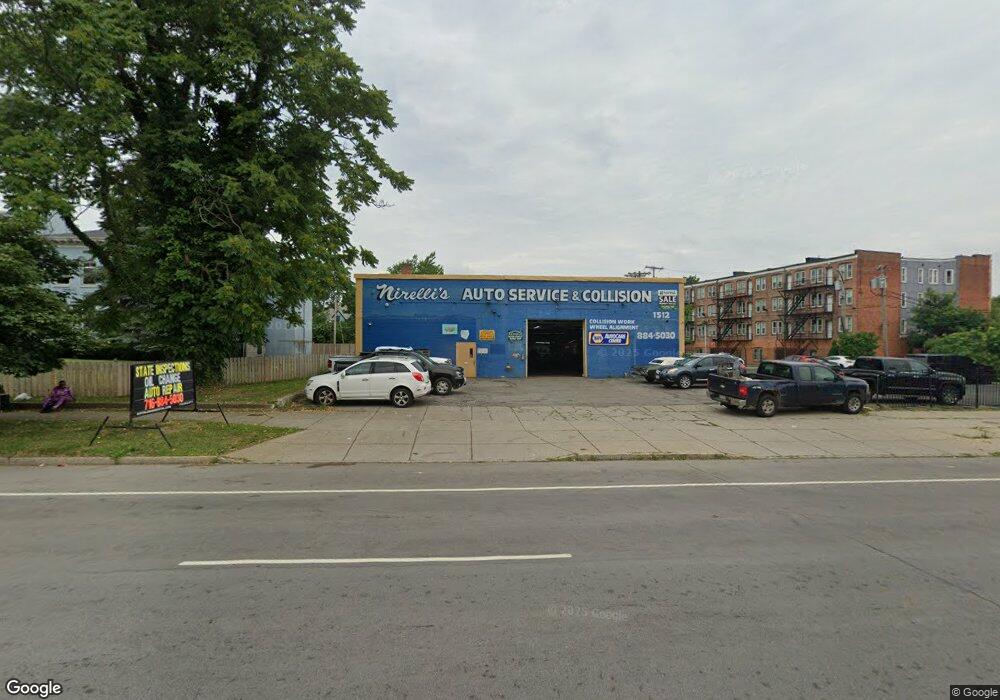
1512 Main St Buffalo, NY 14209
Elmwood-Bryant NeighborhoodEstimated Value: $930,020
--
Bed
--
Bath
18,397
Sq Ft
$51/Sq Ft
Est. Value
About This Home
This home is located at 1512 Main St, Buffalo, NY 14209 and is currently estimated at $930,020, approximately $50 per square foot. 1512 Main St is a home located in Erie County with nearby schools including Health Sciences Charter School, Catholic of Academy West Buffalo, and Nardin Academy.
Ownership History
Date
Name
Owned For
Owner Type
Purchase Details
Closed on
Jun 12, 2007
Sold by
Nirelli Neil and Goldrick Jacqueline
Bought by
Nirelli Andrew J
Current Estimated Value
Home Financials for this Owner
Home Financials are based on the most recent Mortgage that was taken out on this home.
Original Mortgage
$204,000
Outstanding Balance
$126,173
Interest Rate
6.39%
Mortgage Type
Commercial
Estimated Equity
$803,847
Create a Home Valuation Report for This Property
The Home Valuation Report is an in-depth analysis detailing your home's value as well as a comparison with similar homes in the area
Home Values in the Area
Average Home Value in this Area
Purchase History
| Date | Buyer | Sale Price | Title Company |
|---|---|---|---|
| Nirelli Andrew J | $14,400 | None Available |
Source: Public Records
Mortgage History
| Date | Status | Borrower | Loan Amount |
|---|---|---|---|
| Open | Nirelli Andrew J | $204,000 |
Source: Public Records
Tax History Compared to Growth
Tax History
| Year | Tax Paid | Tax Assessment Tax Assessment Total Assessment is a certain percentage of the fair market value that is determined by local assessors to be the total taxable value of land and additions on the property. | Land | Improvement |
|---|---|---|---|---|
| 2024 | $2,522 | $450,000 | $203,000 | $247,000 |
| 2023 | $2,280 | $450,000 | $203,000 | $247,000 |
| 2022 | $2,263 | $450,000 | $203,000 | $247,000 |
| 2021 | $2,263 | $450,000 | $203,000 | $247,000 |
| 2020 | $1,347 | $450,000 | $203,000 | $247,000 |
| 2019 | $6,730 | $175,000 | $41,300 | $133,700 |
| 2018 | $6,221 | $175,000 | $41,300 | $133,700 |
| 2017 | $1,041 | $175,000 | $41,300 | $133,700 |
| 2016 | $5,856 | $175,000 | $41,300 | $133,700 |
| 2015 | -- | $175,000 | $41,300 | $133,700 |
| 2014 | -- | $175,000 | $41,300 | $133,700 |
Source: Public Records
Map
Nearby Homes
- 461 Linwood Ave
- 433 Linwood Ave
- 531 Linwood Ave
- 50 Woodlawn Ave
- 30 Glenwood Ave
- 48 Glenwood Ave
- 1088 Delaware Ave Unit 9F
- 1088 Delaware Ave Unit 3B
- 1088 Delaware Ave Unit 8C
- 1088 Delaware Ave Unit 9I
- 1088 Delaware Ave Unit 6C
- 801 W Ferry St
- 800 W Ferry St Unit 2CC
- 800 W Ferry St Unit 3B
- 800 W Ferry St Unit 9D
- 33 Cleveland Ave
- 770 W Ferry St Unit 16A
- 770 W Ferry St Unit 24A
- 770 W Ferry St Unit 9A
- 1366 Michigan Ave
- 945 W St
- 945 W Ferry St
- 1524 Main #1 St
- 1524 Main St
- 1526 Main St
- 2 Oxford Ave
- 2 Oxford Ave
- 936 W Ferry St
- 471 Linwood Ave
- 932 W Ferry St
- 4 Oxford Ave
- 467 Linwood Ave
- 455 Linwood #1 Ave
- 455 Linwood #2 Ave
- 455 Linwood Ave Unit 2
- 455 Linwood Ave Unit 1
- 455 Linwood Ave
- 928 W Ferry St
- 447 Linwood Ave
- 443 Linwood Ave