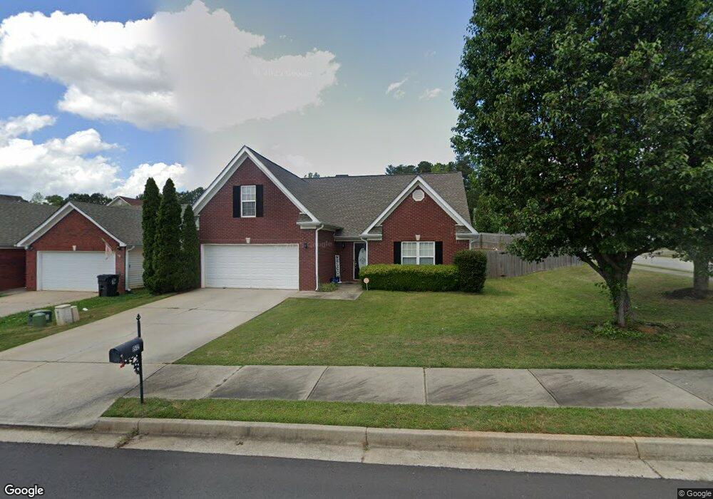
1512 Queen Elizabeth Dr Locust Grove, GA 30248
Estimated Value: $253,000 - $259,000
3
Beds
2
Baths
1,801
Sq Ft
$142/Sq Ft
Est. Value
About This Home
This home is located at 1512 Queen Elizabeth Dr, Locust Grove, GA 30248 and is currently estimated at $255,954, approximately $142 per square foot. 1512 Queen Elizabeth Dr is a home located in Henry County with nearby schools including Locust Grove Elementary School, Locust Grove Middle School, and Locust Grove High School.
Ownership History
Date
Name
Owned For
Owner Type
Purchase Details
Closed on
Jun 8, 2007
Sold by
Suntrust Mtg Inc
Bought by
Lamar James A and Lamar Jessica
Current Estimated Value
Home Financials for this Owner
Home Financials are based on the most recent Mortgage that was taken out on this home.
Original Mortgage
$125,000
Outstanding Balance
$75,826
Interest Rate
6.12%
Mortgage Type
New Conventional
Estimated Equity
$180,128
Purchase Details
Closed on
Nov 7, 2006
Sold by
Cheek Stephen M
Bought by
Suntrust Mtg Inc
Create a Home Valuation Report for This Property
The Home Valuation Report is an in-depth analysis detailing your home's value as well as a comparison with similar homes in the area
Home Values in the Area
Average Home Value in this Area
Purchase History
| Date | Buyer | Sale Price | Title Company |
|---|---|---|---|
| Lamar James A | $125,000 | -- | |
| Suntrust Mtg Inc | $130,087 | -- |
Source: Public Records
Mortgage History
| Date | Status | Borrower | Loan Amount |
|---|---|---|---|
| Open | Lamar James A | $125,000 |
Source: Public Records
Tax History Compared to Growth
Tax History
| Year | Tax Paid | Tax Assessment Tax Assessment Total Assessment is a certain percentage of the fair market value that is determined by local assessors to be the total taxable value of land and additions on the property. | Land | Improvement |
|---|---|---|---|---|
| 2025 | $3,255 | $108,200 | $16,000 | $92,200 |
| 2024 | $3,255 | $102,680 | $16,000 | $86,680 |
| 2023 | $2,419 | $104,360 | $12,800 | $91,560 |
| 2022 | $2,422 | $82,720 | $12,800 | $69,920 |
| 2021 | $2,015 | $65,360 | $12,800 | $52,560 |
| 2020 | $1,917 | $61,240 | $12,000 | $49,240 |
| 2019 | $1,783 | $54,600 | $10,000 | $44,600 |
| 2018 | $1,642 | $50,560 | $9,200 | $41,360 |
| 2016 | $1,398 | $43,960 | $8,000 | $35,960 |
| 2015 | $1,366 | $42,080 | $8,000 | $34,080 |
| 2014 | $1,126 | $35,680 | $8,000 | $27,680 |
Source: Public Records
Map
Nearby Homes
- 1604 Lady Maria Ct
- 1524 Queen Elizabeth Dr
- 1020 Saint Augustine Pkwy
- 1119 Saint Phillips Ct
- 77 Rosser Ln
- 1134 Saint Phillips Ct
- 279 Indian Creek Rd
- 50 Grove Rd
- 110 Ridge St
- 878 Jackson St
- 315 Clover Brook Dr
- 29 Indian Creek Rd
- 863 Jackson St
- 239 Ferguson Ave
- 805 Wetherford Ct
- 0 Rabbit Run Unit 10569153
- 574 Hansen Dr
- 150 Aster Ave
- Cali Plan at Cedar Ridge - Locust Grove Station
- Belfort Plan at Cedar Ridge - Locust Grove Station
- 1516 Queen Elizabeth Dr
- 1705 Queen Victoria Ct Unit 9
- 1504 Queen Elizabeth Dr
- 1520 Queen Elizabeth Dr
- 1513 Queen Elizabeth Dr
- 1509 Queen Elizabeth Dr
- 1517 Queen Elizabeth Dr
- 1709 Queen Victoria Ct
- 1704 Queen Victoria Ct
- 1608 Lady Maria Ct
- 1500 Queen Elizabeth Dr
- 1505 Queen Elizabeth Dr
- 1708 Queen Victoria Ct Unit 4
- 1708 Queen Victoria Ct
- 1612 Lady Maria Ct
- 1715 Queen Victoria Ct
- 1501 Queen Elizabeth Dr
- 1698 Lady Maria Ct
- 1712 Queen Victoria Ct
- 1716 Queen Victoria Ct