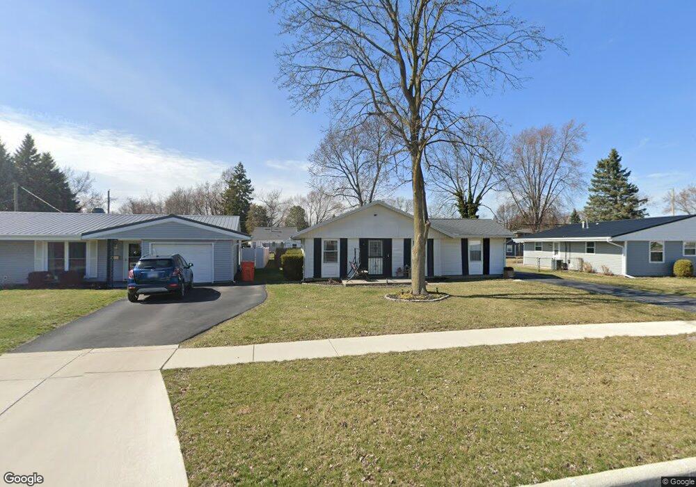
1512 State St Findlay, OH 45840
Estimated Value: $151,000 - $176,000
3
Beds
1
Bath
1,107
Sq Ft
$144/Sq Ft
Est. Value
About This Home
This home is located at 1512 State St, Findlay, OH 45840 and is currently estimated at $159,796, approximately $144 per square foot. 1512 State St is a home located in Hancock County with nearby schools including Whittier Primary School, Bigelow Hill Elementary School, and Glenwood Middle School.
Ownership History
Date
Name
Owned For
Owner Type
Purchase Details
Closed on
Aug 29, 2025
Sold by
State Street Land Trust and Ross Thomas A
Bought by
Vanderhoff Jeffrey T
Current Estimated Value
Home Financials for this Owner
Home Financials are based on the most recent Mortgage that was taken out on this home.
Original Mortgage
$15,400
Outstanding Balance
$12,389
Interest Rate
6.74%
Mortgage Type
New Conventional
Estimated Equity
$147,407
Purchase Details
Closed on
Apr 10, 2018
Sold by
Patriot Property Managers Llc
Bought by
Rose Thomas A and State Street Land Trust
Purchase Details
Closed on
Jan 8, 2018
Sold by
Ross Thomas A and Ross Maria R
Bought by
Patriot Property Managers Llc
Purchase Details
Closed on
Jul 22, 2008
Sold by
The Bank Of New York
Bought by
Ross Thomas A
Home Financials for this Owner
Home Financials are based on the most recent Mortgage that was taken out on this home.
Original Mortgage
$35,900
Interest Rate
6.39%
Mortgage Type
Purchase Money Mortgage
Purchase Details
Closed on
Jun 3, 2008
Sold by
Russell Kurt D and Russell Mindi J
Bought by
Bank Of New York and Encore Credit Receivables Trust 2005-2
Home Financials for this Owner
Home Financials are based on the most recent Mortgage that was taken out on this home.
Original Mortgage
$35,900
Interest Rate
6.39%
Mortgage Type
Purchase Money Mortgage
Purchase Details
Closed on
Feb 14, 2003
Sold by
Shaffer Timothy L
Bought by
Russell Kurt D and Russell Mindi T
Home Financials for this Owner
Home Financials are based on the most recent Mortgage that was taken out on this home.
Original Mortgage
$61,200
Interest Rate
5.94%
Mortgage Type
New Conventional
Purchase Details
Closed on
Dec 13, 1993
Bought by
Shaffer Timothy L
Purchase Details
Closed on
Jul 29, 1992
Bought by
Martin David E
Purchase Details
Closed on
Jan 20, 1989
Bought by
Martin David E and Martin Anna M
Create a Home Valuation Report for This Property
The Home Valuation Report is an in-depth analysis detailing your home's value as well as a comparison with similar homes in the area
Home Values in the Area
Average Home Value in this Area
Purchase History
| Date | Buyer | Sale Price | Title Company |
|---|---|---|---|
| Vanderhoff Jeffrey T | $154,000 | Assured Title | |
| Vanderhoff Jeffrey T | $154,000 | Assured Title | |
| Rose Thomas A | -- | None Available | |
| Patriot Property Managers Llc | -- | Assured Title Agency Inc | |
| Ross Thomas A | $44,900 | Whitman Title | |
| Bank Of New York | $39,000 | Whitman Title | |
| Russell Kurt D | $76,500 | -- | |
| Shaffer Timothy L | $58,000 | -- | |
| Martin David E | -- | -- | |
| Martin David E | $47,000 | -- |
Source: Public Records
Mortgage History
| Date | Status | Borrower | Loan Amount |
|---|---|---|---|
| Open | Vanderhoff Jeffrey T | $15,400 | |
| Closed | Vanderhoff Jeffrey T | $15,400 | |
| Open | Vanderhoff Jeffrey T | $123,200 | |
| Closed | Vanderhoff Jeffrey T | $123,200 | |
| Previous Owner | Ross Thomas A | $35,900 | |
| Previous Owner | Russell Kurt D | $61,200 |
Source: Public Records
Tax History
| Year | Tax Paid | Tax Assessment Tax Assessment Total Assessment is a certain percentage of the fair market value that is determined by local assessors to be the total taxable value of land and additions on the property. | Land | Improvement |
|---|---|---|---|---|
| 2024 | $1,492 | $40,940 | $7,300 | $33,640 |
| 2023 | $1,495 | $40,940 | $7,300 | $33,640 |
| 2022 | $1,490 | $40,940 | $7,300 | $33,640 |
| 2021 | $1,447 | $34,630 | $7,280 | $27,350 |
| 2020 | $1,446 | $34,630 | $7,280 | $27,350 |
| 2019 | $1,418 | $34,630 | $7,280 | $27,350 |
| 2018 | $1,349 | $30,220 | $6,330 | $23,890 |
| 2017 | $1,349 | $30,220 | $6,330 | $23,890 |
| 2016 | $1,339 | $30,220 | $6,330 | $23,890 |
| 2015 | $1,222 | $27,170 | $6,330 | $20,840 |
| 2014 | $1,222 | $27,170 | $6,330 | $20,840 |
| 2012 | $1,231 | $27,170 | $6,330 | $20,840 |
Source: Public Records
Map
Nearby Homes
- 1062 Vincent St
- 0 Sheridan Ave
- 1725 Parkside Place
- 1030 Sheridan Ave
- 1820 Gayle Ln
- 1142 Concord Ct
- 716 Winfield Ave
- 912 Parkside Place
- 1216 Concord Ct
- 0 E Melrose Ave
- 322 Midland Ave
- 301 Allen Ave
- 1001 Skye Dr
- 1474 Southwood Ave
- 1209 Heather Dr
- 741 Central Ave
- 2414 Aberdeen Dr
- 1125 Glen Meadow Dr
- 206 Midland Ave
- 810 Mcconnell St
Your Personal Tour Guide
Ask me questions while you tour the home.