Estimated Value: $198,000 - $247,000
3
Beds
2
Baths
1,785
Sq Ft
$125/Sq Ft
Est. Value
About This Home
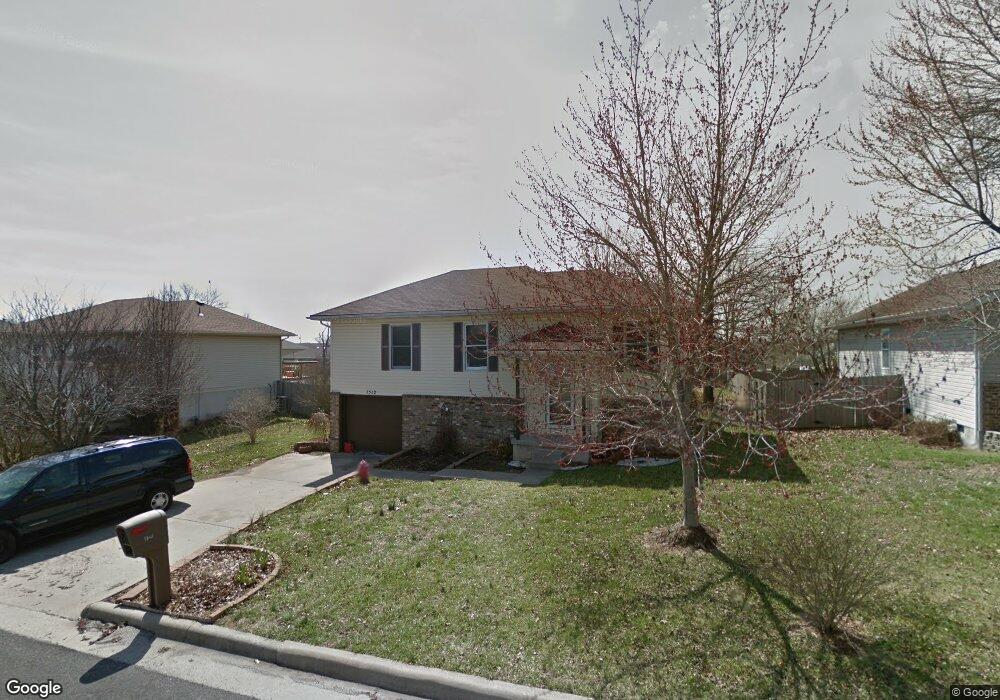
This home is located at 1512 W Daniels Ln, Ozark, MO 65721 and is currently estimated at $222,236, approximately $124 per square foot. 1512 W Daniels Ln is a home located in Christian County with nearby schools including South Elementary School, Ozark Junior High School, and Ozark Middle School.
Ownership History
Date
Name
Owned For
Owner Type
Purchase Details
Closed on
May 21, 2015
Sold by
Bradford Debra and Bradford Bart
Bought by
Battaglia Isaac and Battaglia Brittney
Current Estimated Value
Home Financials for this Owner
Home Financials are based on the most recent Mortgage that was taken out on this home.
Original Mortgage
$96,245
Outstanding Balance
$74,144
Interest Rate
3.68%
Mortgage Type
FHA
Estimated Equity
$148,092
Create a Home Valuation Report for This Property
The Home Valuation Report is an in-depth analysis detailing your home's value as well as a comparison with similar homes in the area
Home Values in the Area
Average Home Value in this Area
Purchase History
| Date | Buyer | Sale Price | Title Company |
|---|---|---|---|
| Battaglia Isaac | -- | Great American Title |
Source: Public Records
Mortgage History
| Date | Status | Borrower | Loan Amount |
|---|---|---|---|
| Open | Battaglia Isaac | $96,245 |
Source: Public Records
Tax History Compared to Growth
Tax History
| Year | Tax Paid | Tax Assessment Tax Assessment Total Assessment is a certain percentage of the fair market value that is determined by local assessors to be the total taxable value of land and additions on the property. | Land | Improvement |
|---|---|---|---|---|
| 2024 | $1,260 | $20,160 | -- | -- |
| 2023 | $1,260 | $20,160 | $0 | $0 |
| 2022 | $1,144 | $18,260 | $0 | $0 |
| 2021 | $1,107 | $18,260 | $0 | $0 |
| 2020 | $955 | $15,920 | $0 | $0 |
| 2019 | $955 | $15,920 | $0 | $0 |
| 2018 | $949 | $15,920 | $0 | $0 |
| 2017 | $949 | $15,920 | $0 | $0 |
| 2016 | $934 | $15,920 | $0 | $0 |
| 2015 | $934 | $15,920 | $15,920 | $0 |
| 2014 | $930 | $16,040 | $0 | $0 |
| 2013 | $9 | $16,040 | $0 | $0 |
| 2011 | $9 | $32,080 | $0 | $0 |
Source: Public Records
Map
Nearby Homes
- 1603 W Daniels St
- 2605 S Lotus St
- Lot 5 S 12th St
- 2304 S 12th St
- 2200 S 12th St
- 2206 S Grassmier Rd Unit Lot 34
- 1904 W Wellington Dr Unit Lot 56
- 1915 W Woodhaven Dr Unit Lot 102
- 1917 W Woodhaven Dr Unit Lot 101
- 1350 W Kirkwood St
- 1432 S Treetop Ct
- 1428 S Treetop Ct
- 803 W Ridgecrest St
- 1420 S Solaria St
- 1408-1410 S Tree Top Ct
- 1218 S 17th St
- 310 W Rainey
- 1408 Rockhill Cir
- 1217 S 14th St
- 1216 S 17th St
- 1512 W Daniels St
- 1510 W Daniels St
- 1514 W Daniels Ln
- 1513 W Daniels St
- 1515 W Daniels St
- 1508 W Daniels St
- 1511 W Daniels St
- 1601 W Daniel Ln
- 1904 S 16th St
- 1509 W Daniels Ln
- 1517 W Daniels St
- 1504 W Daniels St
- 1906 S 16th St
- 1505 W Daniels Ln
- 1905 S 16th St
- 1507 W Matthew Ct
- 1505 W Matthew Ct
- 1500 W Daniels Ln
- 1907 S 16th St
- 1908 S 16th St