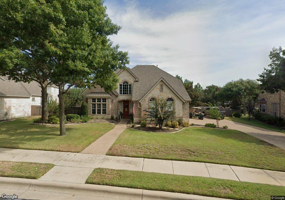
1512 Weiskopf Loop Round Rock, TX 78664
Forest Creek NeighborhoodEstimated Value: $906,708 - $950,000
5
Beds
4
Baths
4,099
Sq Ft
$226/Sq Ft
Est. Value
About This Home
This home is located at 1512 Weiskopf Loop, Round Rock, TX 78664 and is currently estimated at $926,927, approximately $226 per square foot. 1512 Weiskopf Loop is a home located in Williamson County with nearby schools including Forest Creek Elementary School, Ridgeview Middle School, and Cedar Ridge High School.
Ownership History
Date
Name
Owned For
Owner Type
Purchase Details
Closed on
May 3, 2010
Sold by
Brunke Erika A and Brunke Martin F
Bought by
Slape Cary G and Slape Christie L
Current Estimated Value
Home Financials for this Owner
Home Financials are based on the most recent Mortgage that was taken out on this home.
Original Mortgage
$290,000
Outstanding Balance
$193,229
Interest Rate
4.93%
Mortgage Type
New Conventional
Estimated Equity
$733,698
Create a Home Valuation Report for This Property
The Home Valuation Report is an in-depth analysis detailing your home's value as well as a comparison with similar homes in the area
Home Values in the Area
Average Home Value in this Area
Purchase History
| Date | Buyer | Sale Price | Title Company |
|---|---|---|---|
| Slape Cary G | -- | Landamerica Austin Title |
Source: Public Records
Mortgage History
| Date | Status | Borrower | Loan Amount |
|---|---|---|---|
| Open | Slape Cary G | $290,000 |
Source: Public Records
Tax History Compared to Growth
Tax History
| Year | Tax Paid | Tax Assessment Tax Assessment Total Assessment is a certain percentage of the fair market value that is determined by local assessors to be the total taxable value of land and additions on the property. | Land | Improvement |
|---|---|---|---|---|
| 2025 | $12,750 | $856,439 | -- | -- |
| 2024 | $12,750 | $778,581 | -- | -- |
| 2023 | $11,369 | $707,801 | $0 | $0 |
| 2022 | $12,203 | $643,455 | $0 | $0 |
| 2021 | $13,131 | $584,959 | $80,000 | $581,009 |
| 2020 | $12,005 | $531,781 | $74,209 | $457,572 |
| 2019 | $12,059 | $522,341 | $69,978 | $452,363 |
| 2018 | $11,737 | $522,878 | $69,978 | $452,900 |
| 2017 | $11,763 | $499,306 | $65,400 | $433,906 |
| 2016 | $11,761 | $478,471 | $65,400 | $413,071 |
| 2015 | $10,121 | $482,840 | $53,000 | $437,923 |
| 2014 | $10,121 | $438,945 | $0 | $0 |
Source: Public Records
Map
Nearby Homes
- 4514 Harvey Penick Dr
- 1505 Weiskopf Loop
- 2147 Hilton Head
- 2134 Hilton Head
- 131 Mount Ellen St
- 163 Mount Ellen St
- 3922 Harvey Penick Dr
- 321 Lightcliff St
- 124 Silkstone St
- 140 W Highfield St
- 216 Silkstone St
- 308 Castlefields St
- 3804 Spyglass Cove
- 3805 Pebble Ct
- 249 Tanda Ln
- 137 Paul Azinger Dr
- 209 Sage Derby Dr
- 512 Lady Swiss Ln
- 144 Holstein St
- 108 Phil Mickelson Ct
- 1510 Weiskopf Loop
- 1514 Weiskopf Loop
- 1513 Weiskopf Loop
- 1508 Weiskopf Loop
- 1516 Weiskopf Loop
- 4510 Harvey Penick Dr
- 4512 Harvey Penick Dr
- 4508 Harvey Penick Dr
- 1507 Weiskopf Loop
- 4506 Harvey Penick Dr
- 4516 Harvey Penick Dr
- 1518 Weiskopf Loop
- 1506 Weiskopf Loop
- 1525 Weiskopf Loop
- 4504 Harvey Penick Dr
- 1527 Weiskopf Loop
- 4518 Harvey Penick Dr
- 3110 Carnousty St
- 3112 Carnousty St
- 3108 Carnousty St