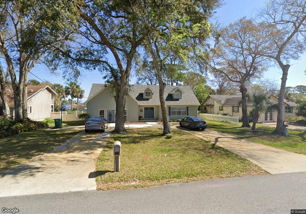
1513 Center Ave Daytona Beach, FL 32117
Estimated Value: $256,000 - $346,000
3
Beds
3
Baths
3,558
Sq Ft
$87/Sq Ft
Est. Value
About This Home
This home is located at 1513 Center Ave, Daytona Beach, FL 32117 and is currently estimated at $309,079, approximately $86 per square foot. 1513 Center Ave is a home located in Volusia County with nearby schools including Holly Hill School, Mainland High School, and Open Bible Christian Academy.
Ownership History
Date
Name
Owned For
Owner Type
Purchase Details
Closed on
Dec 15, 1992
Bought by
Cobb Frederick G and Cobb Claudia O
Current Estimated Value
Purchase Details
Closed on
Feb 15, 1992
Bought by
Cobb Frederick G and Cobb Claudia O
Purchase Details
Closed on
Dec 15, 1989
Bought by
Cobb Frederick G and Cobb Claudia O
Purchase Details
Closed on
Nov 15, 1989
Bought by
Cobb Frederick G and Cobb Claudia O
Purchase Details
Closed on
Nov 15, 1986
Bought by
Cobb Frederick G and Cobb Claudia O
Purchase Details
Closed on
Sep 15, 1980
Bought by
Cobb Frederick G and Cobb Claudia O
Create a Home Valuation Report for This Property
The Home Valuation Report is an in-depth analysis detailing your home's value as well as a comparison with similar homes in the area
Home Values in the Area
Average Home Value in this Area
Purchase History
| Date | Buyer | Sale Price | Title Company |
|---|---|---|---|
| Cobb Frederick G | $72,800 | -- | |
| Cobb Frederick G | $100 | -- | |
| Cobb Frederick G | $100 | -- | |
| Cobb Frederick G | $50,000 | -- | |
| Cobb Frederick G | $70,000 | -- | |
| Cobb Frederick G | $8,000 | -- |
Source: Public Records
Tax History Compared to Growth
Tax History
| Year | Tax Paid | Tax Assessment Tax Assessment Total Assessment is a certain percentage of the fair market value that is determined by local assessors to be the total taxable value of land and additions on the property. | Land | Improvement |
|---|---|---|---|---|
| 2025 | $1,585 | $131,741 | -- | -- |
| 2024 | $1,585 | $128,029 | -- | -- |
| 2023 | $1,585 | $124,300 | $0 | $0 |
| 2022 | $1,561 | $120,680 | $0 | $0 |
| 2021 | $1,572 | $117,165 | $0 | $0 |
| 2020 | $1,543 | $115,547 | $0 | $0 |
| 2019 | $1,493 | $112,949 | $0 | $0 |
| 2018 | $1,491 | $110,843 | $0 | $0 |
| 2017 | $1,502 | $108,563 | $0 | $0 |
| 2016 | $1,503 | $106,330 | $0 | $0 |
| 2015 | $1,552 | $105,591 | $0 | $0 |
| 2014 | $1,535 | $104,753 | $0 | $0 |
Source: Public Records
Map
Nearby Homes
- 1390 Powers Ave
- 1583 Montgomery Ave
- 1585 Tuscaloosa Ave
- 1355 Powers Ave
- 1324 Powers Ave
- 1615 Tuscaloosa Ave
- 623 Unabelle Ave
- 610 Walker St
- 548 Peacock Rd
- 946 15th St Unit 201
- 946 15th St Unit 202
- 1560 Hancock Ln
- 555 Eagle Dr
- 1226 Bender Ave
- 901 Kingsport Ct
- 1591 Revere Ln
- 1544 Franklin Cir
- 1230 Graham Ave
- 919 Royal Oak Ct
- 1000 Walker St
- 1515 Center Ave
- 1524 Decatur Ave
- 1528 Decatur Ave
- 1520 Decatur Ave
- 1530 Decatur Ave
- 1509 Center Ave
- 1516 Decatur Ave
- 1532 Decatur Ave
- 0 Decatur Ave
- 1507 Center Ave
- 1536 Decatur Ave
- 1534 Center Ave
- 1512 Decatur Ave
- 1535 Center Ave
- 1527 Decatur Ave
- 1540 Decatur Ave
- 1523 Decatur Ave
- 1536 Center Ave
- 1508 Decatur Ave
- 1519 Decatur Ave