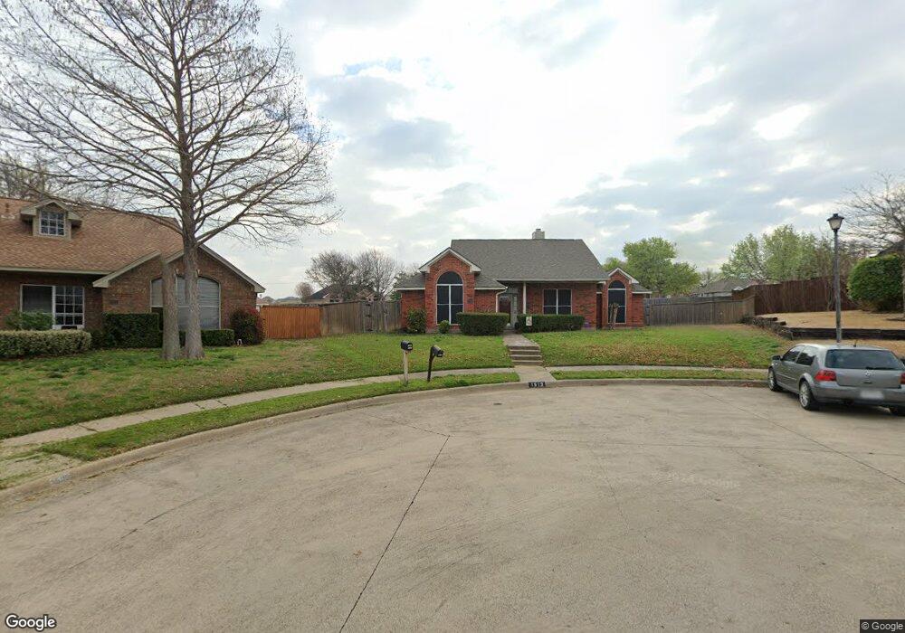
1513 Patty Cir Rowlett, TX 75089
Springfield NeighborhoodEstimated Value: $359,000 - $368,841
3
Beds
3
Baths
1,894
Sq Ft
$192/Sq Ft
Est. Value
About This Home
This home is located at 1513 Patty Cir, Rowlett, TX 75089 and is currently estimated at $364,210, approximately $192 per square foot. 1513 Patty Cir is a home located in Dallas County with nearby schools including Harmony School of Innovation - Garland, Wesleyan Christian Academy, and Garland Christian Adventist School.
Ownership History
Date
Name
Owned For
Owner Type
Purchase Details
Closed on
Oct 24, 1997
Sold by
Child Mark Powers and Child Dana Jean
Bought by
Beard Walter and Beard Cheryl
Current Estimated Value
Home Financials for this Owner
Home Financials are based on the most recent Mortgage that was taken out on this home.
Original Mortgage
$103,579
Outstanding Balance
$16,379
Interest Rate
7.27%
Mortgage Type
FHA
Estimated Equity
$347,831
Create a Home Valuation Report for This Property
The Home Valuation Report is an in-depth analysis detailing your home's value as well as a comparison with similar homes in the area
Home Values in the Area
Average Home Value in this Area
Purchase History
| Date | Buyer | Sale Price | Title Company |
|---|---|---|---|
| Beard Walter | -- | -- |
Source: Public Records
Mortgage History
| Date | Status | Borrower | Loan Amount |
|---|---|---|---|
| Open | Beard Walter | $103,579 |
Source: Public Records
Tax History Compared to Growth
Tax History
| Year | Tax Paid | Tax Assessment Tax Assessment Total Assessment is a certain percentage of the fair market value that is determined by local assessors to be the total taxable value of land and additions on the property. | Land | Improvement |
|---|---|---|---|---|
| 2025 | $5,790 | $375,680 | $88,000 | $287,680 |
| 2024 | $5,790 | $375,680 | $88,000 | $287,680 |
| 2023 | $5,790 | $373,020 | $88,000 | $285,020 |
| 2022 | $7,828 | $323,070 | $88,000 | $235,070 |
| 2021 | $6,021 | $230,000 | $52,800 | $177,200 |
| 2020 | $6,075 | $249,930 | $0 | $0 |
| 2019 | $6,666 | $231,960 | $44,000 | $187,960 |
| 2018 | $6,713 | $231,960 | $44,000 | $187,960 |
| 2017 | $6,052 | $208,550 | $44,000 | $164,550 |
| 2016 | $5,349 | $184,330 | $33,000 | $151,330 |
| 2015 | $3,206 | $144,700 | $30,000 | $114,700 |
| 2014 | $3,206 | $133,500 | $30,000 | $103,500 |
Source: Public Records
Map
Nearby Homes
- 1501 Patty Cir
- 5909 Brookline Dr
- 5806 Beacon Dr
- 2221 Petunia Ln
- 2314 Marigold Dr
- 5702 Antioch Dr
- 6518 Teresa Ln
- 6510 White Oak Dr
- 6718 Livingstone St
- 2001 Maggis Meadow Ln
- 7013 Tremont Ln
- 6110 Tacoma St
- 1709 Northampton Dr
- 6913 Brandford Rd
- 6306 Debbie Cir
- 6617 Stamps St
- 7005 Buckhorn Dr
- 6317 Locust St
- 6826 Conestoga Dr
- 6407 Redwood Ln
- 1514 Patty Cir
- 1509 Patty Cir
- 1510 Patty Cir
- 1505 Patty Cir
- 1506 Patty Cir
- 6026 Brookline Dr
- 6110 Dexham Rd
- 1517 Columbus Dr
- 6106 Dexham Rd
- 1521 Columbus Dr
- 1513 Columbus Dr
- 6114 Dexham Rd
- 6202 Kittyhawk Dr
- 1502 Patty Cir
- 1509 Columbus Dr
- 6022 Brookline Dr
- 1505 Columbus Dr
- 6005 Brookline Dr
- 6206 Kittyhawk Dr
- 1501 Columbus Dr