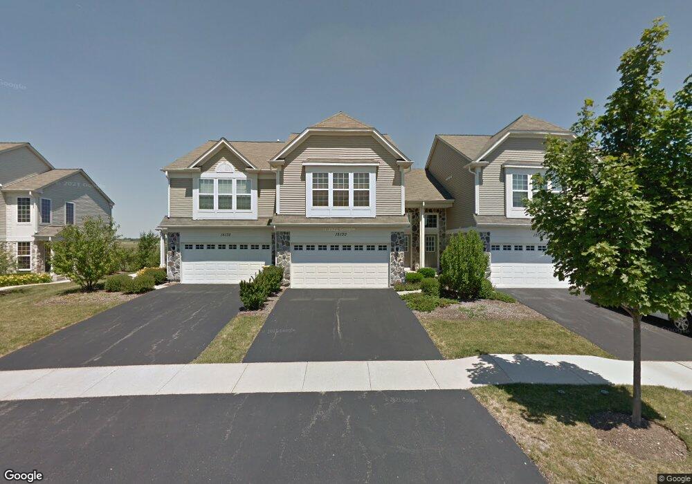
15130 W Pinewood Rd Unit 952 Lockport, IL 60441
South Homer Glen NeighborhoodEstimated Value: $297,318 - $354,000
--
Bed
--
Bath
1,517
Sq Ft
$215/Sq Ft
Est. Value
About This Home
This home is located at 15130 W Pinewood Rd Unit 952, Lockport, IL 60441 and is currently estimated at $325,580, approximately $214 per square foot. 15130 W Pinewood Rd Unit 952 is a home located in Will County with nearby schools including William J. Butler, Hadley Middle School, and Homer Jr High School.
Ownership History
Date
Name
Owned For
Owner Type
Purchase Details
Closed on
Aug 13, 2007
Sold by
Pulte Home Corp
Bought by
Stearns Michael J
Current Estimated Value
Home Financials for this Owner
Home Financials are based on the most recent Mortgage that was taken out on this home.
Original Mortgage
$206,398
Outstanding Balance
$131,414
Interest Rate
6.77%
Mortgage Type
Purchase Money Mortgage
Estimated Equity
$194,166
Create a Home Valuation Report for This Property
The Home Valuation Report is an in-depth analysis detailing your home's value as well as a comparison with similar homes in the area
Home Values in the Area
Average Home Value in this Area
Purchase History
| Date | Buyer | Sale Price | Title Company |
|---|---|---|---|
| Stearns Michael J | $206,500 | Pulte Midwest Title South |
Source: Public Records
Mortgage History
| Date | Status | Borrower | Loan Amount |
|---|---|---|---|
| Open | Stearns Michael J | $206,398 |
Source: Public Records
Tax History Compared to Growth
Tax History
| Year | Tax Paid | Tax Assessment Tax Assessment Total Assessment is a certain percentage of the fair market value that is determined by local assessors to be the total taxable value of land and additions on the property. | Land | Improvement |
|---|---|---|---|---|
| 2024 | $5,843 | $75,096 | $12,038 | $63,058 |
| 2023 | $5,843 | $68,071 | $10,912 | $57,159 |
| 2022 | $5,389 | $63,559 | $10,189 | $53,370 |
| 2021 | $5,129 | $60,217 | $9,653 | $50,564 |
| 2020 | $5,097 | $58,002 | $9,298 | $48,704 |
| 2019 | $4,936 | $55,798 | $8,945 | $46,853 |
| 2018 | $4,789 | $53,809 | $8,842 | $44,967 |
| 2017 | $4,697 | $52,302 | $8,594 | $43,708 |
| 2016 | $4,583 | $50,557 | $8,307 | $42,250 |
| 2015 | $4,451 | $48,659 | $7,995 | $40,664 |
| 2014 | $4,451 | $47,654 | $7,830 | $39,824 |
| 2013 | $4,451 | $47,654 | $7,830 | $39,824 |
Source: Public Records
Map
Nearby Homes
- 15442 W Amelia Cir
- 16663 S Windsor Ln Unit T1644
- 15326 W Harvest Ln
- 16646 S Sun Meadow Dr
- Vacant Lot W 167th St
- 17349 Sprucewood Dr
- 17354 Victoria Ln
- 17355 S Sprucewood Dr
- 17355 Sprucewood Dr
- 17356 S Sprucewood Dr
- 17358 S Sprucewood Dr
- 17362 Sprucewood Dr
- 17362 S Sprucewood Dr
- Lyndale Plan at Sadie Ridge
- Dunbar Plan at Sadie Ridge
- Brighton Plan at Sadie Ridge - The Townes at Sadie
- Barclay Plan at Sadie Ridge
- Essex Plan at Sadie Ridge
- Easton Plan at Sadie Ridge
- Hudson Plan at Sadie Ridge
- 15132 Pinewood Rd Unit 951
- 15126 W Pinewood Rd
- 15130 W Pinewood Rd Unit 95-2
- 15126 Pinewood Rd Unit 954
- 15128 Pinewood Rd Unit 953
- 15120 W Pinewood Rd Unit 94-1
- 15134 Pinewood Rd Unit 964
- 15118 W Pinewood Rd Unit 94-2
- 15136 Pinewood Rd Unit 963
- 15138 Pinewood Rd Unit 962
- 15120 Pinewood Rd Unit 944
- 15116 Pinewood Rd
- 15118 Pinewood Rd Unit 942
- 15120 Pinewood Rd Unit 94-1
- 15125 Pinewood Rd Unit 1221
- 15127 Pinewood Rd Unit 1222
- 15140 Pinewood Rd Unit 961
- 15131 Pinewood Rd Unit 1224
- 15114 Pinewood Rd Unit 944
- 15114 Pinewood Rd Unit 4