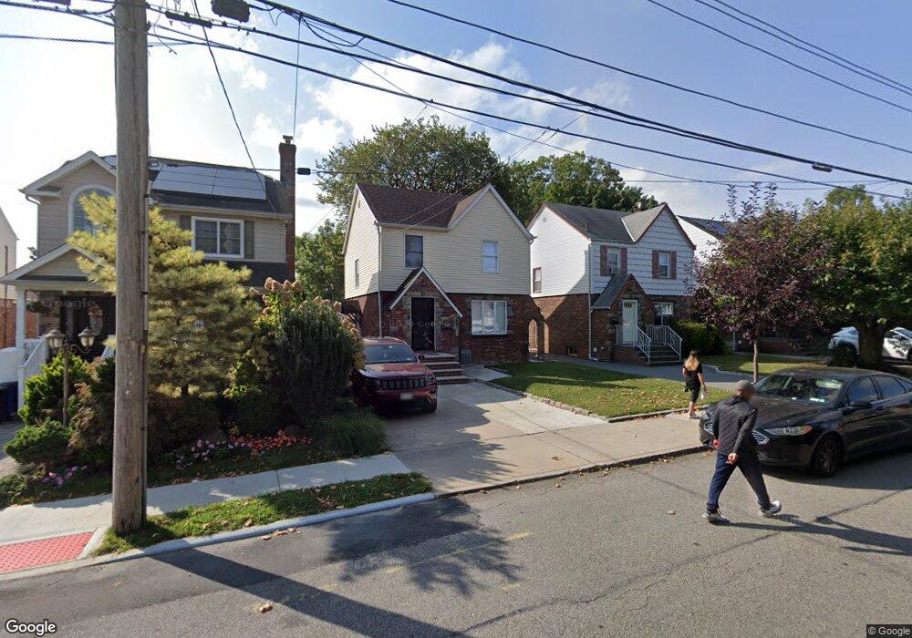
15132 10th Ave Whitestone, NY 11357
Whitestone NeighborhoodEstimated Value: $1,029,000 - $1,098,000
Studio
--
Bath
1,730
Sq Ft
$618/Sq Ft
Est. Value
About This Home
This home is located at 15132 10th Ave, Whitestone, NY 11357 and is currently estimated at $1,069,121, approximately $617 per square foot. 15132 10th Ave is a home located in Queens County with nearby schools including P.S. 193 - Alfred J. Kennedy, J.H.S. 194 William Carr, and Bayside High School.
Ownership History
Date
Name
Owned For
Owner Type
Purchase Details
Closed on
Jul 22, 2020
Sold by
Kaloudis Evangelia
Bought by
Kaloudis Evangelia and Kaloudis Nikolas
Current Estimated Value
Home Financials for this Owner
Home Financials are based on the most recent Mortgage that was taken out on this home.
Original Mortgage
$253,100
Outstanding Balance
$224,432
Interest Rate
3.1%
Mortgage Type
Unknown
Estimated Equity
$844,689
Purchase Details
Closed on
Mar 6, 1998
Sold by
Schlenker Donna S and Schlenker Ralph
Bought by
Kaloudis Chris and Kaloudis Evangelia
Home Financials for this Owner
Home Financials are based on the most recent Mortgage that was taken out on this home.
Original Mortgage
$199,500
Interest Rate
6.89%
Create a Home Valuation Report for This Property
The Home Valuation Report is an in-depth analysis detailing your home's value as well as a comparison with similar homes in the area
Home Values in the Area
Average Home Value in this Area
Purchase History
| Date | Buyer | Sale Price | Title Company |
|---|---|---|---|
| Kaloudis Evangelia | -- | -- | |
| Kaloudis Chris | $307,000 | First American Title Ins Co |
Source: Public Records
Mortgage History
| Date | Status | Borrower | Loan Amount |
|---|---|---|---|
| Open | Kaloudis Evangelia | $253,100 | |
| Closed | Kaloudis Chris | $199,500 |
Source: Public Records
Tax History
| Year | Tax Paid | Tax Assessment Tax Assessment Total Assessment is a certain percentage of the fair market value that is determined by local assessors to be the total taxable value of land and additions on the property. | Land | Improvement |
|---|---|---|---|---|
| 2025 | $9,607 | $50,701 | $14,152 | $36,549 |
| 2024 | $9,607 | $47,832 | $13,129 | $34,703 |
| 2023 | $9,064 | $45,126 | $13,153 | $31,973 |
| 2022 | $9,009 | $64,200 | $17,820 | $46,380 |
| 2021 | $9,425 | $64,620 | $17,820 | $46,800 |
| 2020 | $8,943 | $65,700 | $17,820 | $47,880 |
| 2019 | $8,045 | $61,260 | $17,820 | $43,440 |
| 2018 | $7,368 | $37,605 | $12,648 | $24,957 |
| 2017 | $7,366 | $37,605 | $13,424 | $24,181 |
| 2016 | $7,151 | $37,605 | $13,424 | $24,181 |
| 2015 | $4,059 | $35,209 | $15,349 | $19,860 |
| 2014 | $4,059 | $33,217 | $16,684 | $16,533 |
Source: Public Records
Map
Nearby Homes
- 7-22 151st Place
- 806 Clintonville St
- 12-10 151st Place
- 151-60 7th Ave
- 706 Leggett Place
- 150-30 12th Ave Unit 2B
- 628 151st St
- 150-12 12 Ave
- 1228 150th St
- 150-18 12th Rd
- 14915 11th Ave
- 150-50 6th Ave
- 14910 7th Ave
- 150-55 14th Rd
- 150-129 Powells Cove Blvd
- 150-26 Sullivan Dr
- 150123 Powells Cove Blvd Unit 150-12
- 154-25 13th Ave
- 15424 13th Ave
- 149-16 14th Ave
- 15128 10th Ave
- 15136 10th Ave
- 151-36 10th Ave
- 15140 10th Ave
- 151-40 10th Ave
- 15126 10th Ave
- 151-26 10th Ave
- 15142 10th Ave
- 15122 10th Ave
- 15146 10th Ave
- 15135 11th Ave
- 15131 11th Ave
- 15118 10th Ave
- 15137 11th Ave
- 151-35 11th Ave
- 15127 11th Ave
- 151-31 11th Ave
- 15131 10th Ave
- 15141 11th Ave
- 15150 10th Ave
Your Personal Tour Guide
Ask me questions while you tour the home.