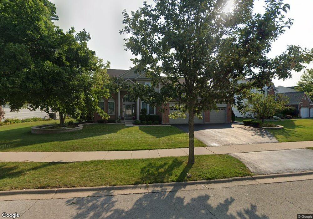
15138 Austin Dr Lockport, IL 60441
South Homer Glen NeighborhoodEstimated Value: $546,000 - $582,000
4
Beds
4
Baths
2,600
Sq Ft
$214/Sq Ft
Est. Value
About This Home
This home is located at 15138 Austin Dr, Lockport, IL 60441 and is currently estimated at $556,107, approximately $213 per square foot. 15138 Austin Dr is a home located in Will County with nearby schools including William J. Butler, Hadley Middle School, and Homer Jr High School.
Ownership History
Date
Name
Owned For
Owner Type
Purchase Details
Closed on
Mar 10, 2017
Sold by
Rucker Edward and Rucker Geneva
Bought by
Harnois James J and Kata Katarzyna E
Current Estimated Value
Home Financials for this Owner
Home Financials are based on the most recent Mortgage that was taken out on this home.
Original Mortgage
$285,600
Outstanding Balance
$237,360
Interest Rate
4.25%
Mortgage Type
New Conventional
Estimated Equity
$318,747
Purchase Details
Closed on
Feb 14, 2007
Sold by
Pulte Home Corp
Bought by
Rucker Edward and Rucker Geneva
Home Financials for this Owner
Home Financials are based on the most recent Mortgage that was taken out on this home.
Original Mortgage
$275,775
Interest Rate
6.27%
Mortgage Type
Purchase Money Mortgage
Create a Home Valuation Report for This Property
The Home Valuation Report is an in-depth analysis detailing your home's value as well as a comparison with similar homes in the area
Home Values in the Area
Average Home Value in this Area
Purchase History
| Date | Buyer | Sale Price | Title Company |
|---|---|---|---|
| Harnois James J | $357,000 | Fidelity National Title | |
| Rucker Edward | $378,500 | Pulte Midwest Title South |
Source: Public Records
Mortgage History
| Date | Status | Borrower | Loan Amount |
|---|---|---|---|
| Open | Harnois James J | $285,600 | |
| Previous Owner | Rucker Edward | $275,775 |
Source: Public Records
Tax History Compared to Growth
Tax History
| Year | Tax Paid | Tax Assessment Tax Assessment Total Assessment is a certain percentage of the fair market value that is determined by local assessors to be the total taxable value of land and additions on the property. | Land | Improvement |
|---|---|---|---|---|
| 2024 | $12,875 | $155,842 | $24,074 | $131,768 |
| 2023 | $12,875 | $141,264 | $21,822 | $119,442 |
| 2022 | $11,787 | $131,899 | $20,375 | $111,524 |
| 2021 | $11,254 | $124,964 | $19,304 | $105,660 |
| 2020 | $11,210 | $120,366 | $18,594 | $101,772 |
| 2019 | $10,884 | $115,792 | $17,887 | $97,905 |
| 2018 | $10,582 | $111,645 | $17,682 | $93,963 |
| 2017 | $10,399 | $108,520 | $17,187 | $91,333 |
| 2016 | $10,173 | $104,901 | $16,614 | $88,287 |
| 2015 | $9,897 | $100,963 | $15,990 | $84,973 |
| 2014 | $9,897 | $98,877 | $15,660 | $83,217 |
| 2013 | $9,897 | $98,877 | $15,660 | $83,217 |
Source: Public Records
Map
Nearby Homes
- 16860 S Ivy Ln
- 15053 Sagebrush Ln Unit 1254
- 16947 S Timber Dr
- 17355 Sprucewood Dr
- 17356 Sprucewood Dr
- 17358 Sprucewood Dr
- 17362 Sprucewood Dr
- 16663 S Windsor Ln Unit T1644
- 17430 Victoria Ln
- 16609 S Silo Bend Dr
- 15456 Amelia Cir
- Essex Plan at Sadie Ridge
- Campbell Plan at Sadie Ridge - The Townes at Sadie
- Braeden Plan at Sadie Ridge - The Townes at Sadie
- Brighton Plan at Sadie Ridge - The Townes at Sadie
- Danbury II Plan at Sadie Ridge - The Townes at Sadie
- Hudson Plan at Sadie Ridge
- Dunbar Plan at Sadie Ridge
- Easton Plan at Sadie Ridge
- Lyndale Plan at Sadie Ridge
- 15142 Austin Dr
- 15134 Austin Dr
- 15134 W Austin Dr
- 15128 Austin Dr
- 15144 W Austin Dr
- 15144 Austin Dr
- 15117 Albright Dr
- 15125 Albright Dr
- 15118 Austin Dr
- 15147 Austin Dr
- 15141 Austin Dr
- 15153 Austin Dr
- 15111 Albright Dr
- 15165 Austin Dr
- 15110 Austin Dr
- 15133 Austin Dr
- 15103 Albright Dr
- 15121 Austin Dr
- 15104 Austin Dr
- 15104 W Austin Dr