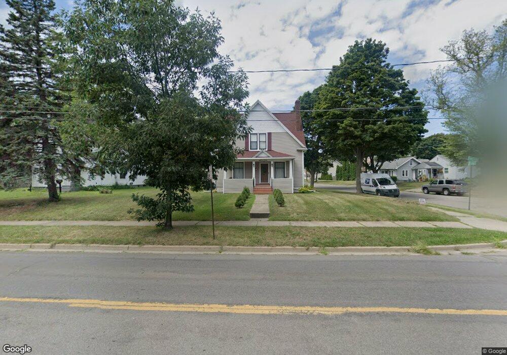
1514 Lansing Ave Jackson, MI 49202
Lansing Avenue Heights NeighborhoodEstimated Value: $144,000 - $164,000
2
Beds
2
Baths
1,606
Sq Ft
$95/Sq Ft
Est. Value
About This Home
This home is located at 1514 Lansing Ave, Jackson, MI 49202 and is currently estimated at $152,380, approximately $94 per square foot. 1514 Lansing Ave is a home located in Jackson County with nearby schools including Hunt Elementary School, Middle School at Parkside, and Jackson High School.
Ownership History
Date
Name
Owned For
Owner Type
Purchase Details
Closed on
Aug 31, 2005
Sold by
Mueller Cassandra
Bought by
Diffenbaugh Tina S and Diffenbaugh Tina Susan
Current Estimated Value
Home Financials for this Owner
Home Financials are based on the most recent Mortgage that was taken out on this home.
Original Mortgage
$36,000
Outstanding Balance
$21,206
Interest Rate
7.5%
Mortgage Type
Fannie Mae Freddie Mac
Estimated Equity
$131,174
Create a Home Valuation Report for This Property
The Home Valuation Report is an in-depth analysis detailing your home's value as well as a comparison with similar homes in the area
Home Values in the Area
Average Home Value in this Area
Purchase History
| Date | Buyer | Sale Price | Title Company |
|---|---|---|---|
| Diffenbaugh Tina S | $45,000 | Legacy Title Agency |
Source: Public Records
Mortgage History
| Date | Status | Borrower | Loan Amount |
|---|---|---|---|
| Open | Diffenbaugh Tina S | $36,000 |
Source: Public Records
Tax History Compared to Growth
Tax History
| Year | Tax Paid | Tax Assessment Tax Assessment Total Assessment is a certain percentage of the fair market value that is determined by local assessors to be the total taxable value of land and additions on the property. | Land | Improvement |
|---|---|---|---|---|
| 2025 | $1,672 | $67,500 | $0 | $0 |
| 2024 | $1,366 | $66,900 | $0 | $0 |
| 2023 | $1,314 | $65,700 | $0 | $0 |
| 2022 | $1,533 | $50,600 | $0 | $0 |
| 2021 | $1,529 | $41,950 | $0 | $0 |
| 2020 | $1,514 | $41,800 | $0 | $0 |
| 2019 | $1,468 | $33,400 | $0 | $0 |
| 2018 | $1,386 | $31,500 | $0 | $0 |
| 2017 | $1,203 | $26,450 | $0 | $0 |
| 2016 | $976 | $29,900 | $29,900 | $0 |
| 2015 | $1,116 | $26,450 | $26,450 | $0 |
| 2014 | $1,116 | $26,100 | $26,100 | $0 |
| 2013 | -- | $26,100 | $26,100 | $0 |
Source: Public Records
Map
Nearby Homes
- 550 Royal Dr
- 636 Madison St
- 1105 Clinton Rd
- 737 Royal Dr
- 1104 N Blackstone St
- 1015 N Blackstone St
- 951 W Monroe St St
- 910 Backus St
- 902 Backus St
- 828 Backus St
- 0 Brookley Ave
- 836 Lincoln St
- 819 N West Ave
- 1115 Cooper St
- 120 Austin Ave
- 623 Steward Ave
- 0 Shirley Dr Unit 24064060
- 613 Backus St
- 611 Steward Ave
- 313 Taylor St
- 1510 Lansing Ave
- 509 Saint Clair Ave
- 509 St Clair
- 511 St Clair
- 504 Saint Clair Ave
- 1506 Lansing Ave
- 0 Lansing Unit 20023146
- 0 Lansing Unit 20028020
- 0 Lansing Ave Unit V/L 201601053
- 0 Lansing Ave Unit 201600552
- 0 Lansing Unit 201600806
- 0 Lansing Ave Unit 55021037668
- 1600 Lansing Ave
- 0 St Clair St Unit 20458616
- 0 St Clair St Unit M21032798
- 0 St Clair St Unit 20421910
- 511 Saint Clair Ave
- 515 Saint Clair Ave
- 1511 Lansing Ave
- 1511 Lansing Ave