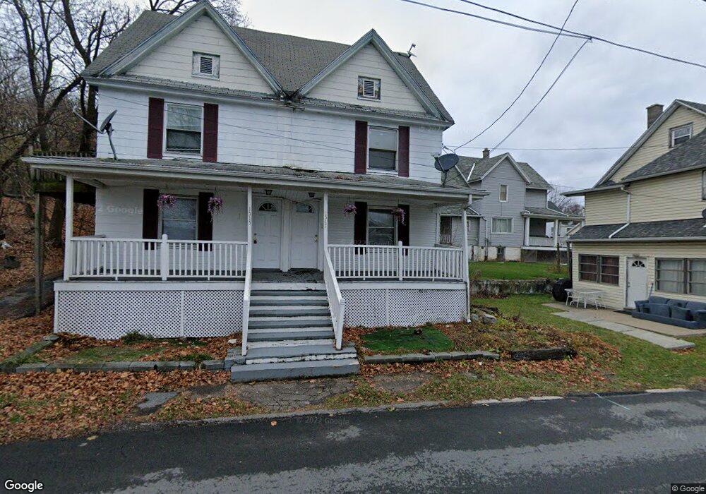
1515 Brick Ave Unit 1517 Scranton, PA 18508
Tripp's Park NeighborhoodEstimated Value: $132,088 - $261,000
--
Bed
--
Bath
--
Sq Ft
0.92
Acres
About This Home
This home is located at 1515 Brick Ave Unit 1517, Scranton, PA 18508 and is currently estimated at $174,522. 1515 Brick Ave Unit 1517 is a home located in Lackawanna County with nearby schools including Neil Armstrong Elementary School, Pinchbeck Elementary School, and Pemberton Elementary School.
Ownership History
Date
Name
Owned For
Owner Type
Purchase Details
Closed on
May 9, 2024
Sold by
Codrington Karena
Bought by
Gral Management Property Inc
Current Estimated Value
Purchase Details
Closed on
May 15, 2006
Sold by
Watkins Jack
Bought by
Tafoya Oswaldo Rios and Tafoya Maria T
Home Financials for this Owner
Home Financials are based on the most recent Mortgage that was taken out on this home.
Original Mortgage
$15,960
Interest Rate
6.53%
Mortgage Type
Stand Alone Second
Create a Home Valuation Report for This Property
The Home Valuation Report is an in-depth analysis detailing your home's value as well as a comparison with similar homes in the area
Home Values in the Area
Average Home Value in this Area
Purchase History
| Date | Buyer | Sale Price | Title Company |
|---|---|---|---|
| Gral Management Property Inc | $115,000 | None Listed On Document | |
| Tafoya Oswaldo Rios | $79,800 | None Available |
Source: Public Records
Mortgage History
| Date | Status | Borrower | Loan Amount |
|---|---|---|---|
| Previous Owner | Tafoya Oswaldo Rios | $15,960 | |
| Previous Owner | Tafoya Oswaldo Rios | $63,840 |
Source: Public Records
Tax History Compared to Growth
Tax History
| Year | Tax Paid | Tax Assessment Tax Assessment Total Assessment is a certain percentage of the fair market value that is determined by local assessors to be the total taxable value of land and additions on the property. | Land | Improvement |
|---|---|---|---|---|
| 2025 | $2,663 | $8,051 | $1,651 | $6,400 |
| 2024 | $2,438 | $8,051 | $1,651 | $6,400 |
| 2023 | $2,438 | $8,051 | $1,651 | $6,400 |
| 2022 | $2,385 | $8,051 | $1,651 | $6,400 |
| 2021 | $2,385 | $8,051 | $1,651 | $6,400 |
| 2020 | $2,342 | $8,051 | $1,651 | $6,400 |
| 2019 | $2,204 | $8,051 | $1,651 | $6,400 |
| 2018 | $2,204 | $8,051 | $1,651 | $6,400 |
| 2017 | $2,166 | $8,051 | $1,651 | $6,400 |
| 2016 | $0 | $8,051 | $1,651 | $6,400 |
| 2015 | $1,639 | $8,051 | $1,651 | $6,400 |
| 2014 | -- | $8,051 | $1,651 | $6,400 |
Source: Public Records
Map
Nearby Homes
- 1515-1517 Brick Ave
- 401 Putnam St
- 1729 Wayne Ave
- 231 Putnam St
- 1711 N Sumner Ave
- 1402 N Rebecca Ave
- 117 Ferdinand St
- 1819 Clearview St Unit L 109
- 1436 Church Ave
- 1810 Cusick Ave
- 314 W Market St
- 0 Philo St Unit GSBSC4763
- 1430 N Main Ave
- 18 Green Ridge St
- 1235 N Sumner Ave
- 337 Spring St
- 440 Leggett St
- 1311 Short Ave
- 116 Little Spike Way Unit L 40
- 332 Spring St
- 1517 Brick Ave
- 405 Putnam St
- 407 Putnam St Unit 409
- 411 Putnam St Unit 413
- 351 Putnam St
- 349 Putnam St
- 370 Ferdinand St
- 347 Putnam St
- 423 Putnam St
- 366 Ferdinand St
- 348 Putnam St
- 410 Putnam St
- 416 Putnam St Unit 41
- 425 Putnam St
- 345 Putnam St
- 362 Ferdinand St Unit 364
- 362 Ferdinand St
- 364 Ferdinand St
- 373 Ferdinand St
- 420 Putnam St