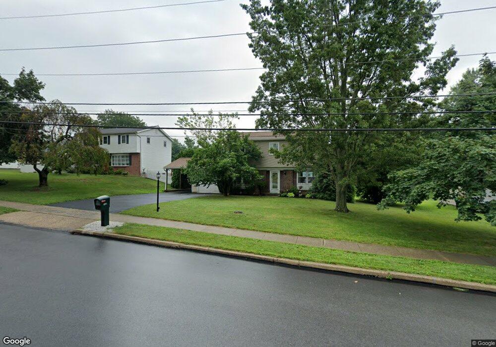
1515 Green Lane Rd Lansdale, PA 19446
Estimated Value: $400,000 - $515,777
4
Beds
2
Baths
1,746
Sq Ft
$262/Sq Ft
Est. Value
About This Home
This home is located at 1515 Green Lane Rd, Lansdale, PA 19446 and is currently estimated at $457,944, approximately $262 per square foot. 1515 Green Lane Rd is a home located in Montgomery County with nearby schools including Gwynedd Square Elementary School, Pennfield Middle School, and North Penn Senior High School.
Ownership History
Date
Name
Owned For
Owner Type
Purchase Details
Closed on
Jun 4, 2024
Sold by
Ragan Richard C and Ragan Jean
Bought by
Ragan Jean
Current Estimated Value
Purchase Details
Closed on
Apr 15, 2009
Sold by
Bank Of New York Mellon
Bought by
Ragan Richard C and Alic Jean
Home Financials for this Owner
Home Financials are based on the most recent Mortgage that was taken out on this home.
Original Mortgage
$227,450
Interest Rate
4.85%
Purchase Details
Closed on
Nov 25, 2008
Sold by
Lennon Amy and Lennon Michael
Bought by
Bank Of Ny Tr
Purchase Details
Closed on
Aug 30, 2005
Sold by
Brand Franklin L and Brand Suzanne R
Bought by
Lennon Michael and Lennon Amy
Home Financials for this Owner
Home Financials are based on the most recent Mortgage that was taken out on this home.
Original Mortgage
$236,800
Interest Rate
5.84%
Create a Home Valuation Report for This Property
The Home Valuation Report is an in-depth analysis detailing your home's value as well as a comparison with similar homes in the area
Home Values in the Area
Average Home Value in this Area
Purchase History
| Date | Buyer | Sale Price | Title Company |
|---|---|---|---|
| Ragan Jean | -- | None Listed On Document | |
| Ragan Richard C | $231,647 | None Available | |
| Bank Of Ny Tr | $1,470 | None Available | |
| Lennon Michael | -- | Landamerica |
Source: Public Records
Mortgage History
| Date | Status | Borrower | Loan Amount |
|---|---|---|---|
| Previous Owner | Ragan Richard C | $227,450 | |
| Previous Owner | Lennon Michael | $236,800 |
Source: Public Records
Tax History Compared to Growth
Tax History
| Year | Tax Paid | Tax Assessment Tax Assessment Total Assessment is a certain percentage of the fair market value that is determined by local assessors to be the total taxable value of land and additions on the property. | Land | Improvement |
|---|---|---|---|---|
| 2025 | $5,783 | $142,760 | $53,790 | $88,970 |
| 2024 | $5,783 | $142,760 | $53,790 | $88,970 |
| 2023 | $5,538 | $142,760 | $53,790 | $88,970 |
| 2022 | $5,198 | $142,760 | $53,790 | $88,970 |
| 2021 | $5,047 | $142,760 | $53,790 | $88,970 |
| 2020 | $4,819 | $142,760 | $53,790 | $88,970 |
| 2019 | $4,735 | $142,760 | $53,790 | $88,970 |
| 2018 | $922 | $142,760 | $53,790 | $88,970 |
| 2017 | $4,546 | $142,760 | $53,790 | $88,970 |
| 2016 | $4,491 | $142,760 | $53,790 | $88,970 |
| 2015 | $4,303 | $142,760 | $53,790 | $88,970 |
| 2014 | $4,303 | $142,760 | $53,790 | $88,970 |
Source: Public Records
Map
Nearby Homes
- 1348 Michael Way
- 109 Durham Ct
- 103 Newport Ct
- 705 Continental Dr
- 502 Clarella Ct
- 10 Bentwood Ct W
- 25 Chestnut Ct E
- 592 Blackmoor Ct
- 102 Ridgewood Way
- 1825 Flintlock Cir
- 11 Elder Ct
- 113 Clemens Ct
- 2212 Mulberry Ct
- 510 Greenwood Ct
- 1653 Bridle Path Dr
- 2415 Hillock Ct
- 144 Oberlin Terrace Unit 15-B
- 134 Oberlin Terrace Unit 15-H
- 128 Wellington Terrace
- 205 Green Bank Way
- 1517 Green Lane Rd
- 1513 Green Lane Rd
- 1519 Green Lane Rd
- 1507 Fairview Way
- 1511 Green Lane Rd
- 1588 Green Lane Rd
- 1521 Green Lane Rd
- 1598 Green Lane Rd
- 1501 Canterbury Dr
- 1509 Green Lane Rd
- 1578 Green Lane Rd
- 1506 Fairview Way
- 1503 Canterbury Dr
- 1613 Morgan Way
- 1568 Green Lane Rd
- 1609 Morgan Way
- 1503 Fairview Way
- 1505 Canterbury Dr
- 1605 Morgan Way
- 1593 Morgan Way