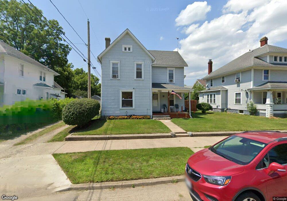
1515 Linden Ave Springfield, OH 45505
Estimated Value: $81,043 - $114,000
3
Beds
1
Bath
1,852
Sq Ft
$52/Sq Ft
Est. Value
About This Home
This home is located at 1515 Linden Ave, Springfield, OH 45505 and is currently estimated at $97,011, approximately $52 per square foot. 1515 Linden Ave is a home located in Clark County with nearby schools including Lincoln Elementary School, Hayward Middle School, and Springfield High School.
Ownership History
Date
Name
Owned For
Owner Type
Purchase Details
Closed on
Mar 31, 1999
Sold by
Hurn Kenneth J and Hurn Bonnie Sue
Bought by
Hurn Kenneth J and Hurn Bonnie Sue
Current Estimated Value
Purchase Details
Closed on
Mar 11, 1999
Sold by
Hurn Kenneth
Bought by
Hurn Kenneth J and Hurn Bonnie Sue
Purchase Details
Closed on
Jan 1, 1999
Sold by
Bowser David K
Bought by
Hurn Kenneth J and Hurn Bonnie
Purchase Details
Closed on
Dec 29, 1998
Sold by
Estate Of Erma M Bowser
Bought by
Bowser David K and Bond Barbara A
Create a Home Valuation Report for This Property
The Home Valuation Report is an in-depth analysis detailing your home's value as well as a comparison with similar homes in the area
Home Values in the Area
Average Home Value in this Area
Purchase History
| Date | Buyer | Sale Price | Title Company |
|---|---|---|---|
| Hurn Kenneth J | -- | -- | |
| Hurn Kenneth J | $15,000 | -- | |
| Hurn Kenneth J | -- | -- | |
| Bowser David K | -- | -- |
Source: Public Records
Tax History Compared to Growth
Tax History
| Year | Tax Paid | Tax Assessment Tax Assessment Total Assessment is a certain percentage of the fair market value that is determined by local assessors to be the total taxable value of land and additions on the property. | Land | Improvement |
|---|---|---|---|---|
| 2024 | $268 | $14,730 | $1,410 | $13,320 |
| 2023 | $268 | $14,730 | $1,410 | $13,320 |
| 2022 | $427 | $14,730 | $1,410 | $13,320 |
| 2021 | $661 | $12,360 | $1,170 | $11,190 |
| 2020 | $662 | $12,360 | $1,170 | $11,190 |
| 2019 | $664 | $12,360 | $1,170 | $11,190 |
| 2018 | $523 | $9,350 | $970 | $8,380 |
| 2017 | $523 | $9,356 | $973 | $8,383 |
| 2016 | $523 | $9,356 | $973 | $8,383 |
| 2015 | $515 | $9,030 | $973 | $8,057 |
| 2014 | $513 | $9,030 | $973 | $8,057 |
| 2013 | $508 | $9,030 | $973 | $8,057 |
Source: Public Records
Map
Nearby Homes
- 1519 Tibbetts Ave
- 550 E Rose St
- 127 Rice St
- 551 Georgia Ave
- 1820 Clay St
- 0 W Perrin Ave Unit 945728
- 0 W Perrin Ave Unit 1041970
- 1754 S Fountain Ave
- 1355 S Fountain Ave
- 1414 Woodward Ave
- 1435 Logan Ave
- 35 E Grand Ave
- 1361 Woodward Ave
- 1029 S Fountain Ave
- 1047 Cypress St
- 833 S Limestone St
- 1603 W Wittenberg Blvd
- 1159 Selma Rd
- 644 Clifton Ave
- 638 Clifton Ave
- 1505 Linden Ave Unit 1507
- 319 Catherine St Unit 321
- 1501 Linden Ave Unit 1503
- 1521 Linden Ave
- 315 Catherine St Unit 317
- 324 Fremont Ave
- 316 Fremont Ave Unit 318
- 309 Catherine St
- 380 Fremont Ave
- 1512 Linden Ave
- 1510 Linden Ave
- 1518 Linden Ave
- 1506 Linden Ave
- 1429 Linden Ave
- 1522 Linden Ave
- 1502 Linden Ave
- 1526 Linden Ave
- 301 Catherine St
- 1530 Linden Ave
- 1423 Linden Ave