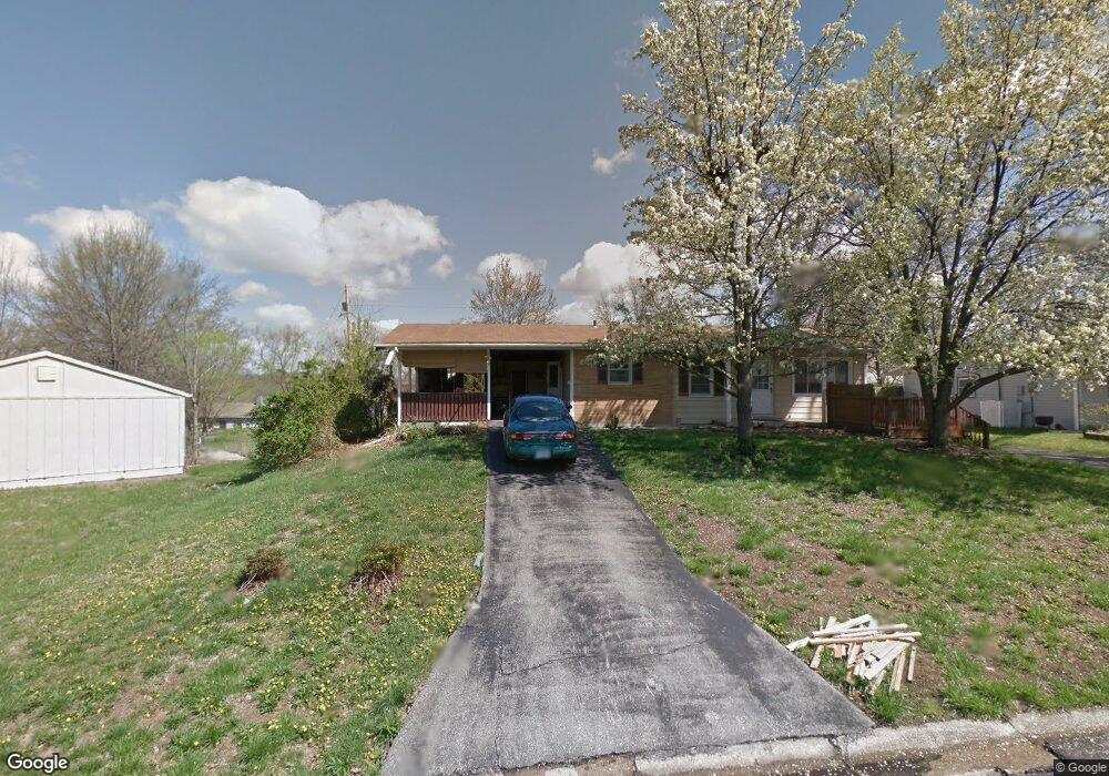
1515 S St Christopher Columbia, MO 65203
Westwinds Park NeighborhoodEstimated Value: $227,000 - $236,460
3
Beds
1
Bath
1,200
Sq Ft
$191/Sq Ft
Est. Value
About This Home
This home is located at 1515 S St Christopher, Columbia, MO 65203 and is currently estimated at $229,615, approximately $191 per square foot. 1515 S St Christopher is a home located in Boone County with nearby schools including Russell Boulevard Elementary School, West Middle School, and David H. Hickman High School.
Ownership History
Date
Name
Owned For
Owner Type
Purchase Details
Closed on
Jul 13, 2012
Sold by
Shorr Boatright Shaina E and Boatright John Ryan
Bought by
Shorr Killian M
Current Estimated Value
Home Financials for this Owner
Home Financials are based on the most recent Mortgage that was taken out on this home.
Original Mortgage
$100,800
Outstanding Balance
$69,975
Interest Rate
3.79%
Mortgage Type
New Conventional
Estimated Equity
$159,640
Purchase Details
Closed on
Jul 3, 2007
Sold by
Brookman Peggy J
Bought by
Shorr Skaina E and Shorr David A
Home Financials for this Owner
Home Financials are based on the most recent Mortgage that was taken out on this home.
Original Mortgage
$104,342
Interest Rate
6.54%
Mortgage Type
FHA
Create a Home Valuation Report for This Property
The Home Valuation Report is an in-depth analysis detailing your home's value as well as a comparison with similar homes in the area
Home Values in the Area
Average Home Value in this Area
Purchase History
| Date | Buyer | Sale Price | Title Company |
|---|---|---|---|
| Shorr Killian M | -- | Boone Central Title Company | |
| Shorr Skaina E | -- | None Available |
Source: Public Records
Mortgage History
| Date | Status | Borrower | Loan Amount |
|---|---|---|---|
| Open | Shorr Killian M | $100,800 | |
| Previous Owner | Shorr Skaina E | $104,342 |
Source: Public Records
Tax History Compared to Growth
Tax History
| Year | Tax Paid | Tax Assessment Tax Assessment Total Assessment is a certain percentage of the fair market value that is determined by local assessors to be the total taxable value of land and additions on the property. | Land | Improvement |
|---|---|---|---|---|
| 2025 | $1,456 | $24,719 | $2,679 | $22,040 |
| 2024 | $1,456 | $21,584 | $2,679 | $18,905 |
| 2023 | $1,444 | $21,584 | $2,679 | $18,905 |
| 2022 | $1,336 | $19,988 | $2,679 | $17,309 |
| 2021 | $1,338 | $19,988 | $2,679 | $17,309 |
| 2020 | $1,272 | $17,852 | $2,679 | $15,173 |
| 2019 | $1,272 | $17,852 | $2,679 | $15,173 |
| 2018 | $1,186 | $0 | $0 | $0 |
| 2017 | $1,172 | $16,530 | $2,679 | $13,851 |
| 2016 | $1,203 | $16,530 | $2,679 | $13,851 |
| 2015 | $1,110 | $16,530 | $2,679 | $13,851 |
| 2014 | $1,116 | $16,530 | $2,679 | $13,851 |
Source: Public Records
Map
Nearby Homes
- 1424 Bradford Dr
- 1402 W Rollins Rd
- 1102 Westwinds Dr
- 1414 Shannon Place
- 1010 Yale
- 839 Marylee Ct
- 1402 Coachlamp Ct
- 906 West Blvd S
- 912 W Rollins Rd
- 1105 Vegas Dr
- 1201 Fieldcrest
- 1108 W Stewart Rd
- 2306 Woodridge Rd
- 404 S Greenwood Ave
- 1307 Garden Ct
- 1109 Lakeshore Dr
- 1008 Lakeshore Dr
- 504 Loch Ln
- 2008 S Deerborn Cir
- 504 S Glenwood Ave
- 1515 Saint Christopher St
- 1513 Saint Christopher St
- 1519 Saint Christopher St
- 1508 Saint Andrew St
- 1506 Saint Andrew St
- 1512 Saint Andrew St
- 1509 Saint Christopher St
- 1514 Saint Christopher St
- 1518 Saint Christopher St
- 1502 Saint Andrew St
- 1510 Saint Christopher St
- 1527 Saint Michael Dr
- 1505 Saint Christopher St
- 1531 Saint Michael Dr
- 1505 S St Christopher
- 1508 Saint Christopher St
- 1523 Saint Michael Dr
- 1414 Saint Andrew St
- 1505 Saint Andrew St
- 1515 Saint Andrew St