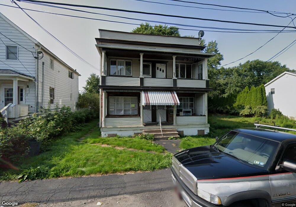
1515 W Locust St Unit 1517 Scranton, PA 18504
Hyde Park NeighborhoodEstimated Value: $175,000 - $239,000
--
Bed
--
Bath
--
Sq Ft
5,140
Sq Ft Lot
About This Home
This home is located at 1515 W Locust St Unit 1517, Scranton, PA 18504 and is currently estimated at $198,333. 1515 W Locust St Unit 1517 is a home located in Lackawanna County with nearby schools including Longan Elementary School, Adams Elementary School, and Frances Willard School.
Ownership History
Date
Name
Owned For
Owner Type
Purchase Details
Closed on
Jan 9, 2020
Sold by
Bank Of America Na
Bought by
1517 Locust St Llc
Current Estimated Value
Home Financials for this Owner
Home Financials are based on the most recent Mortgage that was taken out on this home.
Original Mortgage
$86,220
Interest Rate
3.4%
Mortgage Type
Construction
Purchase Details
Closed on
Nov 25, 2008
Sold by
Salerno Patricia
Bought by
Salerno Patricia
Create a Home Valuation Report for This Property
The Home Valuation Report is an in-depth analysis detailing your home's value as well as a comparison with similar homes in the area
Home Values in the Area
Average Home Value in this Area
Purchase History
| Date | Buyer | Sale Price | Title Company |
|---|---|---|---|
| 1517 Locust St Llc | $48,000 | First Title | |
| Salerno Patricia | -- | None Available |
Source: Public Records
Mortgage History
| Date | Status | Borrower | Loan Amount |
|---|---|---|---|
| Previous Owner | 1517 Locust St Llc | $86,220 |
Source: Public Records
Tax History Compared to Growth
Tax History
| Year | Tax Paid | Tax Assessment Tax Assessment Total Assessment is a certain percentage of the fair market value that is determined by local assessors to be the total taxable value of land and additions on the property. | Land | Improvement |
|---|---|---|---|---|
| 2025 | $2,685 | $8,500 | $1,100 | $7,400 |
| 2024 | $2,450 | $8,500 | $1,100 | $7,400 |
| 2023 | $2,450 | $8,500 | $1,100 | $7,400 |
| 2022 | $2,396 | $8,500 | $1,100 | $7,400 |
| 2021 | $2,396 | $8,500 | $1,100 | $7,400 |
| 2020 | $2,351 | $8,500 | $1,100 | $7,400 |
| 2019 | $2,210 | $8,500 | $1,100 | $7,400 |
| 2018 | $2,210 | $8,500 | $1,100 | $7,400 |
| 2017 | $2,170 | $8,500 | $1,100 | $7,400 |
| 2016 | $0 | $8,500 | $1,100 | $7,400 |
| 2015 | $1,364 | $8,500 | $1,100 | $7,400 |
| 2014 | -- | $8,500 | $1,100 | $7,400 |
Source: Public Records
Map
Nearby Homes
- 1449 Dartmouth St Unit 1449-51 L-13
- 1324 Dartmouth St
- 1223 Eynon St
- 1215 Eynon St
- 816 12th Ave
- 706 Parrott Ave
- 1227-1229 Hampton St
- 1234 Bryn Mawr St Unit 11
- 1157-59 Hampton St
- 405 17th Ave
- 415 18th Ave
- 1335 Sloan St
- 332 14th Ave
- 1819 Luzerne St
- 1301 Sloan St
- 1411 Watson St
- 318 15th Ave
- 1134/1136 Luzerne St
- 1021 Fellows St
- 924 S Main Ave
- 1517 W Locust St
- 1511 W Locust St
- 1509 W Locust St
- 1521 W Locust St
- 1507 W Locust St
- 1501 W Locust St Unit 1503
- 813 Dale Dr
- 1516 1518 W Locust St
- 1516 W Locust St Unit 1518
- 1514 W Locust St
- 1506 W Locust St
- 1512 W Locust St
- 1523 W Locust St
- 1510 W Locust St
- 1501 W 1503 Locust St
- 1451 W Locust St Unit 1453
- 1451 W 1453 Locust St
- 1525 W Locust St
- 820 Dale Dr
- 1447 W Locust St Unit 1449