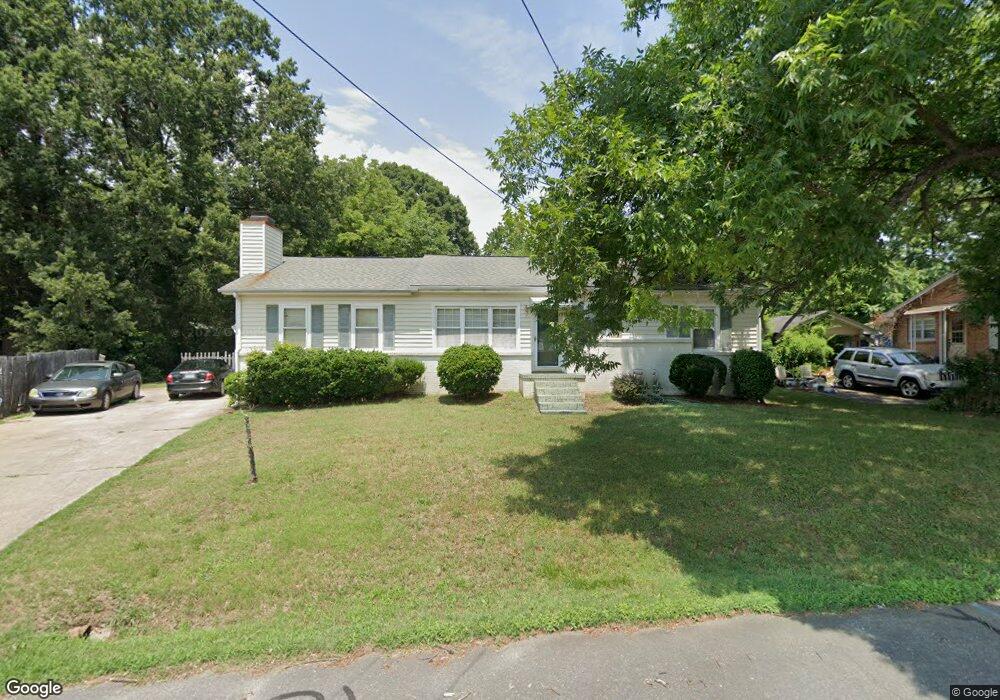
1516 Pearman St Reidsville, NC 27320
Estimated Value: $191,495 - $229,000
--
Bed
--
Bath
1,584
Sq Ft
$132/Sq Ft
Est. Value
About This Home
This home is located at 1516 Pearman St, Reidsville, NC 27320 and is currently estimated at $208,874, approximately $131 per square foot. 1516 Pearman St is a home located in Rockingham County with nearby schools including Monroeton Elementary School, Rockingham County Middle School, and Rockingham County High School.
Ownership History
Date
Name
Owned For
Owner Type
Purchase Details
Closed on
Jul 14, 2006
Sold by
Washburn David F and Washburn Beatrice S
Bought by
Jones Michael E and Jones Dorsel R
Current Estimated Value
Home Financials for this Owner
Home Financials are based on the most recent Mortgage that was taken out on this home.
Original Mortgage
$114,500
Outstanding Balance
$75,494
Interest Rate
8.75%
Mortgage Type
Adjustable Rate Mortgage/ARM
Estimated Equity
$133,380
Create a Home Valuation Report for This Property
The Home Valuation Report is an in-depth analysis detailing your home's value as well as a comparison with similar homes in the area
Home Values in the Area
Average Home Value in this Area
Purchase History
| Date | Buyer | Sale Price | Title Company |
|---|---|---|---|
| Jones Michael E | $114,500 | None Available |
Source: Public Records
Mortgage History
| Date | Status | Borrower | Loan Amount |
|---|---|---|---|
| Open | Jones Michael E | $114,500 |
Source: Public Records
Tax History Compared to Growth
Tax History
| Year | Tax Paid | Tax Assessment Tax Assessment Total Assessment is a certain percentage of the fair market value that is determined by local assessors to be the total taxable value of land and additions on the property. | Land | Improvement |
|---|---|---|---|---|
| 2025 | $2,295 | $185,068 | $14,922 | $170,146 |
| 2024 | $2,295 | $185,068 | $14,922 | $170,146 |
| 2023 | $2,295 | $102,904 | $13,566 | $89,338 |
| 2022 | $1,476 | $102,904 | $13,566 | $89,338 |
| 2021 | $1,476 | $102,904 | $13,566 | $89,338 |
| 2020 | $1,476 | $102,904 | $13,566 | $89,338 |
| 2019 | $1,476 | $102,904 | $13,566 | $89,338 |
| 2018 | $1,505 | $104,776 | $13,690 | $91,086 |
| 2017 | $1,505 | $104,776 | $13,690 | $91,086 |
| 2015 | $1,520 | $104,776 | $13,690 | $91,086 |
| 2014 | $1,505 | $104,776 | $13,690 | $91,086 |
Source: Public Records
Map
Nearby Homes
- 950 Hillsdale St
- 00 Linville Dr
- 1613 Courtland Ave
- 00 Woodside Dr
- 16 Vance St
- 000 Freeway Dr
- 718 W Harrison St
- 902 & 904 Magnolia Ave
- 5+-Ac Freeway Dr
- 17.74+-Ac Freeway Dr
- 22.7+-Ac Freeway Dr
- 322 Carter Ridge Dr
- 501 Fontaine St
- 2222 St James Dr
- 704 Burnett St
- 712 Snead St Unit A & B
- 2213 St James Dr
- 710 Prince Williams St
- 1700 Richardson Dr
- 1330 Sherwood Dr
- 1514 Pearman St
- 1518 Pearman St
- 1513 Vance St
- 1601 Vance St
- 1512 Pearman St
- 1520 Pearman St
- 1511 Pearman St
- 1505 Vance St
- 1605 Vance St
- 1517 Pearman St
- 1507 Pearman St
- 1508 Pearman St
- 3648 Vance St
- 3830 Vance St
- 3830 Vance St Unit 3830 Vance Street Ex
- 3648 Vance St Unit 3648 Vance Street Ex
- 1503 Vance St
- 1526 Pearman St
- 1505 Pearman St
- 1519 Pearman St