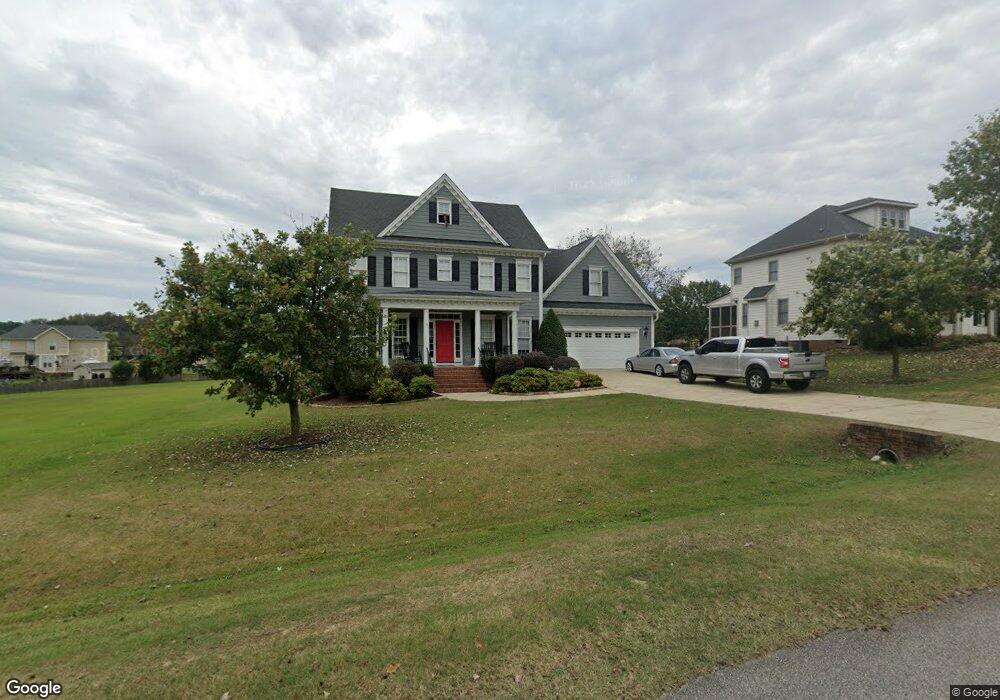
1516 Sophia Ridge Dr Fuquay Varina, NC 27526
Estimated Value: $509,000 - $539,000
3
Beds
3
Baths
2,434
Sq Ft
$215/Sq Ft
Est. Value
About This Home
This home is located at 1516 Sophia Ridge Dr, Fuquay Varina, NC 27526 and is currently estimated at $523,811, approximately $215 per square foot. 1516 Sophia Ridge Dr is a home located in Wake County with nearby schools including Fuquay-Varina High and Southern Wake Academy.
Ownership History
Date
Name
Owned For
Owner Type
Purchase Details
Closed on
Jan 25, 2006
Sold by
Built Moore Homes Inc
Bought by
Willis Colby F and Willis Julie P
Current Estimated Value
Home Financials for this Owner
Home Financials are based on the most recent Mortgage that was taken out on this home.
Original Mortgage
$212,000
Outstanding Balance
$119,418
Interest Rate
6.21%
Mortgage Type
Fannie Mae Freddie Mac
Estimated Equity
$404,393
Create a Home Valuation Report for This Property
The Home Valuation Report is an in-depth analysis detailing your home's value as well as a comparison with similar homes in the area
Home Values in the Area
Average Home Value in this Area
Purchase History
| Date | Buyer | Sale Price | Title Company |
|---|---|---|---|
| Willis Colby F | $265,000 | None Available |
Source: Public Records
Mortgage History
| Date | Status | Borrower | Loan Amount |
|---|---|---|---|
| Open | Willis Colby F | $212,000 |
Source: Public Records
Tax History Compared to Growth
Tax History
| Year | Tax Paid | Tax Assessment Tax Assessment Total Assessment is a certain percentage of the fair market value that is determined by local assessors to be the total taxable value of land and additions on the property. | Land | Improvement |
|---|---|---|---|---|
| 2025 | $3,137 | $487,365 | $100,000 | $387,365 |
| 2024 | $3,047 | $487,365 | $100,000 | $387,365 |
| 2023 | $2,469 | $314,107 | $45,000 | $269,107 |
| 2022 | $2,288 | $314,107 | $45,000 | $269,107 |
| 2021 | $2,227 | $314,107 | $45,000 | $269,107 |
| 2020 | $2,190 | $314,107 | $45,000 | $269,107 |
| 2019 | $2,266 | $275,003 | $42,000 | $233,003 |
| 2018 | $2,084 | $275,003 | $42,000 | $233,003 |
| 2017 | $1,975 | $275,003 | $42,000 | $233,003 |
| 2016 | $1,935 | $275,003 | $42,000 | $233,003 |
| 2015 | $2,163 | $308,528 | $48,000 | $260,528 |
| 2014 | $2,050 | $308,528 | $48,000 | $260,528 |
Source: Public Records
Map
Nearby Homes
- 1800 Phelps Rd W
- 545 Glenwyck Ct
- 2340 Fleming Rd
- 542 Glenwyck Ct
- 2504 Fleming Rd
- Cooper Plan at Broadwell Trace - Broadwell Estates
- Cypress Plan at Broadwell Trace - Broadwell Estates
- 301 Brindle Dr
- McKimmon Plan at Holston
- Winston Plan at Holston
- Watauga Plan at Holston
- Biltmore Plan at Holston
- Nelson Plan at Holston
- Clark Plan at Holston
- Brooks Plan at Holston
- Mallard Plan at Holston
- 605 Hampton Crest Ct
- 2301 Fleming Rd
- 2337 Fleming Rd
- 2341 Fleming Rd
- 1522 Miranda Woods Ln
- 1513 Sophia Ridge Dr
- 1521 Sophia Ridge Dr
- 1509 Sophia Ridge Dr
- 1525 Sophia Ridge Dr
- 113 Phelps Farm Rd
- 117 Phelps Farm Rd
- 109 Phelps Farm Rd
- 1518 Miranda Woods Ln
- 1505 Sophia Ridge Dr
- 121 Phelps Farm Rd
- 214 Parker Grove Ln
- 1525 Miranda Woods Ln
- 1510 Miranda Woods Ln
- 1504 Miranda Woods Ln
- 215 Parker Grove Ln
- 1501 Sophia Ridge Dr
- 1521 Miranda Woods Ln
- 1500 Miranda Woods Ln
- 125 Phelps Farm Rd