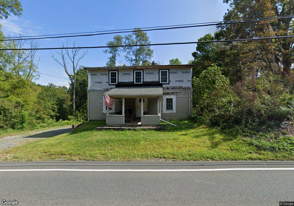
1516 State Route 31 Oxford, NJ 07863
Estimated Value: $229,000 - $438,000
--
Bed
--
Bath
1,904
Sq Ft
$172/Sq Ft
Est. Value
About This Home
This home is located at 1516 State Route 31, Oxford, NJ 07863 and is currently estimated at $327,961, approximately $172 per square foot. 1516 State Route 31 is a home with nearby schools including White Township Consolidated Elementary School.
Ownership History
Date
Name
Owned For
Owner Type
Purchase Details
Closed on
Dec 8, 2020
Sold by
Lambert Ben and Lambert Rebecca
Bought by
State Of New Jersey
Current Estimated Value
Purchase Details
Closed on
Mar 6, 2017
Sold by
U S Bank Trust N A
Bought by
Lambert Ben and Lambert Rebecca
Purchase Details
Closed on
Dec 13, 2016
Sold by
Mowery Susan and Mowery Daniel
Bought by
Us Bank Na and Lsf9 Master Participation Trust
Purchase Details
Closed on
Mar 4, 1996
Sold by
Vanwagner Hasbrouck G and Vanwagner Janet
Bought by
Mowery Daniel and Mowery Susan
Home Financials for this Owner
Home Financials are based on the most recent Mortgage that was taken out on this home.
Original Mortgage
$82,873
Interest Rate
7.67%
Mortgage Type
FHA
Create a Home Valuation Report for This Property
The Home Valuation Report is an in-depth analysis detailing your home's value as well as a comparison with similar homes in the area
Home Values in the Area
Average Home Value in this Area
Purchase History
| Date | Buyer | Sale Price | Title Company |
|---|---|---|---|
| State Of New Jersey | $3,000 | None Available | |
| State Of Nj | $3,000 | None Listed On Document | |
| Lambert Ben | $87,500 | None Available | |
| Us Bank Na | -- | None Available | |
| Mowery Daniel | $83,000 | -- |
Source: Public Records
Mortgage History
| Date | Status | Borrower | Loan Amount |
|---|---|---|---|
| Previous Owner | Mowery Daniel | $82,873 |
Source: Public Records
Tax History Compared to Growth
Tax History
| Year | Tax Paid | Tax Assessment Tax Assessment Total Assessment is a certain percentage of the fair market value that is determined by local assessors to be the total taxable value of land and additions on the property. | Land | Improvement |
|---|---|---|---|---|
| 2025 | $4,775 | $191,000 | $104,700 | $86,300 |
| 2024 | $4,586 | $191,000 | $104,700 | $86,300 |
| 2023 | $4,406 | $191,000 | $104,700 | $86,300 |
| 2022 | $4,406 | $191,000 | $104,700 | $86,300 |
| 2021 | $4,045 | $191,000 | $104,700 | $86,300 |
| 2020 | $4,113 | $188,500 | $104,700 | $83,800 |
| 2019 | $3,885 | $188,500 | $104,700 | $83,800 |
| 2018 | $3,885 | $188,500 | $104,700 | $83,800 |
| 2017 | $4,032 | $188,500 | $104,700 | $83,800 |
| 2016 | $4,111 | $188,500 | $104,700 | $83,800 |
| 2015 | $3,947 | $188,500 | $104,700 | $83,800 |
| 2014 | $3,915 | $188,500 | $104,700 | $83,800 |
Source: Public Records
Map
Nearby Homes
- 8 Buttzville Rd
- 1497 New Jersey 31
- 7 Buttzville Ct
- 50 Green Pond Rd
- 14 Tamarack Rd
- 349 New Jersey 31
- 301 New Jersey 31
- 11 Dogwood Terrace
- 305 Route 31
- 21 Olde Forge
- 79 Mountain Lake Rd
- 3 Rock N' Wood Rd
- 77 Shippen Ridge
- 11 Scranton Pkwy
- 123 Free Union Rd
- 45 Bush St
- 49 Henry St
- 125 Free Union Rd
- 138 Belvidere Ave
- 20 Belvidere Ave
- 1516 New Jersey 31
- 1 Church St
- 2 Craig St
- 3 Craig St
- 23 Buttzville Rd
- 41 Buttzville Rd
- 4 Pierson Ln
- 13 Buttzville Rd
- 44 Buttzville Rd
- 39 Buttzville Rd
- 263 Us Highway 46
- 263 Us-46
- 38 Buttzville Rd
- 38 Buttzville Rd
- 5 Pierson Ln
- 6 Piersons Ln
- 46 Buttzville Rd
- 30 Buttzville Rd
- 1502 State Route 31
- 37 Buttzville Rd