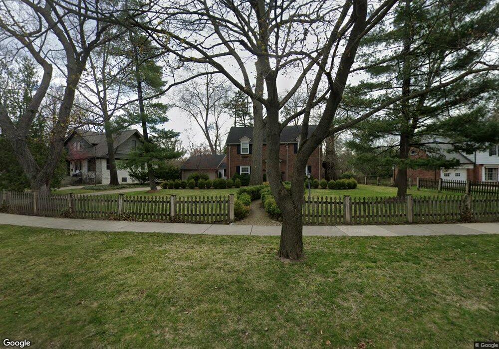
1516 Vinsetta Blvd Royal Oak, MI 48067
Estimated Value: $634,867 - $826,000
4
Beds
2
Baths
2,572
Sq Ft
$291/Sq Ft
Est. Value
About This Home
This home is located at 1516 Vinsetta Blvd, Royal Oak, MI 48067 and is currently estimated at $749,717, approximately $291 per square foot. 1516 Vinsetta Blvd is a home located in Oakland County with nearby schools including Northwood Elementary School, Royal Oak Middle School, and Royal Oak High School.
Ownership History
Date
Name
Owned For
Owner Type
Purchase Details
Closed on
Mar 10, 2025
Sold by
Tikkanen Peter A and Tikkanen Stacey Ann
Bought by
Tikkanen Peter and Tikkanen Peter A
Current Estimated Value
Purchase Details
Closed on
Oct 8, 2003
Sold by
Mann John R and Mann Mary Louise W
Bought by
Tikkanen Peter A and Tikkanen Stacey Ann
Home Financials for this Owner
Home Financials are based on the most recent Mortgage that was taken out on this home.
Original Mortgage
$320,000
Interest Rate
6.23%
Mortgage Type
Balloon
Create a Home Valuation Report for This Property
The Home Valuation Report is an in-depth analysis detailing your home's value as well as a comparison with similar homes in the area
Home Values in the Area
Average Home Value in this Area
Purchase History
| Date | Buyer | Sale Price | Title Company |
|---|---|---|---|
| Tikkanen Peter | -- | None Listed On Document | |
| Tikkanen Peter A | $430,000 | Capital Title Ins Agency |
Source: Public Records
Mortgage History
| Date | Status | Borrower | Loan Amount |
|---|---|---|---|
| Previous Owner | Tikkanen Peter A | $307,300 | |
| Previous Owner | Tikkanen Peter A | $127,000 | |
| Previous Owner | Tikkanen Peter T | $320,000 |
Source: Public Records
Tax History Compared to Growth
Tax History
| Year | Tax Paid | Tax Assessment Tax Assessment Total Assessment is a certain percentage of the fair market value that is determined by local assessors to be the total taxable value of land and additions on the property. | Land | Improvement |
|---|---|---|---|---|
| 2024 | $5,651 | $259,210 | $0 | $0 |
| 2022 | $8,230 | $231,990 | $0 | $0 |
| 2020 | $5,491 | $203,980 | $0 | $0 |
| 2018 | $8,230 | $186,020 | $0 | $0 |
| 2017 | $6,416 | $186,020 | $0 | $0 |
| 2015 | -- | $178,320 | $0 | $0 |
| 2014 | -- | $174,120 | $0 | $0 |
| 2011 | -- | $147,510 | $0 | $0 |
Source: Public Records
Map
Nearby Homes
- 1319 Woodsboro Dr
- 1721 Forestdale Ct
- 1630 W 12 Mile Rd
- 1718 W 12 Mile Rd
- 1808 W 12 Mile Rd
- 1103 Fernwood Rd
- 1828 W 12 Mile Rd
- 1022 Maplegrove Ave
- 1402 Catalpa Dr
- 2015 Alicia Ln
- 934 Lockwood Rd
- 1915 Northwood Blvd
- 820 Oakridge Ave
- 1363 Edgewood Blvd
- 719 W 12 Mile Rd
- 821 Forestdale Rd
- 1197 Catalpa Dr
- 817 Fernwood Rd
- 1450 Wiltshire Rd
- 800 Lockwood Rd
- 1526 Vinsetta Blvd
- 1504 Vinsetta Blvd
- 1421 Cedarhill Dr
- 1518 Woodsboro Dr
- 1608 Vinsetta Blvd
- 1411 Cedarhill Dr
- 1424 Vinsetta Blvd
- 1507 Vinsetta Blvd
- 1502 Woodsboro Dr
- 1525 Vinsetta Blvd
- 1517 Vinsetta Blvd
- 1427 Vinsetta Blvd
- 1414 Cedarhill Dr
- 1403 Cedarhill Dr
- 1620 Vinsetta Blvd
- 1605 Vinsetta Blvd
- 1414 Vinsetta Blvd
- 1507 Woodsboro Dr
- 1406 Woodsboro Dr
- 1417 Vinsetta Blvd