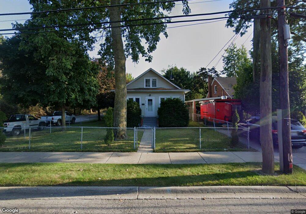
1517 10th St Waukegan, IL 60085
Lyon Acres NeighborhoodEstimated Value: $205,000 - $250,319
4
Beds
2
Baths
1,765
Sq Ft
$131/Sq Ft
Est. Value
About This Home
This home is located at 1517 10th St, Waukegan, IL 60085 and is currently estimated at $231,773, approximately $131 per square foot. 1517 10th St is a home located in Lake County with nearby schools including Clearview Elementary School, John R Lewis Middle School, and Waukegan High School.
Ownership History
Date
Name
Owned For
Owner Type
Purchase Details
Closed on
Jun 17, 1994
Sold by
Urh Charles L
Bought by
Guadarrama Jose A and Ramos Guadalupe
Current Estimated Value
Home Financials for this Owner
Home Financials are based on the most recent Mortgage that was taken out on this home.
Original Mortgage
$45,000
Interest Rate
8.78%
Create a Home Valuation Report for This Property
The Home Valuation Report is an in-depth analysis detailing your home's value as well as a comparison with similar homes in the area
Home Values in the Area
Average Home Value in this Area
Purchase History
| Date | Buyer | Sale Price | Title Company |
|---|---|---|---|
| Guadarrama Jose A | $61,000 | -- |
Source: Public Records
Mortgage History
| Date | Status | Borrower | Loan Amount |
|---|---|---|---|
| Closed | Guadarrama Jose A | $45,000 |
Source: Public Records
Tax History Compared to Growth
Tax History
| Year | Tax Paid | Tax Assessment Tax Assessment Total Assessment is a certain percentage of the fair market value that is determined by local assessors to be the total taxable value of land and additions on the property. | Land | Improvement |
|---|---|---|---|---|
| 2024 | $4,619 | $70,568 | $18,636 | $51,932 |
| 2023 | $5,848 | $57,914 | $15,294 | $42,620 |
| 2022 | $5,848 | $66,631 | $12,687 | $53,944 |
| 2021 | $5,480 | $59,448 | $11,317 | $48,131 |
| 2020 | $5,491 | $55,383 | $10,543 | $44,840 |
| 2019 | $5,491 | $50,750 | $9,661 | $41,089 |
| 2018 | $5,772 | $51,588 | $6,837 | $44,751 |
| 2017 | $5,564 | $45,641 | $6,049 | $39,592 |
| 2016 | $5,138 | $39,660 | $5,256 | $34,404 |
| 2015 | $4,862 | $35,496 | $4,704 | $30,792 |
| 2014 | $2,889 | $22,876 | $2,509 | $20,367 |
| 2012 | $3,781 | $24,785 | $2,719 | $22,066 |
Source: Public Records
Map
Nearby Homes
- 1712 11th St
- 819 S Fulton Ave
- 1511 14th St
- 1244 Victoria Ave
- 724 10th St
- 1210 Park Ave
- 815 Prescott St
- 910 Cummings Ave
- 1101 Adams St
- 720 13th St
- 1521 Seymour Ave
- 1301 Park Ave
- 1102 Wadsworth Ave
- 1423 Victoria Ave
- 842 Wadsworth Ave
- 631 8th St
- 1535 Glenn Dr
- 1617 Grove Ave
- 1542 Victoria Ave
- 831 S Mcalister Ave