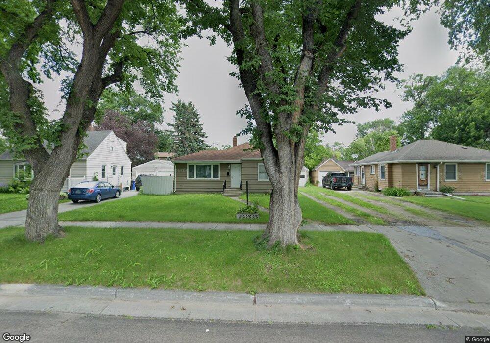
1517 12th Ave S Fargo, ND 58103
Jefferson-Carl NeighborhoodEstimated Value: $156,000 - $188,000
2
Beds
1
Bath
760
Sq Ft
$229/Sq Ft
Est. Value
About This Home
This home is located at 1517 12th Ave S, Fargo, ND 58103 and is currently estimated at $173,909, approximately $228 per square foot. 1517 12th Ave S is a home located in Cass County with nearby schools including Clara Barton Elementary School, Carl Ben Eielson Middle School, and South High School.
Ownership History
Date
Name
Owned For
Owner Type
Purchase Details
Closed on
May 1, 2015
Sold by
Stensgard Michael and Stensgard Karen
Bought by
Norenberg Scott
Current Estimated Value
Home Financials for this Owner
Home Financials are based on the most recent Mortgage that was taken out on this home.
Original Mortgage
$98,320
Outstanding Balance
$75,742
Interest Rate
3.68%
Mortgage Type
New Conventional
Estimated Equity
$98,167
Purchase Details
Closed on
Jun 4, 2010
Sold by
Lundeen David A
Bought by
Stensgard Michael
Purchase Details
Closed on
May 14, 2010
Sold by
Borchert Jeffrey John and Borchart Jeffrey John
Bought by
Lundeen David A
Purchase Details
Closed on
Jul 24, 2009
Sold by
Borchert Lynda Lu
Bought by
Borchert Jeffrey John
Create a Home Valuation Report for This Property
The Home Valuation Report is an in-depth analysis detailing your home's value as well as a comparison with similar homes in the area
Home Values in the Area
Average Home Value in this Area
Purchase History
| Date | Buyer | Sale Price | Title Company |
|---|---|---|---|
| Norenberg Scott | -- | None Available | |
| Stensgard Michael | $69,000 | -- | |
| Lundeen David A | $59,000 | -- | |
| Borchert Jeffrey John | -- | -- |
Source: Public Records
Mortgage History
| Date | Status | Borrower | Loan Amount |
|---|---|---|---|
| Open | Norenberg Scott | $98,320 |
Source: Public Records
Tax History Compared to Growth
Tax History
| Year | Tax Paid | Tax Assessment Tax Assessment Total Assessment is a certain percentage of the fair market value that is determined by local assessors to be the total taxable value of land and additions on the property. | Land | Improvement |
|---|---|---|---|---|
| 2024 | $2,570 | $84,400 | $20,400 | $64,000 |
| 2023 | $2,471 | $81,150 | $20,400 | $60,750 |
| 2022 | $2,427 | $78,050 | $20,400 | $57,650 |
| 2021 | $2,117 | $67,850 | $20,400 | $47,450 |
| 2020 | $2,109 | $67,850 | $20,400 | $47,450 |
| 2019 | $1,951 | $61,350 | $12,100 | $49,250 |
| 2018 | $1,903 | $61,350 | $12,100 | $49,250 |
| 2017 | $1,839 | $59,550 | $12,100 | $47,450 |
| 2016 | $1,652 | $57,800 | $12,100 | $45,700 |
| 2015 | $1,712 | $56,600 | $8,300 | $48,300 |
| 2014 | $1,640 | $52,400 | $8,300 | $44,100 |
| 2013 | $1,564 | $49,900 | $8,300 | $41,600 |
Source: Public Records
Map
Nearby Homes
- 1418 12th Ave S
- 1418 11th Ave S
- 1301 16 1 2 St S
- 1414 10th Ave S
- 1314 14th St S
- 1517 9th Ave S
- 1637 10th Ave S
- 1709 13th Ave S
- 1410 14 1 2 St S
- 1407 17th St S
- 1124 University Dr S
- 1112 University Dr S
- 1208 University Dr S
- 813 17th St S
- 910 University Dr S
- 818 19th St S
- 814 19th St S
- 2009 13th Ave S
- 2013 13th Ave S
- 1118 8th Ave S
- 1521 12th Ave S
- 1513 12th Ave S
- 1525 12th Ave S
- 1524 11th Ave S
- 1522 11th Ave S
- 1526 11th Ave S
- 1113 15th St S
- 1109 15th St S
- 1105 15th St S
- 1518 12th Ave S
- 1514 12th Ave S
- 1522 12th Ave S
- 1201 15 St S
- 1201 15th St S
- 1101 15th St S
- 1526 12th Ave S
- 1205 15th St S
- 1209 15th St S
- 1523 11th Ave S
- 1029 15th St S