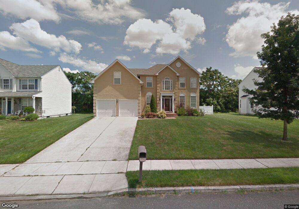
1517 Briar Trail Vineland, NJ 08360
Estimated Value: $382,052 - $523,000
--
Bed
--
Bath
2,900
Sq Ft
$162/Sq Ft
Est. Value
About This Home
This home is located at 1517 Briar Trail, Vineland, NJ 08360 and is currently estimated at $468,763, approximately $161 per square foot. 1517 Briar Trail is a home located in Cumberland County with nearby schools including D'Ippolito Elementary School, Veterans Memorial Intermediate School, and Vineland Senior High School.
Ownership History
Date
Name
Owned For
Owner Type
Purchase Details
Closed on
Jul 30, 2003
Sold by
Hovnanian K Ventures Llc
Bought by
Elliott Lynn A
Current Estimated Value
Purchase Details
Closed on
Jul 30, 2002
Sold by
Hovnanian K Ventures I Llc
Bought by
Elliott Lynn A
Home Financials for this Owner
Home Financials are based on the most recent Mortgage that was taken out on this home.
Original Mortgage
$180,000
Interest Rate
5.52%
Create a Home Valuation Report for This Property
The Home Valuation Report is an in-depth analysis detailing your home's value as well as a comparison with similar homes in the area
Home Values in the Area
Average Home Value in this Area
Purchase History
| Date | Buyer | Sale Price | Title Company |
|---|---|---|---|
| Elliott Lynn A | $202,940 | -- | |
| -- | $202,900 | -- | |
| Elliott Lynn A | $202,940 | -- |
Source: Public Records
Mortgage History
| Date | Status | Borrower | Loan Amount |
|---|---|---|---|
| Previous Owner | Elliott Lynn A | $180,000 |
Source: Public Records
Tax History Compared to Growth
Tax History
| Year | Tax Paid | Tax Assessment Tax Assessment Total Assessment is a certain percentage of the fair market value that is determined by local assessors to be the total taxable value of land and additions on the property. | Land | Improvement |
|---|---|---|---|---|
| 2025 | $7,603 | $238,800 | $36,400 | $202,400 |
| 2024 | $7,603 | $238,800 | $36,400 | $202,400 |
| 2023 | $7,553 | $238,800 | $36,400 | $202,400 |
| 2022 | $7,329 | $238,800 | $36,400 | $202,400 |
| 2021 | $6,682 | $238,800 | $36,400 | $202,400 |
| 2020 | $6,990 | $238,800 | $36,400 | $202,400 |
| 2019 | $6,894 | $238,800 | $36,400 | $202,400 |
| 2018 | $6,713 | $238,800 | $36,400 | $202,400 |
| 2017 | $6,376 | $238,800 | $36,400 | $202,400 |
| 2016 | $6,151 | $238,800 | $36,400 | $202,400 |
| 2015 | $5,925 | $238,800 | $36,400 | $202,400 |
| 2014 | $5,602 | $238,800 | $36,400 | $202,400 |
Source: Public Records
Map
Nearby Homes
- 821 Streamview Ln
- 1230 Ramblewood Dr
- 1249 Sassafras Dr
- 1259 E Cornell St
- 1976 UNIT 237A N East Ave
- 785 E Oak Rd
- 1267 Northeast Blvd
- 1976 N East Ave Unit 32
- 1976 N East Ave Unit 257
- 1976 N East Ave Unit 249
- 1976 N East Ave Unit 233
- 1976 N East Ave Unit 122
- 1976 N East Ave Unit 191
- 1976 N East Ave Unit 248
- 1976 N East Ave Unit 37
- 1410 N Main Rd
- 1510 E Wheat Rd
- 1267 N East Blvd Unit 16C
- 1547 E Wheat Rd
- 584 Overbrook Rd
- 1531 Briar Trail
- 1501 Briar Trail
- 1549 Briar Trail
- 820 Streamview Ln
- 1563 Briar Trail
- 1473 Briar Trail
- 809 Streamview Ln
- 800 Streamview Ln
- 1480 Briar Trail
- 801 Amber Ln
- 1577 Briar Trail
- 789 Streamview Ln
- 786 Streamview Ln
- 785 Amber Ln
- 1464 Briar Trail
- 1461 Briar Trail
- 1455 Briar Trail
- 775 Streamview Ln
- 1458 Briar Trail
- 1595 Briar Trail