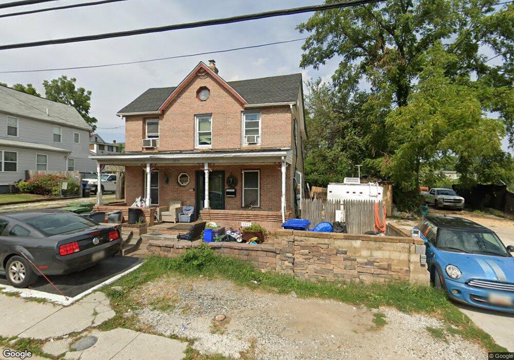
1517 Desoto Rd Baltimore, MD 21230
Morrell Park NeighborhoodEstimated Value: $232,139 - $235,000
4
Beds
2
Baths
1,400
Sq Ft
$167/Sq Ft
Est. Value
About This Home
This home is located at 1517 Desoto Rd, Baltimore, MD 21230 and is currently estimated at $233,570, approximately $166 per square foot. 1517 Desoto Rd is a home located in Baltimore City with nearby schools including Morrell Park Elementary/Middle School, Booker T. Washington Middle School, and Edmondson Westside High School.
Ownership History
Date
Name
Owned For
Owner Type
Purchase Details
Closed on
Apr 19, 2011
Sold by
Central Mortgage Company
Bought by
Burris Kenneth C
Current Estimated Value
Purchase Details
Closed on
Oct 20, 2010
Sold by
Aziz Muhammed
Bought by
Burris Kenneth C
Purchase Details
Closed on
Jul 28, 2004
Sold by
Secretary Of Housing & Urban
Bought by
Aziz Muhammad and Aziz Shahnaz
Purchase Details
Closed on
Mar 5, 2004
Sold by
Secretary Of Housing & Urban
Bought by
Aziz Muhammad and Aziz Shahnaz
Purchase Details
Closed on
Oct 8, 2003
Sold by
Bower Gary E
Bought by
Secretary Of Housing & Urban and Development , The
Purchase Details
Closed on
May 3, 2001
Sold by
Jones Jeff
Bought by
Bower Gary E
Create a Home Valuation Report for This Property
The Home Valuation Report is an in-depth analysis detailing your home's value as well as a comparison with similar homes in the area
Home Values in the Area
Average Home Value in this Area
Purchase History
| Date | Buyer | Sale Price | Title Company |
|---|---|---|---|
| Burris Kenneth C | $37,000 | None Available | |
| Burris Kenneth C | $99,900 | -- | |
| Central Mortgage Company | $99,900 | -- | |
| Aziz Muhammad | $75,000 | -- | |
| Aziz Muhammad | $75,000 | -- | |
| Secretary Of Housing & Urban | $109,645 | -- | |
| Bower Gary E | $88,400 | -- |
Source: Public Records
Tax History Compared to Growth
Tax History
| Year | Tax Paid | Tax Assessment Tax Assessment Total Assessment is a certain percentage of the fair market value that is determined by local assessors to be the total taxable value of land and additions on the property. | Land | Improvement |
|---|---|---|---|---|
| 2025 | $2,905 | $132,233 | -- | -- |
| 2024 | $2,905 | $123,667 | $0 | $0 |
| 2023 | $2,703 | $115,100 | $42,500 | $72,600 |
| 2022 | $2,673 | $113,267 | $0 | $0 |
| 2021 | $2,630 | $111,433 | $0 | $0 |
| 2020 | $2,397 | $109,600 | $42,500 | $67,100 |
| 2019 | $2,385 | $109,600 | $42,500 | $67,100 |
| 2018 | $2,419 | $109,600 | $42,500 | $67,100 |
| 2017 | $2,601 | $117,100 | $0 | $0 |
| 2016 | $3,198 | $117,100 | $0 | $0 |
| 2015 | $3,198 | $117,100 | $0 | $0 |
| 2014 | $3,198 | $122,200 | $0 | $0 |
Source: Public Records
Map
Nearby Homes
- 1710 Wickes Ave
- 1707 Harman Ave
- 1803 Casadel Ave
- 1918 Parksley Ave
- 2809 Washington Blvd
- 2507 Washington Blvd
- 1637 Spence St
- 1703 - 1707 1/2 Spence St
- 1715 Spence St
- 2305 Herkimer St
- 1915 Griffis Ave
- 1962 Sponson St
- 1920 Casadel Ave
- 1933 Griffis Ave
- 2527 Tolley St
- 2104 Whistler Ave
- 1920 Maudlin Ave
- 1052 Parksley Ave
- 2030 Griffis Ave
- 3214 Clarinda Ave
- 1515 Desoto Rd
- 1511 Desoto Rd
- 1509 Desoto Rd
- 1507 Desoto Rd
- 1505 Desoto Rd
- 1504 Wilmington Ave
- 2629 Georgetown Rd
- 1503 Desoto Rd
- 1525 Desoto Rd
- 1501 Desoto Rd
- 2627 Georgetown Rd
- 1502 Wilmington Ave
- 1504 Desoto Rd
- 1502 Desoto Rd
- 2625 Georgetown Rd
- 1500 Desoto Rd
- 2621 Georgetown Rd
- 1508 Desoto Rd
- 2630 Georgetown Rd
- 2619 Georgetown Rd