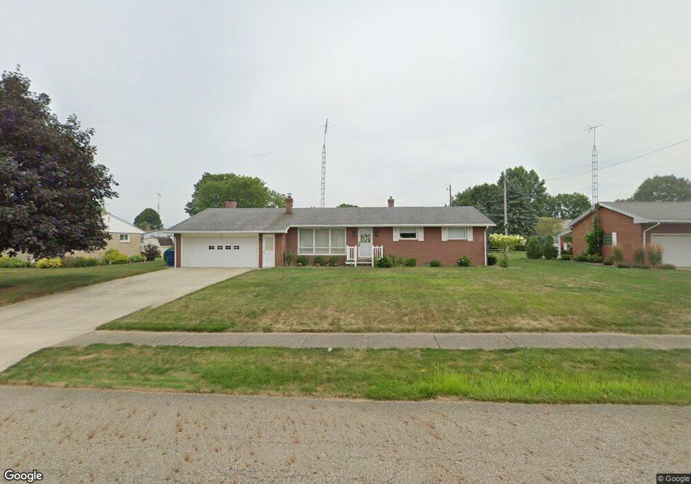
1517 Opal St Louisville, OH 44641
Estimated Value: $222,874 - $247,000
3
Beds
2
Baths
1,520
Sq Ft
$155/Sq Ft
Est. Value
About This Home
This home is located at 1517 Opal St, Louisville, OH 44641 and is currently estimated at $235,719, approximately $155 per square foot. 1517 Opal St is a home located in Stark County with nearby schools including Louisville High School and St. Thomas Aquinas High School & Middle School.
Ownership History
Date
Name
Owned For
Owner Type
Purchase Details
Closed on
Mar 22, 2004
Sold by
Renier Rosemary J
Bought by
Renier Rosemary J and The Rosemary J Renier Living Trust
Current Estimated Value
Purchase Details
Closed on
Nov 3, 2003
Sold by
Renier John C and Renier Rosemary J
Bought by
Renier John C and Renier Rosemary J
Create a Home Valuation Report for This Property
The Home Valuation Report is an in-depth analysis detailing your home's value as well as a comparison with similar homes in the area
Home Values in the Area
Average Home Value in this Area
Purchase History
| Date | Buyer | Sale Price | Title Company |
|---|---|---|---|
| Renier Rosemary J | -- | -- | |
| Renier John C | -- | -- |
Source: Public Records
Tax History Compared to Growth
Tax History
| Year | Tax Paid | Tax Assessment Tax Assessment Total Assessment is a certain percentage of the fair market value that is determined by local assessors to be the total taxable value of land and additions on the property. | Land | Improvement |
|---|---|---|---|---|
| 2025 | -- | $66,540 | $16,910 | $49,630 |
| 2024 | -- | $66,540 | $16,910 | $49,630 |
| 2023 | $2,025 | $56,280 | $15,960 | $40,320 |
| 2022 | $1,024 | $56,280 | $15,960 | $40,320 |
| 2021 | $2,054 | $56,280 | $15,960 | $40,320 |
| 2020 | $1,655 | $50,340 | $14,390 | $35,950 |
| 2019 | $1,662 | $51,840 | $14,390 | $37,450 |
| 2018 | $1,715 | $51,840 | $14,390 | $37,450 |
| 2017 | $1,540 | $46,070 | $12,640 | $33,430 |
| 2016 | $1,572 | $46,070 | $12,640 | $33,430 |
| 2015 | $1,576 | $46,070 | $12,640 | $33,430 |
| 2014 | $1,412 | $39,830 | $10,920 | $28,910 |
| 2013 | $710 | $39,830 | $10,920 | $28,910 |
Source: Public Records
Map
Nearby Homes
- 1715 High St
- 641 S Nickelplate St
- 1812 E Broad St
- 520 S Silver St
- 308 Superior St
- 2110 Edmar St
- 728 E Broad St
- 908 Sand Lot Cir
- 0 Michigan Blvd
- 510 S Bauman Ct
- 204 E Broad St
- 107 E Broad St
- 2015 E Main St
- 3390 Meese Rd NE
- 325 Lincoln Ave
- 1702 View Pointe Ave
- 1639 Horizon Dr
- 1170 Winding Ridge Ave
- 8225 Georgetown St
- 910 Crosswyck Cir