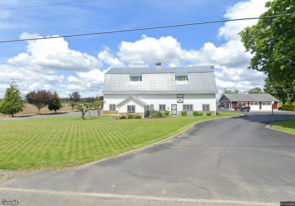
1518 Abbott Rd Lynden, WA 98264
Estimated Value: $1,094,000 - $1,113,440
4
Beds
2
Baths
2,102
Sq Ft
$525/Sq Ft
Est. Value
About This Home
This home is located at 1518 Abbott Rd, Lynden, WA 98264 and is currently estimated at $1,103,720, approximately $525 per square foot. 1518 Abbott Rd is a home located in Whatcom County with nearby schools including Lynden High School and Lynden Christian School.
Ownership History
Date
Name
Owned For
Owner Type
Purchase Details
Closed on
Oct 24, 2006
Sold by
Carroll William F and Carroll Lucinda L
Bought by
Heystek John and Heystek Debra
Current Estimated Value
Home Financials for this Owner
Home Financials are based on the most recent Mortgage that was taken out on this home.
Original Mortgage
$380,000
Outstanding Balance
$225,875
Interest Rate
6.39%
Mortgage Type
Purchase Money Mortgage
Estimated Equity
$877,845
Purchase Details
Closed on
Feb 18, 2000
Sold by
Estate Of Henry F Polinder
Bought by
Polinder Ronald and Polinder Colleen
Home Financials for this Owner
Home Financials are based on the most recent Mortgage that was taken out on this home.
Original Mortgage
$140,000
Interest Rate
8.16%
Create a Home Valuation Report for This Property
The Home Valuation Report is an in-depth analysis detailing your home's value as well as a comparison with similar homes in the area
Home Values in the Area
Average Home Value in this Area
Purchase History
| Date | Buyer | Sale Price | Title Company |
|---|---|---|---|
| Heystek John | $475,280 | Chicago Title Insurance | |
| Polinder Ronald | -- | Whatcom Land Title Company I | |
| Carroll William F | -- | Whatcom Land Title Company I |
Source: Public Records
Mortgage History
| Date | Status | Borrower | Loan Amount |
|---|---|---|---|
| Open | Heystek John | $380,000 | |
| Previous Owner | Carroll William F | $140,000 |
Source: Public Records
Tax History Compared to Growth
Tax History
| Year | Tax Paid | Tax Assessment Tax Assessment Total Assessment is a certain percentage of the fair market value that is determined by local assessors to be the total taxable value of land and additions on the property. | Land | Improvement |
|---|---|---|---|---|
| 2024 | $4,014 | $914,391 | $496,954 | $417,437 |
| 2023 | $4,014 | $1,011,742 | $603,316 | $408,426 |
| 2022 | $3,682 | $928,186 | $553,491 | $374,695 |
| 2021 | $3,327 | $725,137 | $432,410 | $292,727 |
| 2020 | $2,898 | $276,883 | $36,944 | $239,939 |
| 2019 | $2,804 | $523,684 | $312,280 | $211,404 |
| 2018 | $2,798 | $239,829 | $32,000 | $207,829 |
| 2017 | $2,506 | $193,129 | $31,252 | $161,877 |
| 2016 | $2,517 | $181,881 | $29,432 | $152,449 |
| 2015 | $2,259 | $181,881 | $29,432 | $152,449 |
| 2014 | -- | $198,401 | $50,126 | $148,275 |
| 2013 | -- | $180,486 | $45,813 | $134,673 |
Source: Public Records
Map
Nearby Homes
- 1077 Hampton Rd
- 2080 Bowfin Way
- 1792 Bradley Rd
- 1178 E Grover St Unit 101
- 1095 Terrace Dr
- 1319 Bradley Ct
- 924 E Grover St
- 1402 Bradley Meadows Ln
- 400 E Front St
- 2105 Lagerwey Cir
- 2103 Lagerwey Cir
- 220 Skipping Stone Loop
- 231 Skipping Stone Loop
- 215 Skipping Stone Loop
- 7343 Hannegan Rd Unit 2
- 214 Skipping Stone Loop
- 1251 Garden Cir
- 1660 Eastwood Way
- 205 Riverwalk Dr
- 208 Skipping Stone Loop
- 0 Northwood Rd
- 200 Northwood Rd
- 1517 Abbott Rd
- 1591 Abbott Rd
- 1407 Abbott Rd
- 1428 Abbott Rd
- 1389 Abbott Rd
- 1364 Abbott Rd
- 1519 Timon Rd
- 7867 Noon Rd
- 7845 Noon Rd
- 1441 Polinder Rd
- 7842 Noon Rd
- 1679 Timon Rd
- 8000 Thiel Rd
- 8134 Northwood Rd
- 7800 Noon Rd
- 1379 Polinder Rd
- 8135 Northwood Rd
- 8 Shortcake Ln