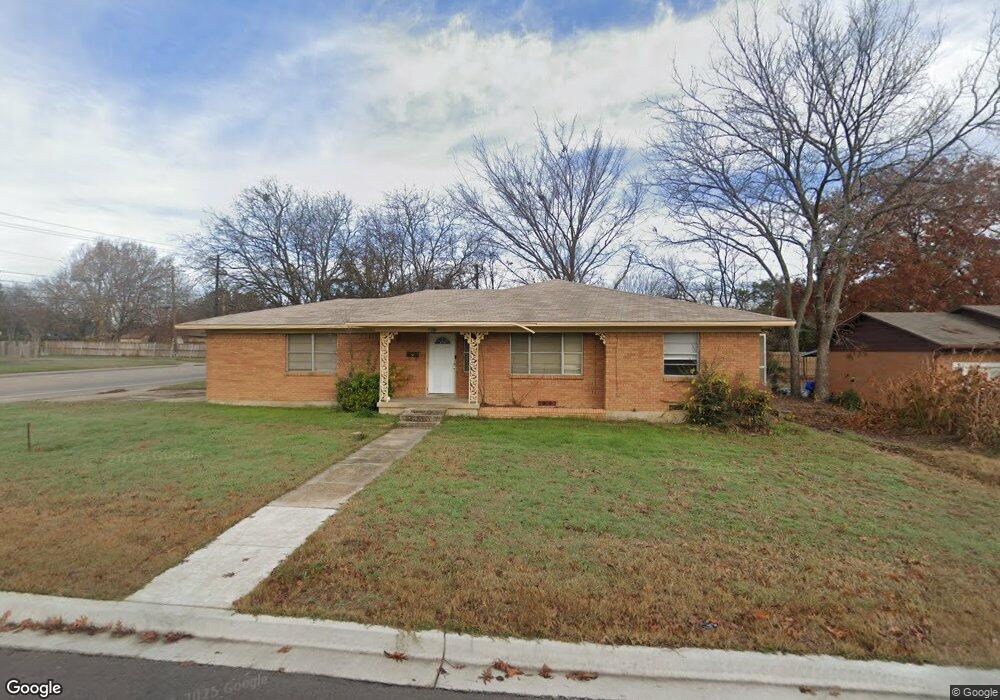
1518 Broadway St Denton, TX 76201
Downtown Denton NeighborhoodEstimated Value: $302,000 - $323,000
3
Beds
2
Baths
1,373
Sq Ft
$228/Sq Ft
Est. Value
About This Home
This home is located at 1518 Broadway St, Denton, TX 76201 and is currently estimated at $313,138, approximately $228 per square foot. 1518 Broadway St is a home located in Denton County with nearby schools including Newton Rayzor Elementary School, Calhoun Middle School, and Denton High School.
Ownership History
Date
Name
Owned For
Owner Type
Purchase Details
Closed on
Oct 1, 2004
Sold by
Blalock James H and Blalock Anna L
Bought by
Himes Curtis and Himes Joanne
Current Estimated Value
Home Financials for this Owner
Home Financials are based on the most recent Mortgage that was taken out on this home.
Original Mortgage
$78,000
Interest Rate
5.81%
Mortgage Type
Seller Take Back
Create a Home Valuation Report for This Property
The Home Valuation Report is an in-depth analysis detailing your home's value as well as a comparison with similar homes in the area
Home Values in the Area
Average Home Value in this Area
Purchase History
| Date | Buyer | Sale Price | Title Company |
|---|---|---|---|
| Himes Curtis | -- | Stewart Title |
Source: Public Records
Mortgage History
| Date | Status | Borrower | Loan Amount |
|---|---|---|---|
| Closed | Himes Curtis | $78,000 |
Source: Public Records
Tax History Compared to Growth
Tax History
| Year | Tax Paid | Tax Assessment Tax Assessment Total Assessment is a certain percentage of the fair market value that is determined by local assessors to be the total taxable value of land and additions on the property. | Land | Improvement |
|---|---|---|---|---|
| 2025 | $5,639 | $308,052 | $127,380 | $180,672 |
| 2024 | $5,639 | $292,156 | $0 | $0 |
| 2023 | $4,649 | $243,463 | $127,380 | $116,083 |
| 2022 | $3,885 | $183,000 | $85,680 | $97,320 |
| 2021 | $3,857 | $173,520 | $85,680 | $87,840 |
| 2020 | $3,902 | $170,722 | $85,680 | $85,042 |
| 2019 | $4,082 | $171,086 | $85,680 | $85,406 |
| 2018 | $3,817 | $158,000 | $85,680 | $72,320 |
| 2017 | $3,337 | $135,000 | $55,720 | $79,280 |
| 2016 | $3,261 | $108,000 | $40,988 | $67,012 |
| 2015 | $2,544 | $101,969 | $40,988 | $60,981 |
| 2013 | -- | $86,484 | $31,604 | $54,880 |
Source: Public Records
Map
Nearby Homes
- 1509 Egan St
- 1813 Crescent St
- 1716 Cordell St
- 419 Marietta St
- 1014 Hillcrest St
- 1115 Egan St
- 321 Fry St
- 406 Fry St
- 918 Egan St
- 330 Ponder St
- 913 Cordell St
- 910 Stanley St Unit 3
- 910 Stanley St Unit 5
- 910 Stanley St Unit 1
- 910 Stanley St Unit 2
- 910 Stanley St Unit 6
- 2044 W Oak St
- 1200 Thomas St
- 1007 Westway St
- 1027 Stanley St
- 1514 Broadway St
- 1700 Broadway St
- 1508 Broadway St
- 1517 Linden Dr
- 1515 Linden Dr
- 1704 Broadway St
- TBD Malone and Broadway
- 1502 Broadway St
- 1515 Broadway St
- 1509 Linden Dr
- 1706 Broadway St
- 1701 Linden Dr
- 1708 Broadway St Unit A
- 1503 Linden Dr
- 1424 Broadway St
- 1705 Linden Dr
- 1501 Broadway St
- 1710 Broadway St
- 1423 Linden Dr
- 1425 Broadway St