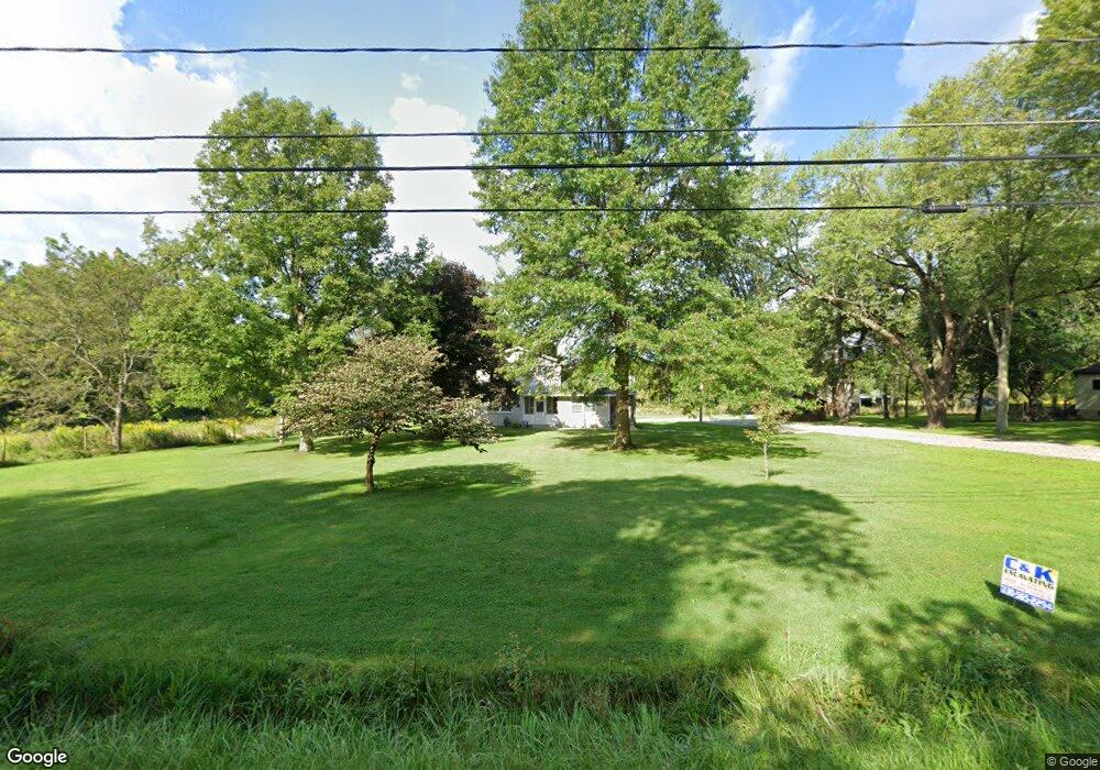
1518 Collar Price Rd Hubbard, OH 44425
Estimated Value: $194,000 - $314,000
3
Beds
3
Baths
1,992
Sq Ft
$129/Sq Ft
Est. Value
About This Home
This home is located at 1518 Collar Price Rd, Hubbard, OH 44425 and is currently estimated at $257,594, approximately $129 per square foot. 1518 Collar Price Rd is a home located in Trumbull County with nearby schools including Hubbard Elementary School, Hubbard Middle School, and Hubbard High School.
Ownership History
Date
Name
Owned For
Owner Type
Purchase Details
Closed on
Mar 30, 2018
Sold by
Pitts Kelsey M
Bought by
Pitts Christopher M
Current Estimated Value
Purchase Details
Closed on
Aug 8, 2016
Sold by
Ross Gail L and Ross Paul
Bought by
Pitts Christopher M and Pitts Kelsey M
Home Financials for this Owner
Home Financials are based on the most recent Mortgage that was taken out on this home.
Original Mortgage
$152,000
Outstanding Balance
$121,823
Interest Rate
3.62%
Mortgage Type
Adjustable Rate Mortgage/ARM
Estimated Equity
$135,771
Purchase Details
Closed on
Feb 13, 2006
Sold by
Mckinzie Twila
Bought by
Ross Gail L
Purchase Details
Closed on
Feb 8, 2006
Sold by
Mckinzie Twila
Bought by
Ross Gail L
Purchase Details
Closed on
Oct 13, 2005
Sold by
Mckinzie Earl
Bought by
Ross Gail L
Purchase Details
Closed on
May 18, 2005
Sold by
Mckinzie Earl
Bought by
Ross Gail L
Purchase Details
Closed on
Jan 1, 1990
Sold by
Mckenzie Earl Virgil
Bought by
Gail L Ross
Create a Home Valuation Report for This Property
The Home Valuation Report is an in-depth analysis detailing your home's value as well as a comparison with similar homes in the area
Home Values in the Area
Average Home Value in this Area
Purchase History
| Date | Buyer | Sale Price | Title Company |
|---|---|---|---|
| Pitts Christopher M | -- | None Available | |
| Pitts Christopher M | $180,000 | None Available | |
| Ross Gail L | -- | None Available | |
| Ross Gail L | -- | None Available | |
| Ross Gail L | -- | -- | |
| Ross Gail L | -- | -- | |
| Gail L Ross | -- | -- |
Source: Public Records
Mortgage History
| Date | Status | Borrower | Loan Amount |
|---|---|---|---|
| Open | Pitts Christopher M | $152,000 |
Source: Public Records
Tax History Compared to Growth
Tax History
| Year | Tax Paid | Tax Assessment Tax Assessment Total Assessment is a certain percentage of the fair market value that is determined by local assessors to be the total taxable value of land and additions on the property. | Land | Improvement |
|---|---|---|---|---|
| 2024 | $3,631 | $69,830 | $17,780 | $52,050 |
| 2023 | $3,631 | $69,830 | $17,780 | $52,050 |
| 2022 | $3,097 | $55,200 | $16,210 | $38,990 |
| 2021 | $3,110 | $55,200 | $16,210 | $38,990 |
| 2020 | $2,887 | $54,950 | $15,960 | $38,990 |
| 2019 | $2,691 | $48,690 | $14,770 | $33,920 |
| 2018 | $2,612 | $48,690 | $14,770 | $33,920 |
| 2017 | $2,604 | $48,690 | $14,770 | $33,920 |
| 2016 | $2,412 | $46,200 | $14,770 | $31,430 |
| 2015 | $2,420 | $46,200 | $14,770 | $31,430 |
| 2014 | $2,374 | $46,200 | $14,770 | $31,430 |
| 2013 | $2,655 | $46,200 | $14,770 | $31,430 |
Source: Public Records
Map
Nearby Homes
- 6855 Stewart Sharon Rd
- 7111 Pine Grove Dr
- 5910 Chestnut Ridge Rd
- 1441 Warner Rd
- 5683 Chestnut Ridge Rd
- 1911 Hubbard Thomas Rd
- 1472 Warner Rd
- 1975 Warner Rd
- 1354 Stevenson Rd
- 5950 Mount Everett Rd
- 132 Drummond Ave
- 256 Warner Rd
- 7370 Brookwood Dr
- 7737 Elm St
- 6984 Warren Sharon Rd
- 6220 Warren Sharon Rd
- 1952 Hubbard Masury Rd
- 6333 Warren Sharon Rd
- 6130 Warren Sharon Rd
- 7086 Warren Sharon Rd
- 1504 Collar Price Rd
- 1541 Collar Price Rd
- 1556 Collar Price Rd
- 1480 Collar Price Rd
- 1564 Collar Price Rd
- 1470 Collar Price Rd
- 1571 Collar Price Rd
- 1533 Collar Price Rd
- 1574 Collar Price Rd
- 1575 Collar Price Rd
- 1460 Collar Price Rd
- 1469 Collar Price Rd
- 1455 Collar Price Rd
- 1444 Collar Price Rd
- 1602 Collar Price Rd
- 1593 Collar Price Rd
- 1441 Collar Price Rd
- 1612 Collar Price Rd
- 1611 Collar Price Rd
- 1624 Collar Price Rd