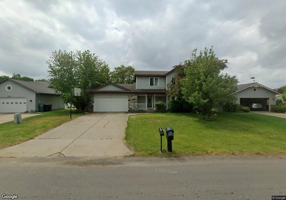
1518 Springbrook Dr Jenison, MI 49428
Estimated Value: $379,376 - $457,000
4
Beds
3
Baths
2,000
Sq Ft
$204/Sq Ft
Est. Value
About This Home
This home is located at 1518 Springbrook Dr, Jenison, MI 49428 and is currently estimated at $407,344, approximately $203 per square foot. 1518 Springbrook Dr is a home located in Ottawa County with nearby schools including Bauerwood Elementary School, Jenison Junior High School, and Jenison High School.
Ownership History
Date
Name
Owned For
Owner Type
Purchase Details
Closed on
Jan 26, 2011
Sold by
Munuma Jack Mangala and Lioubimtseva Elena
Bought by
Lioubimtseva Elena
Current Estimated Value
Purchase Details
Closed on
Jan 3, 2006
Sold by
Lioubimtseva Elena and Munuma Jack Mangala
Bought by
Munuma Jack Mangala and Lioubimtseva Elena
Purchase Details
Closed on
Jun 1, 2004
Sold by
Klunder Daniel R and Klunder Tonya S
Bought by
Munuma Jack Mangola and Lioubimtseva Elena
Home Financials for this Owner
Home Financials are based on the most recent Mortgage that was taken out on this home.
Original Mortgage
$156,000
Outstanding Balance
$77,127
Interest Rate
6.17%
Mortgage Type
Purchase Money Mortgage
Estimated Equity
$330,217
Create a Home Valuation Report for This Property
The Home Valuation Report is an in-depth analysis detailing your home's value as well as a comparison with similar homes in the area
Home Values in the Area
Average Home Value in this Area
Purchase History
| Date | Buyer | Sale Price | Title Company |
|---|---|---|---|
| Lioubimtseva Elena | -- | None Available | |
| Munuma Jack Mangala | -- | None Available | |
| Munuma Jack Mangola | $195,000 | -- |
Source: Public Records
Mortgage History
| Date | Status | Borrower | Loan Amount |
|---|---|---|---|
| Open | Munuma Jack Mangola | $156,000 | |
| Closed | Munuma Jack Mangola | $19,400 |
Source: Public Records
Tax History
| Year | Tax Paid | Tax Assessment Tax Assessment Total Assessment is a certain percentage of the fair market value that is determined by local assessors to be the total taxable value of land and additions on the property. | Land | Improvement |
|---|---|---|---|---|
| 2025 | $2,404 | $168,500 | $0 | $0 |
| 2024 | $23 | $168,600 | $0 | $0 |
| 2023 | $2,206 | $154,700 | $0 | $0 |
| 2022 | $2,422 | $131,400 | $0 | $0 |
| 2021 | $2,352 | $126,300 | $0 | $0 |
| 2020 | $2,326 | $120,600 | $0 | $0 |
| 2019 | $2,328 | $111,600 | $0 | $0 |
| 2018 | $2,165 | $103,400 | $0 | $0 |
| 2017 | $2,128 | $99,800 | $0 | $0 |
| 2016 | $2,114 | $98,200 | $0 | $0 |
| 2015 | $2,018 | $87,200 | $0 | $0 |
| 2014 | $2,018 | $83,700 | $0 | $0 |
Source: Public Records
Map
Nearby Homes
- 1468 Maplewood Dr Unit 9
- 8148 Greenridge Dr
- 2145 Bauer Rd
- 7951 Engelhurst Ct
- 1941 Newcastle Dr
- 1215 Sycamore Dr
- 8252 Lamplight Dr
- 9067 Hollace Ct
- 8081 Weatherwax Dr Unit 44
- 2550 Willow View Dr
- 7425 Boulder Bluff Dr Unit 112
- 625 Summerset Dr
- 2488 Cedar West Dr
- 7439 Eastlane Ave
- 7425 Pinegrove Dr Unit 98
- 2272 Baldwin St
- 7373 Pinegrove Dr Unit 109
- 7391 Terrace Ln
- 7341 Pinegrove Dr
- 7350 Glendora Ave
- 1528 Springbrook Dr
- 1506 Springbrook Dr
- 1494 Springbrook Dr
- 1523 Springbrook Dr
- 1511 Springbrook Dr
- 1531 Springbrook Dr
- 1501 Springbrook Dr
- 1552 Springbrook Dr
- 1543 Springbrook Dr
- 1472 Springbrook Dr
- 1489 Springbrook Dr
- 1553 Springbrook Dr
- 1477 Springbrook Dr
- 1566 Springbrook Dr
- 8546 Corsica Dr
- 1475 Caprice Dr
- 1483 Caprice Dr
- 1465 Caprice Dr
- 1565 Springbrook Dr
- 8536 Corsica Dr
Your Personal Tour Guide
Ask me questions while you tour the home.