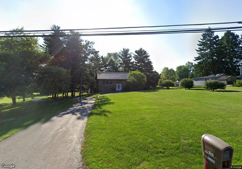
1518 Windsor Rd Mansfield, OH 44905
Estimated Value: $255,000 - $378,000
2
Beds
2
Baths
2,028
Sq Ft
$152/Sq Ft
Est. Value
About This Home
This home is located at 1518 Windsor Rd, Mansfield, OH 44905 and is currently estimated at $307,375, approximately $151 per square foot. 1518 Windsor Rd is a home located in Richland County with nearby schools including Madison High School, St. Mary Catholic School, and Temple-Christian School.
Ownership History
Date
Name
Owned For
Owner Type
Purchase Details
Closed on
Jul 29, 1998
Sold by
Stigall Michael W
Bought by
Burton Cecil B Lou E
Current Estimated Value
Home Financials for this Owner
Home Financials are based on the most recent Mortgage that was taken out on this home.
Original Mortgage
$122,400
Outstanding Balance
$26,830
Interest Rate
7.5%
Mortgage Type
VA
Estimated Equity
$280,545
Purchase Details
Closed on
Jan 8, 1991
Sold by
Stigall Lewis H
Bought by
Stigall Michael W
Create a Home Valuation Report for This Property
The Home Valuation Report is an in-depth analysis detailing your home's value as well as a comparison with similar homes in the area
Home Values in the Area
Average Home Value in this Area
Purchase History
| Date | Buyer | Sale Price | Title Company |
|---|---|---|---|
| Burton Cecil B Lou E | $120,000 | -- | |
| Stigall Michael W | $85,000 | -- |
Source: Public Records
Mortgage History
| Date | Status | Borrower | Loan Amount |
|---|---|---|---|
| Open | Burton Cecil B Lou E | $122,400 |
Source: Public Records
Tax History
| Year | Tax Paid | Tax Assessment Tax Assessment Total Assessment is a certain percentage of the fair market value that is determined by local assessors to be the total taxable value of land and additions on the property. | Land | Improvement |
|---|---|---|---|---|
| 2024 | $3,181 | $74,720 | $9,110 | $65,610 |
| 2023 | $3,279 | $74,720 | $9,110 | $65,610 |
| 2022 | $2,444 | $53,340 | $7,290 | $46,050 |
| 2021 | $2,443 | $53,340 | $7,290 | $46,050 |
| 2020 | $2,462 | $53,340 | $7,290 | $46,050 |
| 2019 | $2,134 | $44,830 | $6,130 | $38,700 |
| 2018 | $2,116 | $44,830 | $6,130 | $38,700 |
| 2017 | $2,200 | $44,830 | $6,130 | $38,700 |
| 2016 | $2,324 | $48,180 | $5,820 | $42,360 |
| 2015 | $2,286 | $48,180 | $5,820 | $42,360 |
| 2014 | $2,278 | $48,180 | $5,820 | $42,360 |
| 2012 | $1,110 | $50,720 | $6,130 | $44,590 |
Source: Public Records
Map
Nearby Homes
- 1990 Woodmont Rd
- 690 Ashland Rd
- 2202 Lakewood Dr
- 811 Mayflower Ave
- 1495 Timber Rd
- 1187 -1189 Fleming Falls Rd
- 1674 Honeysuckle Dr
- 1359 N Stewart Rd
- 1098 Stewart Rd N
- 620 Running Brook Way
- 937 Expressview Dr
- 961 Neil Cir N
- 683 Coachman Rd
- 671 Coachman Rd
- 632 Coachman Rd
- 1226 Evergreen Ave W
- 1217 Evergreen Ave W
- 602 Champion Rd
- 644 Skyline Rd
- 1168 ConcheMcO St
- 1506 Windsor Rd
- 1526 Windsor Rd
- 1519 Clearview Cir
- 1478 Windsor Rd
- 1503 Windsor Rd
- 1965 Ashland Rd
- 1546 Windsor Rd
- 1531 Windsor Rd
- 1955 Ashland Rd
- 1491 Windsor Rd
- 2345 Ashland Rd Unit 2347
- 1523 Clearview Cir
- 1554 Windsor Rd
- 1481 Windsor Rd
- 1551 Windsor Rd
- 1989 Ashland Rd
- 1989 Ashland Rd
- 1989 Ashland Rd
- 1555 Windsor Rd
- 1564 Windsor Rd
Your Personal Tour Guide
Ask me questions while you tour the home.