Estimated Value: $143,000 - $157,178
3
Beds
1
Bath
1,098
Sq Ft
$138/Sq Ft
Est. Value
About This Home
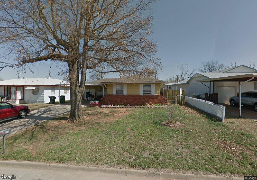
This home is located at 1519 Dianna Dr, Yukon, OK 73099 and is currently estimated at $152,045, approximately $138 per square foot. 1519 Dianna Dr is a home located in Canadian County with nearby schools including Myers Elementary School, Independence Elementary School, and Yukon Middle School.
Ownership History
Date
Name
Owned For
Owner Type
Purchase Details
Closed on
Aug 28, 2015
Sold by
Foreman Donald Lee and Foreman Yvonne Lenore
Bought by
Corr Amber and Corr Jeremy
Current Estimated Value
Home Financials for this Owner
Home Financials are based on the most recent Mortgage that was taken out on this home.
Original Mortgage
$88,271
Outstanding Balance
$69,236
Interest Rate
3.87%
Mortgage Type
FHA
Estimated Equity
$82,809
Purchase Details
Closed on
Apr 4, 2003
Sold by
Foreman Donald and Foreman Y
Create a Home Valuation Report for This Property
The Home Valuation Report is an in-depth analysis detailing your home's value as well as a comparison with similar homes in the area
Home Values in the Area
Average Home Value in this Area
Purchase History
| Date | Buyer | Sale Price | Title Company |
|---|---|---|---|
| Corr Amber | $90,000 | Old Republic Title Co Of Ok | |
| -- | -- | -- |
Source: Public Records
Mortgage History
| Date | Status | Borrower | Loan Amount |
|---|---|---|---|
| Open | Corr Amber | $88,271 |
Source: Public Records
Tax History Compared to Growth
Tax History
| Year | Tax Paid | Tax Assessment Tax Assessment Total Assessment is a certain percentage of the fair market value that is determined by local assessors to be the total taxable value of land and additions on the property. | Land | Improvement |
|---|---|---|---|---|
| 2024 | $1,392 | $13,486 | $1,980 | $11,506 |
| 2023 | $1,392 | $12,844 | $1,980 | $10,864 |
| 2022 | $1,331 | $12,232 | $1,980 | $10,252 |
| 2021 | $1,282 | $11,744 | $1,980 | $9,764 |
| 2020 | $1,206 | $11,184 | $1,980 | $9,204 |
| 2019 | $1,227 | $11,345 | $1,980 | $9,365 |
| 2018 | $1,172 | $10,805 | $1,980 | $8,825 |
| 2017 | $1,137 | $10,479 | $1,980 | $8,499 |
| 2016 | $1,084 | $9,980 | $1,980 | $8,000 |
| 2015 | $633 | $7,084 | $1,832 | $5,252 |
| 2014 | $633 | $6,747 | $1,812 | $4,935 |
Source: Public Records
Map
Nearby Homes
- 114 Larry Ave
- 14512 Rochefort Ln
- 14524 Giverny Ln
- 14500 Giverny Ln
- 1805 Janeen St
- 1421 Spring Creek Dr
- 117 Asbill Ave
- 1308 Holly Ave
- 332 W Platt Dr
- 1521 Spring Creek Dr
- 0 Landon Ln
- 1008 Queensboro Place
- 1005 S 3rd St
- 1313 Kingston Dr
- 129 W Parkland Dr
- 205 W Parkland Dr
- 1512 Summerton Place
- 1000 Winnipeg Dr
- 116 E Parkland Dr
- 501 Queensboro Place